Hartland Point circular
Devon Walk
County/Area - Devon
Author - Lou Johnson
Length - 10.0 miles / 16.3 km Ascent - 1435 feet / 435 metres
Time - 6 hours 30 minutes Grade - moderate
Maps 

| Ordnance Survey Explorer 126 | Sheet Map | 1:25k | BUY |
| Anquet OS Explorer 126 | Digital Map | 1:25k | BUY |
| Ordnance Survey Landranger 190 | Sheet Map | 1:50k | BUY |
| Anquet OS Landranger 190 | Digital Map | 1:50k | BUY |
Walk Route Description
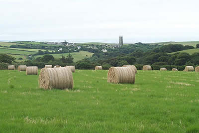
Click image to visit gallery of 10 images.
Countryside and coast combine to make this route a worthwhile walk. The start is the small car park on the cliff top adjacent to the Rocket House above Hartland Quay (Grid ref. SS225248). Hartland Quay is reached by taking the B3248 off the A39 near Clovelly.
After parking follow the path back towards the village of Stoke. Note the path runs just inside the field on the north side of the lane and continues rather strangely across front gardens in the village before petering out near the large church. Continuing with care along the road to Hartland, turn left at the first junction (Grid ref. 246247). Cross over Abbey River and turn right along the track towards Pattard Wood. In just under half a mile a signed footpath turns off left and climbs up through the woodland into open pastures.
Reaching a track, turn left and continue in a north-easterly direction with the hamlet of Cheristow on your left to reach the road at Pattard Cross. Head east along the road to reach the next junction at Youltree Cross. Go straight over this crossroad and take the left fork at the next junction. Follow the road round to turn left for Exmansworthy and Fattacott. Heading north pass Exmansworthy Farm and enter the small National Trust car park on your right. At the far end is a signed footpath (not shown on the 1:25000 map) that leads you to the South West Coast Path above Chapman Rock.
Turn left along the coast path. The route undulates but is easy to follow with good waymarking. Out to sea you will be able to make out Lundy Island whilst ahead you will be able to see the ugly radio communications tower on Hartland Point. Quite soon you will reach the small car park at Barley Bay from where it is a short distance to Hartland Point. There is an interpretation board, which details amongst other items the circumstances of the wrecked ship that can seen below rusting on the beach.
The coastal path now swings south and begins to become more challenging. After climbing to Blagdon and Upright Cliffs the path descends to cross a stream before crossing the flat ground on the landward side of Smoothlands, which is very distinctive feature, to reach Damehole Point. Suddenly the scenery becomes superb with incredible rock formations carved by the sea. Climbing onto Bleaberry Cliff the path descends again to cross a stream before another ascent and descent brings you to Blackpool Mill. From here a steep final ascent onto The Warren and a level section back to the Rocket House complete the route.
Other walks nearby
| Walk 1824 | Hartland Point Circular | easy | 3.0 miles |
| Walk 3208 | Stoke & Hartland Quay | moderate | 6.4 miles |
| Walk 3207 | Knap Head to Mansley Cliff | moderate | 8.0 miles |
| Walk 1788 | Welcombe Mouth and Darracott | moderate | 6.0 miles |
| Walk 1719 | Clovelly & the South West Coast Path | easy/mod | 6.0 miles |
| Walk 1996 | Woodford & Hollygrove Wood | easy/mod | 5.1 miles |
| Walk 2295 | Buck's Mill & Peppercombe | easy/mod | 6.2 miles |
| Walk 1047 | Abbotsham Cliff beach and Kipling's Tor, Westward Ho! | easy | 3.5 miles |
| Walk 3755 | Dizzard Point, Millook from Penhalt Cliff | moderate | 6.0 miles |
| Walk 2161 | Appledore to Westward Ho! | easy | 4.5 miles |
Recommended Books & eBooks
South West Coast Path Map Booklet - Minehead to St Ives
 Map of the northern section of the 630 mile (1014km) South West Coast Path National Trail. Covers the trail from Minehead to St Ives along the north Devon and Cornish coastline. This convenient and compact booklet of Ordnance Survey 1:25,000 maps shows the route, providing all of the mapping you need to walk the trail in either direction.
More information
South West Coast Path Map Booklet - St Ives to Plymouth
 Map of part of the southern section of the 630 mile (1014km) South West Coast Path National Trail. Covers the trail from St Ives to Plymouth along the west Cornwall and Devon coastline. This convenient and compact booklet of Ordnance Survey 1:25,000 maps shows the route, providing all of the mapping you need to walk the trail in either direction.
More information
Messaging & Social Media
Message Walking Britain and follow the latest news.

Mountain Weather
Stay safe on the mountains with detailed weather forecasts - for iOS devices or for Android devices.