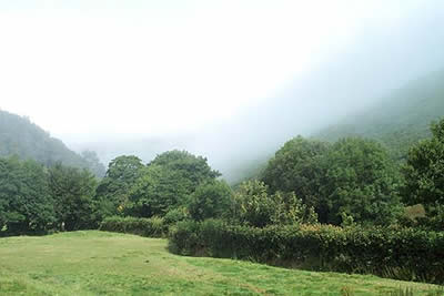
The Doone Valley from Malmsmead
Exmoor Walk
Nat Park - Exmoor
County/Area - Devon & Somerset
Author - Lou Johnson
Length - 8.5 miles / 13.8 km Ascent - 1395 feet / 423 metres
Time - 5 hours 40 minutes Grade - moderate
Maps 

| Ordnance Survey Explorer OL9 | Sheet Map | 1:25k | BUY |
| Anquet OS Explorer OL9 | Digital Map | 1:25k | BUY |
| Ordnance Survey Landranger 180 | Sheet Map | 1:50k | BUY |
| Anquet OS Landranger 180 | Digital Map | 1:50k | BUY |
Walk Route Description
Click image to visit gallery of 8 images.
Lorna Doone was a fictional character created by R.D. Blackmore using the landscape of this area as a basis for the novel. The walk starts in the pleasant village of Malmsmead and continues to Oare Church before heading up the valley containing Badgworthy Water to finish with a walk across the moors.
Starting from the village car park (Grid ref. SS791478) walk to the road junction in the village centre and turn left for Oare. Cross Badgworthy Water and follow the lane for approximately 300 metres and turn left onto the signed footpath. This crosses Oare Water by footbridge with the onward route a right turn to head south-east. This path continues alongside the river to join a lane. Turn right, re-cross Oare Water and continue up to the road junction. Oare church is opposite and is worth a visit.
After visiting the church exit the churchyard and turn right along the lane and almost immediately right again onto a bridleway, which climbs gently. At the first junction fork right alongside a small wood. The path/track contours around the hillside before descending to Cloud Farm. Cross Badgworthy Water and turn left (upstream) to follow a clear track.
This leads without any need for further directions to the site of a Medieval village (Grid ref. 7924440), which is a short way west of the river. Unfortunately there are few obvious remains in this pleasant spot, which nevertheless makes an ideal place for a rest and refreshments. Heading northwest along a clear bridleway the route climbs gently onto the moors to reach a gate (Grid ref. 781452). Go through the gate and continue along the bridleway with good views of the open moors.
Crossing the northern flank of Withycombe Ridge the route descends to Lankcombe Ford. Cross this and bear right to pick up a clear track heading just north of east. Stay on this as it contours around the east side of Malmsmead Hill to reach Easter Lane (Grid ref. 781473). Note - this track is not shown on the OS maps. A more direct route leaves the route described at grid ref. 777460). Reaching Easter Lane, turn right and after a kilometre you arrive back in Malmsmead.
Other walks nearby
| Walk 1262 | Watersmeet & Foreland Point | mod/hard | 10.5 miles |
| Walk 3729 | Foreland Point | moderate | 5.0 miles |
| Walk 1910 | Countisbury and Watersmeet from Lynmouth | easy/mod | 4.5 miles |
| Walk 3391 | Valley of Rocks frrom Lynton | easy/mod | 3.8 miles |
| Walk 3386 | Barle Valley & Cow Castle from Simonsbath | easy/mod | 6.4 miles |
| Walk 1727 | Shallowford, Hoar Oak Tree & The Chains | moderate | 11.7 miles |
| Walk 2387 | Pinkery Pond Circular | easy/mod | 5.8 miles |
| Walk 1221 | Selworthy Beacon & North Hill from Bossington | moderate | 8.5 miles |
| Walk 3390 | Heddon Valley from Woody Bay | moderate | 5.3 miles |
| Walk 2451 | Withypool & Barle Valley | easy/mod | 6.0 miles |
Recommended Books & eBooks
No suggestions for this area.Messaging & Social Media
Message Walking Britain and follow the latest news.

Mountain Weather
Stay safe on the mountains with detailed weather forecasts - for iOS devices or for Android devices.