Circuit of Pendle Hill from Barley Green
Forest of Bowland Walk
Region - Forest of Bowland
County/Area - Lancashire
Author - Lou Johnson
Length - 8.5 miles / 13.8 km Ascent - 1690 feet / 512 metres
Time - 6 hours 0 minutes Grade - moderate
Maps 

| Ordnance Survey Explorer OL41 | Sheet Map | 1:25k | BUY |
| Anquet OS Explorer OL41 | Digital Map | 1:25k | BUY |
| Ordnance Survey Landranger 103 | Sheet Map | 1:50k | BUY |
| Anquet OS Landranger 103 | Digital Map | 1:50k | BUY |
Walk Route Description
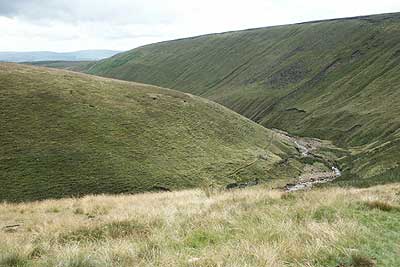
Click image to visit gallery of 8 images.
Pendle Hill is famous for its connection with the "Witches of Pendle". This route makes a circuit of the plateau that forms the summit complementing a shorter ascent detailed in walk 1267. This route does use one section of hard to follow path so it is an idea to ensure you have map and compass skills if poor visibility is likely.
The start is the car park at Barley Green (Grid ref. SD823403) where there is an information centre, cafe and toilets. Exit the car park onto the road and turn right to reach a cross-roads in a few metres. Go straight across following a lane between houses and past a waterworks on your right to reach Lower Ogden Reservoir. Stay on the lane and continue west. You will soon reach the dam for Upper Ogden Reservoir. When the lane bears right and climbs fork left and head to the base of the dam wall.
The path climbs to the right and then follows the northern shore of the reservoir. Ignore the path signed Pendle Hill going right and continue into the valley of clough ahead. The path crosses the stream (Grid ref. SD 792402) and climbs onto the moor above the stream but still following it as it swings northeast. Ignore any paths not following the stream including a signed path that goes right towards the summit of Pendle Hill. Instead stay on a narrow trod keeping the stream on your right to reach a wall (Grid ref. SD 797413) that goes left (northwest). Follow this wall to reach a ladder stile after 500 metres.
At the stile you should, weather permitting get a grand view across the Ribble Valley to the Yorkshire Dales. Cross the stile and, keeping the edge of the escarpment, follow a narrow path that heads east. After one kilometre this joins a path coming up from Downham. Turn right following a clear path to the summit of Pendle Hill.
Leave the summit on a clear path south. Stay near the edge of the escarpment which should be on your left. After 600 metres (Grid ref. SD 804408) look out for a descending path that heads northeast down the escarpment. Take this to Pendle House. Turn left along the access road to reach Barley Lane (Grid ref. SD 814416). Turn right down the lane and after a few metres take the signed footpath on your left. This leads across a field to a track. Turn left along this and just opposite the first house turn right through a gate into the field. The path follows the hedge which should be on your left. Despite little use this path takes you to Lower Black Moss Reservoir. Turn right here where a signed path leads you back to Barley
Other walks nearby
| Walk 3111 | Barley Circular | easy/mod | 7.5 miles |
| Walk 1818 | Downham & Pendle Hill | moderate | 8.0 miles |
| Walk 1655 | Downham & Pendle Hill (short version) | moderate | 6.3 miles |
| Walk 2938 | Nick of Pendle from Pendleton | easy/mod | 6.3 miles |
| Walk 2632 | The Ribble Valley from Sawley | easy/mod | 9.0 miles |
| Walk 2293 | Weets Hill | easy/mod | 5.3 miles |
| Walk 2217 | Clitheroe Town Trail - Ribble Valley | easy | 1.0 miles |
| Walk 2196 | Clowbridge Reservoir & Singing Ringing Tree | easy/mod | 4.0 miles |
| Walk 2304 | East Marton and the Drumlins | easy/mod | 5.5 miles |
| Walk 2861 | Pinhaw Beacon from Lothersdale | easy | 4.0 miles |
Recommended Books & eBooks
Walking in the Forest of Bowland and Pendle
 A guidebook to 40 diverse circular day walks suitable for walkers with navigational skills. The Forest of Bowland and Pendle are two of north west England's upland AONBs, perfect for walkers who enjoy exploring rough hilly, sometimes pathless terrain. The routes include Ward's Stone, Pendle Hill, Longridge Fell and Fair Snape Fell.
More information
Walking on the West Pennine Moors
 This guidebook describes 30 walks on the West Pennine Moors, around Blackburn, Darwen, Chorley and Bolton, home to some of the most inspiring and exhilarating walking country. The walks range from short, easy rambles to more challenging hikes covering a variety of terrain, all of it easily accessible for day walking.
More information
Messaging & Social Media
Message Walking Britain and follow the latest news.

Mountain Weather
Stay safe on the mountains with detailed weather forecasts - for iOS devices or for Android devices.