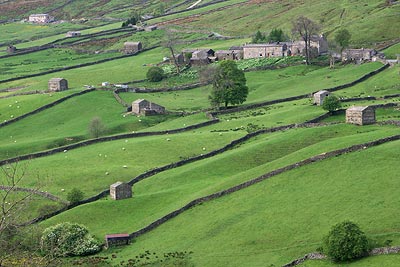
Muker & Upper Swaledale from Keld
Yorkshire Dales Walk
Nat Park - Yorkshire Dales - Swaledale
County/Area - North Yorkshire
Author - Lou Johnson
Length - 6.5 miles / 10.6 km Ascent - 1300 feet / 394 metres
Time - 4 hours 30 minutes Grade - easy/mod
Maps 

| Ordnance Survey Explorer OL19 | Sheet Map | 1:25k | BUY |
| Anquet OS Explorer OL19 | Digital Map | 1:25k | BUY |
| Ordnance Survey Landranger 91 | Sheet Map | 1:50k | BUY |
| Anquet OS Landranger 91 | Digital Map | 1:50k | BUY |
Walk Route Description
Click image to visit gallery of 12 images.
Upper Swaledale is, in my opinion, one of the most interesting areas within the boundaries of the Yorkshire Dales National Park. This route is no exception and offers a mixture of high level and valley walking with visits to picturesque villages. As a bonus the area is rich in industrial heritage and you are able to see at first hand some of the remaining ruins.
This Yorkshire Dales walk starts in the small village of Keld (Grid ref. NY892011) where there is car parking, public toilets and limited opportunities for refreshments. Leave the village and take the left hand fork to reach the main road. Turn left towards Muker and after approximately 400 metres turn left down a signed bridleway. This route leads across the southwestern side of Kisdon Hill before dropping steeply into the attractive village of Muker (shop, pub, refreshments etc.).
The onward route is located to the north of the church down a minor road flanked by cottages. The footpath strikes north (Grid ref. SD 910980) across hay meadows for approximately a kilometre to reach a path junction (Grid ref. SD 909986). Turn right here and cross the Swale using the substantial footbridge. On reaching the east bank of the river turn left and follow the broad track northwards alongside the Swale.
Crossing Swinner Gill (Grid ref. NY 908004) you will see extensive evidence of the lead mining that one took place in this valley with the remains of a flue on the hillside together with ruins from an engine house and other auxiliary buildings. Continuing the main path climbs to reach a junction (Grid ref. NY 904008). Turn right here and walk the short distance to the ruins of Crackpot Hall. After inspecting these return to the main path and continue towards Keld.
Far below on your left is Kisdon Force which is an impressive sight when the Swale is in spate. Just after crossing East Gill (Grid ref. NY 896011) turn left and cross the Swale and continue into Keld village. If you want to take a closer look at the falls turn left immediately after crossing the bridge and follow the Pennine Way. After a short distance you will notice a narrow footpath on your left descending to the Swale from where a good view of the falls can be obtained.
Other walks nearby
| Walk 1053 | Swinner Gill and Muker | mod/hard | 8.5 miles |
| Walk 1768 | Thomas Gill and Ravenseat from Tan Hill | moderate | 8.7 miles |
| Walk 1341 | Nine Standards Rigg | moderate | 6.0 miles |
| Walk 1056 | Gunnerside & Surrender Bridge | moderate | 10.3 miles |
| Walk 1197 | Gunnerside & Swinner Gills | moderate | 8.5 miles |
| Walk 3093 | Bunton Hush, Blakethwaite & Gunnerside Gill | easy/mod | 5.5 miles |
| Walk 1252 | Great Pinseat | easy/mod | 5.5 miles |
| Walk 3624 | Great Shunner Fell from Hardraw | mod/hard | 9.2 miles |
| Walk 3621 | Great Shunner Fell & Lovely Seat | mod/hard | 11.4 miles |
| Walk 1383 | Pendragon Castle | easy | 2.3 miles |
Recommended Books & eBooks
Walking in the Yorkshire Dales: South and West
 Part of a two-book set, this guidebook describes 44 walks in the southern and western Yorkshire Dales, including the famous 23 mile Three Peaks circuit over Pen-y-Ghent, Whernside and Ingleborough. The other, mostly circular routes of 3½ to 13 miles cover the scenic region between Sedbergh, Kirkby Lonsdale, Settle, Skipton and Grassington.
More information
Walking in the Yorkshire Dales: North and East
 This guidebook contains 43 circular day walks in the north and east Yorkshire Dales. It explores the dales, hills and moors between Kirkby Stephen and Pateley Bridge. Walking ranges from gentle 3 mile strolls to more strenuous day-long rambles across the Howgills, Wensleydale, Swaledale, Nidderdale, Mallerstang and Coverdale.
More information
Messaging & Social Media
Message Walking Britain and follow the latest news.

Mountain Weather
Stay safe on the mountains with detailed weather forecasts - for iOS devices or for Android devices.