Shutlingsloe from Trentabank
Peak District Walk
Nat Park - Peak District - Shutlingsloe Macclesfield Forest
County/Area - Cheshire
Author - Lou Johnson
Length - 3.0 miles / 4.9 km Ascent - 880 feet / 267 metres
Time - 2 hours 20 minutes Grade - easy/mod
Maps 

| Ordnance Survey Explorer OL24 | Sheet Map | 1:25k | BUY |
| Anquet OS Explorer OL24 | Digital Map | 1:25k | BUY |
| Ordnance Survey Landranger 118 | Sheet Map | 1:50k | BUY |
| Anquet OS Landranger 118 | Digital Map | 1:50k | BUY |
Walk Route Description
Click image to visit gallery of 6 images.
This hill walk is an ideal introduction to the Cheshire sector of the Peak District National Park. The route is easy to follow, the ascent is generally not too steep and the scenic rewards from the summit exceptional in fine weather. Known locally as the "Cheshire Matterhorn", Shutlingsloe has a distinctive outline when viewed from certain directions and it is easy to see why it earned this nickname.
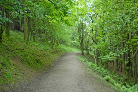
The start is the small car park adjacent to the visitor centre at Trentabank (Grid ref. SJ961711). After parking, walk back towards the road and turn right along the footpath that runs parallel to the road. Ignore the first path right and continue a short way further along by the road to reach the second path going right. Take this and start to climb into the woods. Keep straight ahead at the next junction and continue to climb.
The end of the woodland is in sight when a track comes in from the right. Continue ahead here looking out for a signed path on your right to Shutlingsloe. Take this, and leave the forest for High Moor. The path is paved and progress fast and soon you get your first sight of your objective. Reaching a wall, go through the gate and turn right, keeping the wall on your immediate right. This path will lead without any further need for navigation to the summit area. The views are extensive with Shining Tor the highest point in Cheshire, the moors by the Cat & Fiddle pub above Wildboarclough, the Roaches and Tittesworth Reservoir amongst the many scenic highlights.
The return route follows the outward route by staying on the flagged path back to the forest edge and main track. Turn left, bearing right at the first junction to descend to the road. It is worth noting that Trentabank Reservoir is home to a sizeable number of Herons and in May you can see the chicks on their nests high in the trees by the edge of the reservoir.
Other walks nearby
| Walk 1371 | Rossendale Ramble from Sutton | moderate | 12.0 miles |
| Walk 1183 | Shining Tor & Axe Edge Moor | moderate | 9.0 miles |
| Walk 1233 | Shining Tor & Windgather Rocks | moderate | 7.5 miles |
| Walk 2527 | Kettleshulme & Taxal Edge from Lamaload | moderate | 10.0 miles |
| Walk 1652 | Three Shires Head | easy | 4.5 miles |
| Walk 2233 | Flash & Three Shires Head | easy/mod | 6.2 miles |
| Walk 3588 | Rainow Circular | easy/mod | 5.5 miles |
| Walk 1728 | Axe Edge Moor & Three Shires Head | easy/mod | 7.2 miles |
| Walk 3136 | Shining Tor & Goyt's Clough | easy/mod | 5.1 miles |
| Walk 2577 | Hawk's Nest, Goldstitch Moss & Lud's Church | moderate | 8.0 miles |
Recommended Books & eBooks
Great Mountain Days in the Pennines
 An inspirational guidebook to 50 classic walks on the rolling Pennine landscape. The graded routes, between 6 and 13 miles in length, cover classic Pennine fells and moorland such as Whernside, Ilkley Moor and Pendle Hill; exploring the North and South Pennines, Yorkshire Dales, Howgills and Dark Peak. Many routes are also suited to fell running.
More information
Dark Peak Walks
 Guidebook to 40 walks in the Dark Peak area of the Peak District National Park. 35 circular routes for most abilities, from 8km to 19km, around Edale, Marsden, Fairholmes, Baslow and Castleton, including Kinder Scout and Mam Tor, and 5 longer (25km to 45km) routes highlighting the best of the Gritstone Edges, High Moorland and Deep Valleys.
More information
Messaging & Social Media
Message Walking Britain and follow the latest news.

Mountain Weather
Stay safe on the mountains with detailed weather forecasts - for iOS devices or for Android devices.