Rhobell Fawr and Dduallt from Llanfachreth
Snowdonia/Eryri Walk
Nat Park - Snowdonia - Arenigs
County/Area - Gwynedd
Author - John Treble
Length - 12.0 miles / 19.5 km Ascent - 3050 feet / 924 metres
Time - 9 hours 0 minutes Grade - moderate
Maps 

| Ordnance Survey Explorer OL23 | Sheet Map | 1:25k | BUY |
| Anquet OS Explorer OL23 | Digital Map | 1:25k | BUY |
| Ordnance Survey Landranger 124 | Sheet Map | 1:50k | BUY |
| Anquet OS Landranger 124 | Digital Map | 1:50k | BUY |
Walk Route Description
Click image to see photo description.
This Snowdonia (Eryri) walk is similar to Walk 2811 since it takes in the same two peaks. But starting from LLanfachreth instead of Rhydymain does have some advantages: LLanfachreth is higher above sea level than Rhydymain and is a lovely little village worth exploring for a little time for its own interest. The start of the walk takes you through some very pretty deciduous woodland and the exposure to conifer plantations is quite small; in particular, the end of the walk is mostly across open countryside.
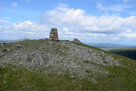
There is very handy parking behind the village school right at the start of the walk (Grid ref. SH756225). Walk along the road to the other end of the school, and you will see the bridleway which starts the walk leading past the school to the NE. The bridleway forks at the edge of the wood. Take the left hand branch to stay among the trees, continuing across rough pasture until you come across a track. Take the track in a N direction to the top of the bwlch, where there is a wall on the right. This wall leads all the way to the top of Rhobell Fawr, which you should reach about 2 hours after starting. The views are outstanding to the Rhinogs and north to Snowdon.
Descend from Rhobell Fawr in an ENE direction using the stile to cross the wall. The path follows another wall which descends to a track (Grid ref. SH798256). Turn left along the track and follow it for a short distance. There is a patch of the conifer wood on your right which has been more recently planted than the rest. Cross the wood in an E direction through this patch. I followed the line of the dilapidated wall at the northerly edge, which was quite wet towards the far edge. Climb the fence and turn NE heading for the corner of the wood, where there is an inconveniently located stile over the fence. From here make a beeline for the ridge of Dduallt, which you should have conquered in less than four hours from the start. From the track to the top of Dduallt is hard going: sometimes boggy, always rough. It is the only place I have been in Wales where there is no apparent sign of previous visitors. This is literally off the beaten track. It is also a good place from which to admire the symmetry and mass of Rhobell Fawr.
To return, retrace your steps to the edge of the forest and the track. Turn sharp left here and follow the track along the edge of the forest until you reach the fork at grid ref. SH797249. Leave the main track here (it leads to Rhydymain) and take the right hand fork, which skirts around the bottom of Rhobell Fawr, through a small wood. A furlong or so after leaving the wood, a footpath is signposted leading uphill to the right of the track. This path skirts around Moel Gors-y-Garnedd, following a line not far from a wall on the left. After about 2/3 mile cross this wall by a stile and continue diagonally ?over a little rocky outcrop to a gate in the corner of the field. From here the path is well-marked. Follow it due W, turning NW after a short distance around the buildings at Cae-heuad, whence you should follow the access track. After about 1/4 mile the track makes a sharp right turn, then joins a road. Turn left and follow the road a short distance to the marked footpath on the right, which will take you past Cae-Glas and Cae-crwth back to the wood and the school from which you started. The report in these pages of the descent to Rhydymain is not encouraging. By contrast, the return to Llanfachreth is a lovely gentle walk on easy tracks, and across farmland and woods, with good views of Cadair Idris.
Other walks nearby
| Walk 2551 | Rhobell Fawr from near Rhydymain | moderate | 5.7 miles |
| Walk 2937 | Aran Fawddwy northern approach | mod/hard | 8.4 miles |
| Walk 1646 | The Precipice Walk | easy | 3.5 miles |
| Walk 1107 | Waun Oer and Maesglase near Dinas Mawddwy | mod/hard | 11.0 miles |
| Walk 2334 | The Torrent Walk near Dolgellau | easy | 1.6 miles |
| Walk 1190 | Aran Fawddwy | mod/hard | 7.5 miles |
| Walk 3055 | Glasgwm | moderate | 4.5 miles |
| Walk 1255 | The Aran Ridge | hard | 11.2 miles |
| Walk 1400 | The Arans | hard | 14.0 miles |
| Walk 2059 | Castell Carndochan near Bala | easy/mod | 2.5 miles |
Recommended Books & eBooks
The Cambrian Way
 Guidebook to the Cambrian Way, a challenging three-week mountain trek through Wales from Cardiff to Conwy. The 470km un-waymarked route is presented from south to north. Often sticking to long, beautiful ridgelines, it crosses wild and rugged terrain and visits many of Wales's highest mountains, including Snowdon.
More information
The Wales Coast Path
 A single guidebook to walking the whole Wales Coast Path - 1400km (870 miles) the length of Wales from Chester to Chepstow, including Anglesey, described in 57 stages. The route passes through the Snowdonia and Pembrokeshire National Parks and many AONBs and can be linked with the Offa's Dyke Path for a complete circuit of Wales.
More information
Messaging & Social Media
Message Walking Britain and follow the latest news.

Mountain Weather
Stay safe on the mountains with detailed weather forecasts - for iOS devices or for Android devices.