Ombersley, the Droitwich Canal, Salwarpe & the Severn
Worcestershire Walk
County/Area - Worcestershire
Author - Peter Lane
Length - 11.0 miles / 17.9 km Ascent - 630 feet / 191 metres
Time - 6 hours 10 minutes Grade - easy/mod
Maps 

| Ordnance Survey Explorer 204 | Sheet Map | 1:25k | BUY |
| Anquet OS Explorer 204 | Digital Map | 1:25k | BUY |
| Ordnance Survey Landranger 150 | Sheet Map | 1:50k | BUY |
| Anquet OS Landranger 150 | Digital Map | 1:50k | BUY |
Walk Route Description
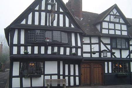
Click image to visit gallery of 12 images.
This walk starts in the picturesque village of Ombersley and tours the Worcestershire countryside using the Wychavon and Monarch's Ways, returning along the mighty River Severn. A significant portion of the route is along the partly restored Droitwich Canal. This virtually flat route passes variously through fields, parkland, towpaths and river banks.
Despite the extensive use of defined leisure paths, waymarking can be sporadic and inconsistent, so map and compass are essential. This route can be very muddy too in places, so stout footwear is also essential. Two crossings of the A449 dual carriageway also present a potential hazard.
The starting point is the King's Arms in Ombersley, grid reference SO845635. There is ample parking along the road, particularly now that Ombersley has been by-passed. At the North end of the elegant King's Arms a signpost signals the footpath to Hadley. Follow this, noting the peculiar Wychavon Way marker - a stylised "W" made to resemble a crown. You will be following this route for some distance, but don't rely on the stylised waymark being present at every turn. At the busy A449 dual carriageway cross over taking extreme care. The continuation is directly opposite and runs virtually due East across fields.
Head for Gardner' Grove (wood) and keep it to your left. Multiple footpaths intersect at the wood's corner. Here continue East, flanking the wood until you come to Orchard Cottage. Flank this on two sides and emerge onto the driveway and thence to A4133 main road. Turn right here, cross and take the first minor road to the left into Hadley. At a junction, continue right to follow the Wychavon Way down a lane. Pass the Mill House and then the lane becomes a bridlepath running along the South side of Nunnery Wood (one of at least two so-named in Worcestershire).
At a metal kissing gate, depart the Wychavon Way and passing through the gate, take up the Monarch's Way. Continue through the fields along a well trodden path and cross the access road from Westwood Farm to Westwood House. Walk across Westwood Park in an Easterly direction along a fairly well worn route, reaching the main drive to Westwood House. Cross this and passing through a kissing gate opposite, follow the Monarch's Way through woods as it turns right and emerges at Westwood Way on the outskirts of Droitwich.
The planners have made a very sensible change to the Monarch's Way's ongoing route here, taking it left for a short distance along Westwood Way and then turning first right along Briar Mill. (On older maps the route continues along the deadly A4133). Walkers must make sure they walk along Westwood Way over the A4133 which then becomes Briar Mill. Cross over the River Salwarpe and then pick up the Droitwich Canal towpath heading South West. Follow this all the way to Salwarpe hamlet itself.
At the time of writing, there was no choice but to exit the towpath at a Y branch and head up to the Church, given ongoing repairs to the retaining wall along the canal. This is a worthwhile diversion in any eventuality, in order to see the churchyard with its ancient Yew trees. Just beyond the Church, a stile on the left and waymark denotes the continuation of the Monarch's way across fields, soon rejoining the canal towpath.
A picnic table along the towpath is just one of two places where you can stop for a picnic. The next is the bench at Porter Mill, where the towpath gives way to a minor road (beware of swans!). From this point, turn left at the T junction and then depart the Monarch's Way, continuing along the towpath describing a giant "U" on the map.
The towpath reaches a derelict lock as it emerges at a bridge. A parallel path runs directly to the right here, doubly signposted as a footpath and bridleway. Turn 180 degrees and double back along this very muddy path which then swings left and crosses a footbridge. Continue left, following the blue bridlepath waymark, cross the River Salwarpe itself on a footbridge and head due North up the obvious bridlepath, ignoring the two footpaths peeling off to the left. Keep following this path as it turns left into a field and left again over a footbridge shortly after. Emerge onto a minor road at Chatley.
Turn left briefly and then take the footpath opposite along the side of Caves Farm. Reaching a kissing gate opposite in a particularly muddy spot, pass through and turn 90 degrees left, follow the hedge-line and continue across a field when the hedge disappears. Waymarks on stubby posts help to define this path as it works its way to the busy A449 dual carriageway.
Cross the main road taking extreme care. A tarmac path slightly North on the opposite side descends to a wooded area. Follow this Northwards to a lane, turn left and curve left down the lane to a stile on the right and a short section of footpath leading over another stile in a few metres onto the river plain. Follow the bank of the mighty River Severn Northwards past a couple of wooden sheds and then a green tin shed at a fence boundary.
Another 300 metres on from the tin shed a stile on an embankment on the right signals the return to the Wychavon Way. Follow this through muddy woods, past Black Pool (keeping to its banks) and then through fields back to the road. Turn North along the road and return to the start point. The pubs in Ombersley are renowned for their good food, the Crown and Sandys is particularly popular at lunch times.
Other walks nearby
| Walk 2142 | Severn Valley from Grimley | easy | 5.0 miles |
| Walk 3240 | Woodbury and Abberley Hills from Great Witley | easy/mod | 5.3 miles |
| Walk 1099 | Abberley Hills - Worcestershire Way Circular | easy/mod | 4.0 miles |
| Walk 3662 | Abberley Circular | easy/mod | 4.8 miles |
| Walk 1006 | Hanbury Hall & Piper's Hill Circular | easy | 5.5 miles |
| Walk 3461 | Hanbury Park from Piper's Hill circular | easy | 5.3 miles |
| Walk 1480 | Mount Segg & Harvington Hall | easy | 5.8 miles |
| Walk 3502 | Two Rivers Walk to Powick and Worcester | easy | 6.5 miles |
| Walk 3217 | Bewdley and Snuffmill Dingle | easy | 5.0 miles |
| Walk 1313 | White Ladies & Aston circular | easy | 5.5 miles |
Recommended Books & eBooks
No suggestions for this area.Messaging & Social Media
Message Walking Britain and follow the latest news.

Mountain Weather
Stay safe on the mountains with detailed weather forecasts - for iOS devices or for Android devices.