Around Aldermaston
Berkshire Walk
County/Area - Berkshire
Author - Peter Lane
Length - 5.0 miles / 8.1 km Ascent - 100 feet / 30 metres
Time - 2 hours 40 minutes Grade - easy
Maps 

| Ordnance Survey Explorer 159 | Sheet Map | 1:25k | BUY |
| Anquet OS Explorer 159 | Digital Map | 1:25k | BUY |
| Ordnance Survey Landranger 174 | Sheet Map | 1:50k | BUY |
| Anquet OS Landranger 174 | Digital Map | 1:50k | BUY |
| Ordnance Survey Landranger 175 | Sheet Map | 1:50k | BUY |
| Anquet OS Landranger 175 | Digital Map | 1:50k | BUY |
Walk Route Description
Click image to visit gallery of 12 images.
A straightforward short walk that features water courses prominently. A pleasant circular that visits meadows along the courses of the Kennet River and Kennet and Avon Canal.
The walk commences at Aldermaston Wharf. Park on the side of the road at Station Road just at the swing bridge on the A340 in the village, grid reference SU601672. Cross the A340 at the swing bridge and head along the towpath heading East along the canal passing the Kennet and Avon Canal Visitor Centre. Continue past the canal boat refurbishment works and many long boats, past a lock to the next swing bridge on a minor road. Turn right here and after 400 metres turn right at the Kennet River, following the footpath past gravel ponds until reaching a driveway.
Turn right up the driveway for a few metres and look for a narrow enclosed footpath. Follow this to a Salmon ladder and river crossing. Continue over a stile after crossing the river and after about 100 metres turn right, following the footpath sign along the hedge-line. Keep the hedge to the right and the path eventually turns into a green lane. Continue along this past a property until a footpath is seen turning off to the left. Ignore this and after a few meters a footpath to the right appears. Cross the stile and enter the open field. Head straight across to a stile, footbridge and continue following the same line until the path emerges at the A340 at the Mill. This is a popular venue for weddings and functions.
Cross the road (with care), turn left and after a few metres take the footpath on the right that follows the Kennet River closely. Take this footpath across a field, turning right across a bridge over a small tributary, straight across a field, then variously following the river bank and through nearby woods (although never far from the river). Cross the bridge and follow the river back along the opposite side (cycle route 4). The canal turns off left emanating from the river. The footpath continues up the cut to a bridge at Froude's Lane. Cross the bridge and continue along the right bank of the canal.
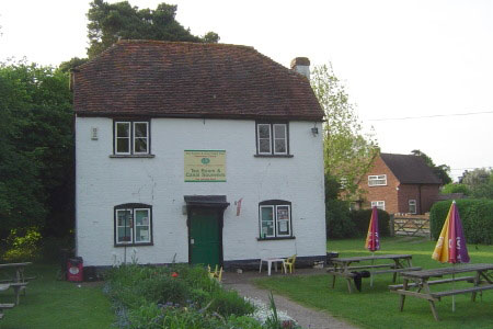
Eventually the towpath returns to Aldermaston Wharf. Take note of the design of lock 95 with its unusual collapsed walls. After the wharf itself, return to the start point, or turn right at the A340 and visit the Butt Inn after about 100 metres!
Other walks nearby
| Walk 1847 | Silchester Common & Calleva Atrebatum | easy/mod | 6.2 miles |
| Walk 1508 | Hannington & Kingsclere circular | easy | 6.0 miles |
| Walk 2344 | Newbury to Hungerford via Kennet & Avon Canal | easy/mod | 9.0 miles |
| Walk 2275 | Lowbury Hill & The Fair Mile | easy/mod | 7.8 miles |
| Walk 3413 | North Wessex Downs & Source of the Test | moderate | 15.0 miles |
| Walk 3484 | The Fair Mile & Unhill Bottom, near Streatley | easy/mod | 7.8 miles |
| Walk 2660 | Lowbury Hill & Roden Downs from Compton | easy/mod | 6.0 miles |
| Walk 2063 | Watership Down and Ladle Hill from the Sydmonton Estate | easy | 4.5 miles |
| Walk 3594 | Beacon Hill near Burghclere | easy | 1.5 miles |
| Walk 3595 | Old Burghclere & Burghclere from Beacon Hill | easy/mod | 5.6 miles |
Recommended Books & eBooks
The Kennet and Avon Canal
 Guidebook to walking along the Kennet & Avon Canal. The 94 mile route from Reading to Bristol is split into 7 stages of fairly easy walking and includes the UNESCO World Heritage Site of Bath and Bristol's Floating Harbour. 20 circular walks are also included, ranging from 4¼ to 9 miles, taking in the best sections of the canal.
More information
Messaging & Social Media
Message Walking Britain and follow the latest news.

Mountain Weather
Stay safe on the mountains with detailed weather forecasts - for iOS devices or for Android devices.