Saddle Fell, Fair Snape Fell & Parlick from Chipping
Forest of Bowland Walk
Region - Forest of Bowland
County/Area - Lancashire
Author - Lou Johnson
Length - 8.0 miles / 13 km Ascent - 1520 feet / 461 metres
Time - 5 hours 30 minutes Grade - moderate
Maps 

| Ordnance Survey Explorer OL41 | Sheet Map | 1:25k | BUY |
| Anquet OS Explorer OL41 | Digital Map | 1:25k | BUY |
| Ordnance Survey Landranger 102 | Sheet Map | 1:50k | BUY |
| Anquet OS Landranger 102 | Digital Map | 1:50k | BUY |
Walk Route Description
Click image to visit gallery of 12 images.
The Forest of Bowland has a variety of landscapes from rolling agricultural land to wild moorland. In addition this Area of Outstanding Natural Beauty (AONB) has a number of picturesque villages including Chipping from where this walk starts. The route crossed fields to climb onto the open fells eventually reaching one of the greatest viewpoints in England. The return is via quiet country lanes.
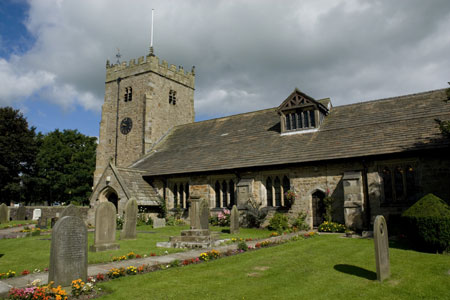
The village of Chipping has a car park and toilets (grid ref. SD621433). To start take the lane between the church and cafe walking in a north-westerly direction out of the village. At the first junction bear right and descend to pass one of the former cotton mills now producing chairs. Continue uphill on the lane with the large millpond on your left. About half way along the pond take the signed footpath on your right (grid ref SD619436). This climbs across a field heading roughly north. The way ahead is clear and you soon reach an indistinct path junction in the third field (grid ref. SD620441). Bear left here and take the narrow path that drops down to run parallel to Dobson's Brook, which is on your left. The path enters some trees with the route ahead always clear. Reaching a field with Windy Hill above to your right (grid ref. SD619445), continue and walk parallel to the stream on your left to join an access track. Turn left along this track to reach a road (grid ref. SD616448).
Cross straight over and walk up the access road to Saddle End farm. Ahead the fells are in view with the pyramid shape of Parlick Fell at the western end. Pass through Saddle End farmyard to join a rough track climbing onto the moors. The track is clear on the ground although in some places there is a choice of routes all seeming to end up at the same place. Open Country is reached at a gate (grid ref. SD611456). The track continues to climb steadily onto the flanks of Saddle Fell. You eventually reach a prominent cairn. After this the track continues towards a fence (grids ref. SD609468).
Using the stile, cross the fence and head across the moor following the clear path. The conditions underfoot are excellent in clear weather the route is never in doubt. Do check over your right shoulder after a short distance as you will be rewarded with a view that contains the Yorkshire Big Three (Pen-y-Ghent, Whernside and Ingleborough). After just over a kilometre you reach a fence (grid ref. SD597472). A few metres to the north is a cairn marking the true summit of Fair Snape Fell. However this unexciting location need now be visited unless you are bagging summits.
Cross the fence using the stile and bear left walking roughly parallel to the fence in a south-westerly direction. There is evidence of a path in places but the best advice is to follow your nose and take the easiest line across the moor. The going is generally good with the odd patch of soft peat. Soon you will arrive at the wind shelter and trig point on Fair Snape Fell West (grid ref. SD591468). This is a wonderful viewpoint and one of the best in England. With the Yorkshire Big Three, the Lake District Fells, the Isle of Man, Snowdonia (Eryri), the northern Peak District and much, much more to see in the 360 degree panorama you need to make sure you do this walk when the visibility is good. To add to the entertainment you are also likely to see many para-gliders and fixed wing gliders enjoying this location as the fells lift the incoming westerlies.
To continue, head south east from the shelter on a developing path to swing in a large arc round to the summit of Parlick. The way ahead is clear and you should soon be sitting on the final top of the walk. Parlick occupies a grand position looking south over Chipping towards Longridge Fell and beyond. Descend the south-eastern slopes of Parlick to reach Fell Foot cottage where you join a lane.
Walk down the lane, going straight ahead at the first junction. At Fish House Lane (grid ref. SD605439) turn left. Turn right at Fish House and walk back into Chipping. The footpaths across the fields look tempting although in reality the path junction at grid ref. SD611437 offers a few challenges. Unless you are a competent navigator prepared to fight through the undergrowth and hunt for waymarks then the lane is the easiest choice!
Other walks nearby
| Walk 2505 | Fair Snape Fell from Fell Foot, Forest of Bowland | moderate | 6.0 miles |
| Walk 2384 | Hodder Valley from Whitewell | easy/mod | 6.8 miles |
| Walk 2596 | The River Brock & Beacon Fell | easy/mod | 9.0 miles |
| Walk 2594 | Totridge Fell & Fiendsdale Head, Forest of Bowland | moderate | 11.0 miles |
| Walk 1670 | Hazelhurst Fell, Fair Snape Fell and Parlick | moderate | 11.0 miles |
| Walk 2508 | Dunsop Fell & the Forest of Bowland | moderate | 10.0 miles |
| Walk 2510 | Totridge Fell via Langden & Bleadale Water | mod/hard | 10.0 miles |
| Walk 2555 | Whitendale from Dunsop Bridge | moderate | 8.0 miles |
| Walk 2556 | Whitendale & Dunsop Fell from Dunsop Bridge | mod/hard | 15.0 miles |
| Walk 2331 | Whin Fell & Ouster Rake from Dunsop Bridge | moderate | 8.3 miles |
Recommended Books & eBooks
Walking on the West Pennine Moors
 This guidebook describes 30 walks on the West Pennine Moors, around Blackburn, Darwen, Chorley and Bolton, home to some of the most inspiring and exhilarating walking country. The walks range from short, easy rambles to more challenging hikes covering a variety of terrain, all of it easily accessible for day walking.
More information
Walking in the Forest of Bowland and Pendle
 A guidebook to 40 diverse circular day walks suitable for walkers with navigational skills. The Forest of Bowland and Pendle are two of north west England's upland AONBs, perfect for walkers who enjoy exploring rough hilly, sometimes pathless terrain. The routes include Ward's Stone, Pendle Hill, Longridge Fell and Fair Snape Fell.
More information
Messaging & Social Media
Message Walking Britain and follow the latest news.

Mountain Weather
Stay safe on the mountains with detailed weather forecasts - for iOS devices or for Android devices.