Penzance - a town stroll
Cornwall Walk
County/Area - Cornwall
Author - West Cornwall Tourism
Length - 1.5 miles / 2.4 km
Ascent - nominal or unknown
Time - 0 hours 50 minutes Grade - easy
Maps 

| Ordnance Survey Explorer 102 | Sheet Map | 1:25k | BUY |
| Anquet OS Explorer 102 | Digital Map | 1:25k | BUY |
| Ordnance Survey Landranger 203 | Sheet Map | 1:50k | BUY |
| Anquet OS Landranger 203 | Digital Map | 1:50k | BUY |
Walk Route Description
Click image to see photo description.
Penzance is the principal town on the Land's End peninsula. The town's name derives from the Cornish pen sans meaning holy headland. Penzance prospered from the 16th century, when markets were established and the town and harbour drew business away from nearby Marazion, which until then was the main port and market town on Mount's Bay. Penzance became a tin-trading town in later centuries and developed apace after the Great Western Railway established its western terminal where the present handsome Victorian station still stands. This circular walk gives a fresh insight to the interest and charm of this famous Cornish town.
Start at the Tourist Information Centre (grid ref SW475305) and cross towards the car park and cafe opposite. Continue along Wharf Road, with the car park to your left, then cross just before the entrance to the car park. Go left and pass the old lifeboat-house. Penzance was the first Cornish port to have a lifeboat. It was bought for 150 guineas in 1803 but was never used and was sold in lieu of debt in 1812. Continuous service did not begin until 1853 when a boat was supplied by the National Shipwreck Institution, predecessor of the modern RNLI. The lifeboat-house was built in 1885, but ceased service in 1908 when the lifeboat was moved to Newlyn and later, in 1913, to Penlee Point, between Newlyn and Mousehole. The present lifeboat is based at Newlyn.
Go left from the old lifeboat-house and follow the walkway across Ross Bridge and above the Abbey Basin. Ross Bridge was opened in 1881 as a link between the harbour piers and the railway. it was named after local MP, mayor and banker, Charles Campbell Ross and was replaced in 1981 after a century of service. Holman's dry-dock, on the right, was cut out of granite in 1810 and is still a ship-repair yard. Continue to the National Lighthouse Museum, which is housed in the old Trinity House Depot. The depot was built in the 1870's on the site where the building blocks of the Wolf Rock Lighthouse were fashioned. The present Lighthouse Museum offers a fascinating view of a remarkable tradition.
Continue to the Dolphin Inn. This distinctive building was said to be the occasional headquarters of the great Elizabethan commander Sir John Hawkins during the long hostilities with 16th century Spain. The inn was reputedly used as a courthouse by George Jeffreys, the infamous 'Hanging Judge' who tried, and rather briskly condemned, many followers of Monrnouth's rebellion in the 17th century. During the early 1900's, workmen restoring the building found a hideaway which contained two oak casks in a good state of preservation. Another secret room was found in the roof at a later date. The inn also holds the dubious reputation of being the first place in Britain where tobacco was smoked, a possible reference to the early landfall of 16th century vessels importing tobacco to Britain from the West Indies. The ghost of an old sea Captain is said to haunt The Dolphin. Just round to the left of The Dolphin is the Barbican complex including an aquarium, several craft shops, and a cafe, all housed in an old building of great character.
From The Dolphin, cross the road once more, with special care on this busy corner, and walk alongside the inner harbour and out to the end of the pier. This arm of the pier was extended in 1852 after a shipping accident in the harbour. The lighthouse on the pier was erected at the same time, replacing one destroyed by a storm in 1825. The cast iron column of the lighthouse was manufactured by the Copperhouse Foundry at Hayle. From this pier the R.M.V Scillonian makes its regular sailings to the Isles of Scilly.
Retrace your steps along the quay to reach the main road. Go left and continue to the granite war memorial, erected in 1922 to commemorate the Great War. Below are the Battery Rocks, so called because a small fort, complete with a battery of guns, was built here in 1740 because of Britain's intermittent Hostilities with France. The fortifications were later lost beneath the present Jubilee Pool, an art deco construction of 1935 that has been recently refurbished. There is a broad walkway leading round the left-side of the pool to the Battery Rocks.
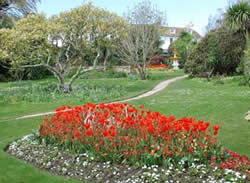
Re-cross the road to enter the St. Anthony's Gardens. These were laid out in 1933 close to the site of the ancient Chapel of St. Anthony a small religious building reputedly built by fishermen, possibly as early as the 6th century. The large fountain that stands in the gardens is carved out of a single piece of granite. It once stood outside St. John's Hall, Penzance's municipal building in Alverton Street. From the Gardens there are fine views across the bay to the fishing port of Newlyn. Leave the gardens through an iron gate, then turn left. Pass the Yacht Inn, a 1936 building in good, 'marine' style. Turn right, cross the road, then enter St. Mary's churchyard beneath a stone arch, and walk through the churchyard to the Church. This granite building, built between 1832-36, stands on the site of a medieval chapel and is an example of rather severe Victorian Gothic architecture.
The high altar is impressive. The interior of the church was restored after fire devastated it in 1985. Leave the churchyard by the main gate and go left up Chapel Street. The red-brick house of Maria Branwell, the mother of Charlotte, Emily, Anne and Branwell Bronte, is passed on your left; a plaque marks the spot. The building is probably 18th century.
Reach a cross-roads. Diagonally opposite is the Admiral Benbow, which has some 17th century features. The building is, inevitably, associated with smuggling, as symbolised by the piratical figure straddling the roof-ridge. Opposite the Benbow is the Nautical Museum with many marine artefacts and exhibits. Turn left and, soon, bear right at a fork by Regent Buildings. Follow the road downhill, and seek out a relief of the severed head of St. John the Baptist over a doorway on the right. This is the old Common Seal of the Borough of Penzance, registered in 1620 and adopted by the Corporation, possibly because of its association with the ancient name pen sans that meant holy head as much as holy headland.
Continue downhill past the old National School, built in 1841. Cross to the right at the junction, and a short distance further on, turn right, signed Morrab Gardens. Go through a gap by iron railings into Coulson's Place, turn up right and go through a gate into the Morrab gardens. The Gardens were laid out in 1889, and contain many subtropical plants such as palms, aloe, myrtle, geranium and camelia. There are magnolias that are over 100 years old. Enjoy the gardens, then leave through the northern exit, which lies above and to the right of the ornamental fountain. Walk a short distance, then take the first turn on the left; there is a gas-lamp at its entrance. Continue along the passageway of Morrab Terrace past a row of attractive stuccoed houses. Keep straight ahead across an open area and continue down a narrow passageway to reach a zebra-crossing at Morrab Road.
Cross over, then go right, then left through the gateway to Penlee Memorial Park. The 1860's Penlee House is soon reached. It is now the Penzance and District Museum and Art Gallery, with excellent displays of fine art, archaeology, local history and figurative paintings of the Newlyn School. The granite cross that stands in front of Penlee House dates from the 11th century and originally stood at Penzance's busy Greenmarket. Behind Penlee House are the restful Penlee Memorial Gardens.
Return through the gateway to Morrab Road, then turn left to pass the Public Library and School of Art. Note the fine mounted cannon outside the latter. Go left down the wide passageway alongside the School of Art. At the end of the railings, and just before the car park, turn right and walk up the lane to emerge at the main road just right of the First and Last Inn. Cross over, using the pedestrian crossing. Go right, then left up Penalverne Drive and cross right, using another crossing, to reach St. John's Hall. This substantial building, one of the largest granite buildings in Britain, was built in the 1860's. On the top step is a granite slab; it is over seventeen feet long and is one of the largest ever cut. Within St.John's Hall is The Royal Geological Society of Cornwall's Geological Museum housing an outstanding collection.
From St. John's Hall, go along Alverton Street towards the centre of Penzance. Cross the bottom of Clarence Street and continue through the bustling Greenmarket to Market Place. Ahead lies the Market house (Lloyds Bank building) with its handsome dome. The building was erected in 1838. It's eastern half was used as a market and the western section was the Guildhall. Go down the narrow lane to the left of the Market House. In front of the impressive eastern portico, and commanding the view down Market Jew Street, is a statue of Humphry Davy, Penzance's most famous son. Davy was born in Market Jew Street in 1778. He was an outstanding chemist and had literary and artistic gifts also. He is known popularly for his invention of the miner's safety lamp, but his greatest achievement was his discovery of such elements as potassium, sodium, calcium and magnesium. Davy was knighted, made a Baronet, and became president of the Royal Society.
Continue down a cobbled ramp and use pedestrian-controlled lights to cross Market Jew Street, then go up right and back to Market Place. Turn left, and keep left, down Chapel Street. Pass the Union Hotel, once the town Assembly Rooms and said to be the place where, in 1805, the announcement was first made of the outcome of the Battle of Trafalgar and of Nelson's death. Opposite is the Egyptian house, with its strikingly ornate facade, created in about 1836 during a time when Egyptology was in fashion. The facade was refurbished, and painted in bright colours, during the early 1970's. Further down Chapel Street pass the Turk's head, said to be the oldest pub in Penzance.
Turn left, just past the Admiral Benbow, and go down Abbey Street past Abbey House, parts of which are thought to be 17th century and older, although the facade is early 19th century. Keep ahead down Abbey Slip and then keep right to reach the old lifeboat house. Turn left along Wharf Road to return to the TIC and the station.
Other walks nearby
| Walk 3501 | Penzance to Porthcurno via Mousehole and Lamorna | moderate | 11.0 miles |
| Walk 2205 | Newlyn - a village trail | easy | 1.0 miles |
| Walk 2208 | Marazion - a town stroll | easy | 1.0 miles |
| Walk 1224 | Men-an-tol & Ding Dong Mine | easy | 3.0 miles |
| Walk 2354 | Merry Maidens & Lamorna Cove | easy | 4.1 miles |
| Walk 1081 | Zennor & St Ives coast path | mod/hard | 11.0 miles |
| Walk 1223 | Morvah to Zennor coast | moderate | 5.5 miles |
| Walk 2614 | St Loy's Cove & Logan Rock | moderate | 8.5 miles |
| Walk 3325 | Chun Quoit & Carn Kenidjack | easy | 4.0 miles |
| Walk 1028 | Chun Quoit and Botallack | moderate | 8.0 miles |
Recommended Books & eBooks
Walking in Cornwall
 This guidebook includes routes to 40 day walks in Cornwall. From short, easy strolls to longer, wilder routes, there is plenty to appeal to both families and experienced walkers. The walks explore the interior and coasts, including walks through picturesque villages, old tin-mining areas and the Lizard and Land's End Peninsulas.
More information
Messaging & Social Media
Message Walking Britain and follow the latest news.

Mountain Weather
Stay safe on the mountains with detailed weather forecasts - for iOS devices or for Android devices.