Herefordshire Beacon from Hollybush
Malvern Hills Walk
Region - Malvern Hills
County/Area - Herefordshire & Worcestershire
Author - Lou Johnson
Length - 6.5 miles / 10.6 km Ascent - 1470 feet / 445 metres
Time - 4 hours 40 minutes Grade - easy/mod
Maps 

| Ordnance Survey Explorer 190 | Sheet Map | 1:25k | BUY |
| Anquet OS Explorer 190 | Digital Map | 1:25k | BUY |
| Ordnance Survey Landranger 150 | Sheet Map | 1:50k | BUY |
| Anquet OS Landranger 150 | Digital Map | 1:50k | BUY |
Walk Route Description
Click image to visit gallery of 9 images.
The Malvern Hills rise to the west of the River Severn. They form an impressive line of summits, the highest point of which is the Worcestershire Beacon at the northern end of the range. The hills lose height as you head south and this route concentrates on a section of the southern section of the ridge and includes the Herefordshire Beacon.
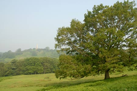
The walk starts from the small car park (Grid ref. SO758368) on the north side of the A438 Ledbury to Tewksbury road at Hollybush a couple of miles east of Eastnor Castle. The entry to the car park is not that obvious but is located almost on the crest of the hill. Space is limited so on fine days parking may be problematic. After parking take the signed track heading roughly north along the west flank of Midsummer Hill. This leads gently uphill with improving views to your left down to Eastnor Castle. You will also see the Obelisk in Eastnor Park on your left. Reaching a junction of tracks by a gate (Grid ref. SO756380), turn left and continue on the clear path to the Obelisk. From here the views across the rolling Herefordshire countryside are excellent.
To continue, return to the path junction and take the track entering the woodland. Stay ahead on the main track, which is easy to follow through the wood. In places the track is quite wet and an alternative parallel path has developed alongside the main track. This section of the walk traverses the western flank of the Malvern Hills although very little is seen during this pleasant section through the woods. After just under a mile the track bends left below Clutter's Cave and near a water tank with a signed footpath going straight ahead (Grid ref. SO760392). Take the footpath and continue through more woodland and past some large houses to the A449 main road.
Turn left along the main road for a short way and take the signed footpath on the opposite side. Do take care here as it is a busy road with limited visibility. Descend through the wood and into open fields. Ignore the footpath on your left just after leaving the wood and walk down the field to take the path on your right just before reaching the field boundary. Follow this path up the field and into the wood to reach the main road again. There is a café here and toilets.
Cross the main road to the car park. There is an information board outlining the history of British Camp. This Iron Age Hill Fort dates from 200 BC and occupies much of the Herefordshire Beacon. Leave the car park by taking the tarmac path uphill onto the Herefordshire Beacon opting for the higher path by forking right. This climb soon offers some excellent views along the main ridge of the Malvern Hills as well as offering an interesting insight into the substantial earthworks and defensive ditches of British Camp. The summit (338 m.) is soon reached and offers a grandstand view of the surrounding area, something which the builders of fort had clearly understood.
To continue the walk, descend south from the summit crossing Millennium Hill onto Broad Down. Below to your right is British Camp Reservoir. Stay on the main ridge crossing Hangman's Hill and Swinyard Hill. Reaching a stone built direction indicator (Grid ref. SO762383), turn right and descend to the track used on the outward section of the walk. Turn left along the track and continue to the path junction (Grid ref. SO756380). Take care to select the correct path and continue south back to the start.
Other walks nearby
| Walk 2380 | The Malverns from the Gullet | moderate | 12.0 miles |
| Walk 2664 | Herefordshire Beacon from British Camp car park | easy | 2.0 miles |
| Walk 1211 | The Worcestershire Beacon | easy/mod | 4.5 miles |
| Walk 1870 | Dymock Daffodil Walk | easy/mod | 9.0 miles |
| Walk 2445 | Upton-upon-Severn Circular | easy/mod | 6.8 miles |
| Walk 1556 | The Malverns - end to end | hard | 10.0 miles |
| Walk 1658 | Malverns circular from Noirth Hill | very hard | 18.0 miles |
| Walk 2483 | Cradley Circular | easy/mod | 6.0 miles |
| Walk 2817 | The Marcle Ridge from Much Marcle | easy/mod | 7.0 miles |
| Walk 1516 | Pershore Circular | easy/mod | 8.3 miles |
Recommended Books & eBooks
No suggestions for this area.Messaging & Social Media
Message Walking Britain and follow the latest news.

Mountain Weather
Stay safe on the mountains with detailed weather forecasts - for iOS devices or for Android devices.