Bredon Hill from Elmley Castle
Worcestershire Walk
County/Area - Worcestershire
Author - Peter Lane
Length - 5.5 miles / 8.9 km Ascent - 820 feet / 248 metres
Time - 3 hours 30 minutes Grade - easy/mod
Maps 

| Ordnance Survey Explorer 190 | Sheet Map | 1:25k | BUY |
| Anquet OS Explorer 190 | Digital Map | 1:25k | BUY |
| Ordnance Survey Landranger 150 | Sheet Map | 1:50k | BUY |
| Anquet OS Landranger 150 | Digital Map | 1:50k | BUY |
Walk Route Description
Click image to visit gallery of 10 images.
This short walk visits isolated Bredon Hill which dominates the otherwise flat Vale of Evesham. As a Marilyn in its own right, this walk is a must for any peak bagger. However there is much to recommend this walk besides peak bagging. A substantial and well preserved earthwork occupies part of the plateau summit along with a tower folly. The views from the summit extend 360 degrees.
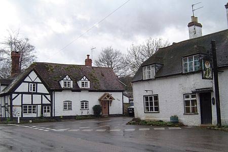
The start point is the quaint village of Elmley Castle. Park on the roadside North of the T-junction, grid reference SO982412. Walk to the T-junction and turn right (NW) along the road. Watch out for the short-cut footpath across a field that cuts the corner off the 90 degree left hand bend. Proceed up the hill towards Hill House Farm. At the end of the tarmac, a bridlepath continues up the hill to the right. Shortly after a gate, take the left hand muddier bridlepath (watch for the marker) continuing up the hill. Ignore other crossing bridlepaths and follow the track as it curves right and comes to a gate that opens out into Kemerton Camp earthwork.
Explore the earthwork at your leisure, making for the toposcope and tower folly. The views from the earthwork are spectacular, extending to the Vale of Evesham, the Malverns and the Cotswolds. From the tower, head in the general direction of the microwave tower WSW of the camp and join the permissive path to the amusingly named Lalu Farm. Here approach the farmhouse and to the right the bridlepath continues (with the microwave tower to your right) towards a wood. Reaching the wood, turn right and follow the boundary of the wood past the microwave tower until you reach the Wychavon Way as it enters the wood on the left.
Follow the Wychavon Way now down the hill. As it picks up a stream on the left and the road appears ahead, you can take one of the footpaths to the left over the stream to take the right of way that runs parallel to the road towards the Church in Elmley Castle. If you opt for this route, beware of mud! Check the condition of the field and whether or not it is planted up - take the road if conditions are unfavourable.
Return to Elmley Castle and take a few moments to look at the Cotswold stone built Church.
Other walks nearby
| Walk 2495 | Bredon Hill Circular | moderate | 10.6 miles |
| Walk 3637 | Evesham & Haselor Hill from Cropthorne | easy/mod | 8.0 miles |
| Walk 1853 | Bredon Hill from Kemerton | easy/mod | 5.2 miles |
| Walk 3063 | Stanway & Snowshill circular | moderate | 8.0 miles |
| Walk 1355 | Stoulton Circular | easy/mod | 7.5 miles |
| Walk 3072 | Broadway, Stanton & Laverton | easy/mod | 7.5 miles |
| Walk 3250 | The Broadway Tower from Broadway | easy/mod | 5.0 miles |
| Walk 3327 | Temple Guiting & Cutsdean from Stanway | moderate | 10.0 miles |
| Walk 3692 | Egdon, Stoulton & White Ladies Aston | easy | 6.3 miles |
| Walk 2676 | River Severn & Apperley from Tewkesbury | easy/mod | 7.5 miles |
Recommended Books & eBooks
No suggestions for this area.Messaging & Social Media
Message Walking Britain and follow the latest news.

Mountain Weather
Stay safe on the mountains with detailed weather forecasts - for iOS devices or for Android devices.