The Cloud from Rushton Spencer
Staffordshire Walk
County/Area - Staffordshire - North Staffordshire
Author - Mike Bexley
Length - 9.0 miles / 14.6 km Ascent - 630 feet / 191 metres
Time - 5 hours 10 minutes Grade - easy/mod
Maps 

| Ordnance Survey Explorer 268 | Sheet Map | 1:25k | BUY |
| Anquet OS Explorer 268 | Digital Map | 1:25k | BUY |
| Ordnance Survey Landranger 118 | Sheet Map | 1:50k | BUY |
| Anquet OS Landranger 118 | Digital Map | 1:50k | BUY |
Walk Route Description
Click image to see photo description.
For those people who have gazed at it from the Leek to Macclesfield road or for those people who have looked at this distinctive hill from afar, now is the time to stand on the top of 'The Cloud' and enjoy the view. The walk starts by crossing farmland. Then it is quiet lanes and bridleways with a gradual climb to the summit. After spending time taking in the views a short easy descent takes you back to the start. The route over the fields can be difficult to follow so there is extra detail. However armed with the Explorer map you should find no problems with navigation.
The walk starts from the Staffordshire Way car park in the village of Rushton Spencer on the A523 Leek to Macclesfield road. This car park is down a lane next to the Knot Inn (grid ref. SJ936624). Locate the Staffordshire Way and head south along the former railway track as far as the first road bridge. Here take the steps on the right up to the road. Cross the river and take the first footpath on your left. Cross the field half right to locate a stile on a high bank with wet ground at its foot. Continue in the same direction to reach a footbridge over a stream (grid ref. 935611).
Follow the footpath over a further stile and up the field to pass Lee House on your right. You will then exit onto a road serving Lee House. Turn right down this road and on reaching a further road turn left. This road descends to a stream. Just past the stream take the footpath on your left and proceed up the tractor path continuing in the same direction over fields and further stiles. On reaching a five-bar gate turn right towards Oxhay Farm. After a short distance take a stile on the right of the farm track. Climb the hill heading for a gap in the wall and continuing in the same direction to reach a road (grid ref. 917604).
Cross over the road and go down the drive to the house. Turn left at the house wall through their gate over their lawn to the stile in the wall. Take the stile on the right in the fence then another high stile on the right to trend left across the field to a further stile. From here proceed in the same direction through a gate to reach a farm lane (grid ref 913 607).
Turn right and walk a short distance towards Ashmore House to take the left. Further stiles will lead you down to a large footbridge over a stream and up to a road (grid ref. 908611). Turn left towards Long Edge Farm to take the first road right. From this point on the hardest part of the map reading is over! Continue up this pleasant lane to reach Dial Lane. It is thought that this lane was named after a circle of stones that used to be situated behind the Burial Chamber the other side of the field in front of you ( which can be reached by turning right along the road and then first left where a short footpath leads to the Chamber - then retrace your steps).
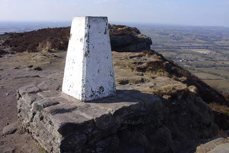
At Dial Lane turn left then right to walk up Gosberryhole Lane. Follow this bridleway turning left at the top. Stay on the bridleway climbing gently towards the summit bearing right to take the footpath up to Cloud Plantation. On reaching the stile you can proceed straight on through the woods or take the left path around the edge, both paths meet at the Trig Point (grid ref 905 637).
After a stop to take in the impressive views take the edge path to the east. This drops down to a road. Turn left down the road and take a footpath on the right. This is a lovely stretch descending to a lane. At the lane turn right and right again to follow the lane to Raven's Clough Farm (grid ref. 920637). As you reach the entrance to the farm take the footpath on the right, which leads over the field to reach the River Dane, which is on your left. Locate a yellow footpath marker in the distance and stay on the footpath over the river to reach a railway bridge. Proceed up the right hand side to what used to be a railway track. Turn right at the top and a short level walk brings you back to the start by the Knot Inn.
Other walks nearby
| Walk 1288 | Roaches & Hen Cloud from Tittesworth Reservoir | moderate | 8.5 miles |
| Walk 1178 | Roaches and Lud's Church | moderate | 7.3 miles |
| Walk 1707 | The Roaches short circular | easy/mod | 5.0 miles |
| Walk 3030 | Roaches & Lud's Church | easy/mod | 7.0 miles |
| Walk 2577 | Hawk's Nest, Goldstitch Moss & Lud's Church | moderate | 8.0 miles |
| Walk 1596 | Lud's Church and Roach End from Gradbach | easy/mod | 4.5 miles |
| Walk 1598 | Lud's Church, Back Forest & Clough Head | easy/mod | 6.8 miles |
| Walk 3323 | Gradbach, Three Shires Head & Knotbury | easy/mod | 7.1 miles |
| Walk 3197 | Flash, Knotbury & Three Shires Head | easy/mod | 8.2 miles |
| Walk 1371 | Rossendale Ramble from Sutton | moderate | 12.0 miles |
Recommended Books & eBooks
Walking in the Peak District - White Peak East
 Guidebook describing 42 half-day and day walks in the limestone landscapes of Derbyshire's White Peak, part of the Peak District National Park. One of two volumes, this book covers the east of the region, with potential bases including Bakewell, Eyam, Castleton, Birchover, Matlock and Wirksworth.
More information
Messaging & Social Media
Message Walking Britain and follow the latest news.

Mountain Weather
Stay safe on the mountains with detailed weather forecasts - for iOS devices or for Android devices.