Llyn Crafnant, Capel Curig & Llyn Colwyd from Trefriw
Snowdonia/Eryri Walk
Nat Park - Snowdonia - Eastern Carneddu
County/Area - Conwy
Author - Mike Bexley
Length - 13.0 miles / 21.1 km Ascent - 2900 feet / 879 metres
Time - 9 hours 20 minutes Grade - mod/hard
Maps 

| Ordnance Survey Explorer OL17 | Sheet Map | 1:25k | BUY |
| Anquet OS Explorer OL17 | Digital Map | 1:25k | BUY |
| Ordnance Survey Landranger 115 | Sheet Map | 1:50k | BUY |
| Anquet OS Landranger 115 | Digital Map | 1:50k | BUY |
Walk Route Description
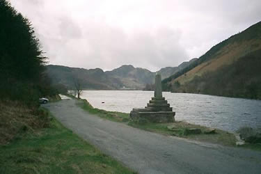
Click image to visit gallery of 4 images.
This is great walk using the old pass through the mountains connecting Trefriw to Capel Curig. The walk also depends on reservoir service roads, which make the walk much easier. At all times the views of the towering mountains are awesome and despite staying a low level you get a feeling of being "in the mountains".
From the Trefriw car park (grid ref. SH781630), opposite the large Woollen Mill, turn right over the narrow river bridge then turn left up the steep road opposite Fairy Fall Hotel. Keep on this narrow road for approximately 2 miles (3.2 km) until you reach Llyn Crafnant Reservoir (grid ref 754616). Cross over the river and through the gate to follow the bridleway on the right hand side of the reservoir. Do not go over any stiles until the track climbs to a corner. Here you descend left down a well worn path to a stile. Continue through some woods to pass some holiday cottages to reach the end of the road that comes up the other side of the reservoir (grid ref 740603).
Take the path ahead. This leads to a stile, turning right to follow a well defined path climbing up through the mountains to the left of Crimpiau. On reaching the brow Carnedd Moel-siabod dominates the skyline ahead. The path descends gradually to a concrete footbridge. Cross over the bridge and continue downhill away from the river through woods. Ignore the stiles on your left, which lead down to the road, instead continuing ahead to reach the A5 opposite the shops in Capel Curig.
Turn right along the busy A5. The first clearly signed footpath on the right is just after the corner and the house named Bron Heulog (which has no nameplate). Take this path and gradually climb up to Tal-y-waun, with its views of Tryfan up Ogwen valley. The path breaks up across the boggy moor but the direction is signposted to the bridge at the head of the impressive Llyn Cowlyd Reservoir (grid ref 717609).
Cross over the bridge and stile, turning right to follow the path on the left side (north side) of the Reservoir. Towards the end of this path it begins to climb. Start the climb with the path but turn right at the rocks walking along a wide path towards the dam.
On reaching the dam, descend down the dry side! Then walk away from the dam following the large pipe to the road that serves the farm on the left (grid ref 742642). Turn right through the five bar gate and walk up the single track road, which climbs out of the valley. At the top the views are of Llanrwst and in the distance the Denbigh Moors. Staying on the road you drop down to your start at Trefriw.
Other walks nearby
| Walk 2592 | Llyn Geirionydd & Llyn Bychan from Llyn Crafnant | moderate | 9.5 miles |
| Walk 2608 | Crimpiau & Creigiau Gleision from Llyn Crafnant | moderate | 7.5 miles |
| Walk 2679 | Circuit of Llyn Crafnant | easy | 3.5 miles |
| Walk 2285 | Llyn Geirionydd & Llyn Crafnant | easy/mod | 5.5 miles |
| Walk 1332 | Gwydir ForestLakes from Tyn Llwyn | easy/mod | 6.5 miles |
| Walk 1635 | Garnedd Uchaf & Llyn Eigiau | mod/hard | 9.0 miles |
| Walk 2542 | Foel Grach & Llyn Eigiau | moderate | 8.5 miles |
| Walk 2638 | Craig Eigiau, Melynilyn & Dulyn Resrs nr. Tal-y-Bont | moderate | 7.0 miles |
| Walk 3047 | The Carneddau from Llyn Eigiau | hard | 10.0 miles |
| Walk 2821 | Melynllyn & Dulyn Reservoir from Llyn Eigiau parking | easy/mod | 5.5 miles |
Recommended Books & eBooks
Snowdonia: 30 Low-level and easy walks - South
 Guidebook describing 30 walks in Snowdonia, Wales. Routes are mostly low level and on clear paths and showcase the region's beautiful scenery and rich history and culture. Part of a 2-volume set, this southern volume includes Trawsfynydd, Bala, Dolgellau, Machynlleth, the Harlech Coast and the valleys of the Mawddach and Dyfi.
More information
Snowdonia: 30 Low-level and easy walks - North
 Guidebook describing 30 walks in Snowdonia, Wales. Routes are mostly low level and on clear paths and showcase the region's beautiful scenery and rich history and culture. Part of a 2-volume set, this northern volume includes the Snowdon area, the Ogwen and Conwy Valleys, Betws-y-Coed, Beddgelert, Ffestiniog and the coast.
More information
Messaging & Social Media
Message Walking Britain and follow the latest news.

Mountain Weather
Stay safe on the mountains with detailed weather forecasts - for iOS devices or for Android devices.