Tideswell, Miller's & Cressbrook Dales from Litton
Peak District Walk
Nat Park - Peak District - Bakewell Monsal Trail
County/Area - Derbyshire
Author - Mike Bexley
Length - 7.0 miles / 11.4 km Ascent - 1200 feet / 364 metres
Time - 4 hours 40 minutes Grade - easy
Maps 

| Ordnance Survey Explorer OL24 | Sheet Map | 1:25k | BUY |
| Anquet OS Explorer OL24 | Digital Map | 1:25k | BUY |
| Ordnance Survey Landranger 119 | Sheet Map | 1:50k | BUY |
| Anquet OS Landranger 119 | Digital Map | 1:50k | BUY |
Walk Route Description
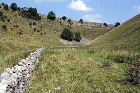
Click image to see photo description.
This easy Peak District walk in the Derbyshire dales visits three dales south of the charming village of Litton. There is always something of interest in these limestone dales, Trout in the rivers, Orchids in July and climbers on the crags throughout the year. In general paths are very clear but a little care is required to pick up the correct road from the village.
From Litton Village (Grid ref. SK165751), leave on the minor road in a south westerly direction passing Dale House to the road junction (Grid ref. 155748). Turn left and continue down hill, passing the sewage works on the right to reach a car park and picnic area, which is at the head of Tideswell Dale. Take the path to the right of the toilet block to follow the river down to a lane. Turn left to follow the River Wye downstream through Miller's Dale.
Reaching a collection of cottages note how clear the river is and you should be able to see the large trout. They are quite tame and will react quickly if you flick a small piece of bread into the river. The path now passes through the large derelict building of Litton Mill, notorious for its child labour. Still following the north bank of the river you will notice the river widens to form large pools. You are now in the rather quaintly named Water-cum-Jolly Dale surrounded by high cliffs. The sheer faces on your left are the playground for climbers. All the climbs have been graded and there are many sport climbs, which can be identified by the pre-fixed bolts in the rock face. At the cave you will see many of these bolts.
Just after the cave do not cross over the weir but keep to the north bank to pass another old mill (Grid ref. 173728). Turn left up the lane, keeping to the right hand lane to pass some cottages to enter Cressbrook Dale at a bend in the lane. There used to be a thriving watercress industry in this dale and this is the place to see the Common Spotted Orchid (when in flower the dale is covered with them).
The path wanders through the bushes and trees never far away from the brook before it climbs steeply up the east bank (Grid ref 176745) only to drop back down again into the dale. Keep to the dale passing the impressive Peter's Stone on your right, which is thought to be the place of the last public hanging in this country from the gibbet. The path ends at a road. Turn left and then left again to follow the footpath up the fields to Mires Lane and back to the start.
Other walks nearby
| Walk 1650 | Miller's Dale & Cressbrook Dale from Tideswell Dale | easy/mod | 5.5 miles |
| Walk 1859 | Chee Dale & Monk's Dale from Miller's Dale | moderate | 7.3 miles |
| Walk 1100 | Abney Moor & Bretton Clough | moderate | 8.5 miles |
| Walk 1651 | Monsal Trail & Ashford-in-the-Water from Lees Bottom | easy/mod | 8.8 miles |
| Walk 3341 | Brushfield, Miller's Dale & Monsal Head from Lees Bottom | easy/mod | 6.5 miles |
| Walk 1206 | Chelmorton & Flagg from Taddington | easy/mod | 6.0 miles |
| Walk 3620 | Bretton Clough & Abney Moor | easy/mod | 6.0 miles |
| Walk 1080 | Shatton Moor and Offerton | easy/mod | 7.5 miles |
| Walk 1270 | Abney Circular | easy/mod | 7.2 miles |
| Walk 1896 | Horseshoe Dale & Deep Dale from Wye Dale | easy/mod | 6.4 miles |
Recommended Books & eBooks
Dark Peak Walks
 Guidebook to 40 walks in the Dark Peak area of the Peak District National Park. 35 circular routes for most abilities, from 8km to 19km, around Edale, Marsden, Fairholmes, Baslow and Castleton, including Kinder Scout and Mam Tor, and 5 longer (25km to 45km) routes highlighting the best of the Gritstone Edges, High Moorland and Deep Valleys.
More information
Great Mountain Days in the Pennines
 An inspirational guidebook to 50 classic walks on the rolling Pennine landscape. The graded routes, between 6 and 13 miles in length, cover classic Pennine fells and moorland such as Whernside, Ilkley Moor and Pendle Hill; exploring the North and South Pennines, Yorkshire Dales, Howgills and Dark Peak. Many routes are also suited to fell running.
More information
Messaging & Social Media
Message Walking Britain and follow the latest news.

Mountain Weather
Stay safe on the mountains with detailed weather forecasts - for iOS devices or for Android devices.