Boundary Walk from Marsden
South Pennines Walk
Nat Park - Peak District - Black Hill Dovestone
Region - South Pennines
County/Area - West Yorkshire
Author - Peter Schofield
Length - 13.0 miles / 21.1 km Ascent - 1980 feet / 600 metres
Time - 8 hours 30 minutes Grade - moderate
Maps 

| Ordnance Survey Explorer OL1 | Sheet Map | 1:25k | BUY |
| Anquet OS Explorer OL1 | Digital Map | 1:25k | BUY |
| Ordnance Survey Landranger 110 | Sheet Map | 1:50k | BUY |
| Anquet OS Landranger 110 | Digital Map | 1:50k | BUY |
Walk Route Description
Click image to visit gallery of 3 images.
The Peak District National Park was established in 1951, followed three years later by the creation of the Ranger Service (then known by the more authoritarian sounding name of "wardens"). To celebrate the service's fiftieth anniversary in 2004, a fifteen day walk along the park boundary took place starting and finishing at Marsden. This walk is a modified version of the first day's route, following the actual boundary over much of its length but changed to enable public transport to be used at both ends. At many points, the walk offers fine views over this relatively little known northern extremity of the Peak District.
This Peak District walk starts in Marsden at the roundabout at the foot of Binn Road (Grid ref. SE048113). Go up Binn Road and continue along the road for 150 metres past the junction with the Wessenden Valley track. At the corner of a small copse, turn left through a gate and follow a path up to the front of a cottage. Go left around the cottage and continue straight on a path up the hill to reach a farm road, turning left to follow it to its end at Upper Acre Head. Keep straight ahead to a National Trust sign on the bank of the Deer Hill conduit, which here forms our first encounter with the park boundary.
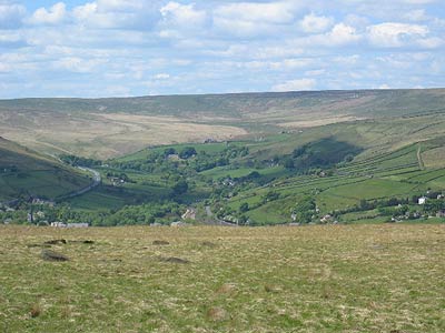
The conduit is followed for the next 1.3 km to Deer Hill Reservoir, and extensive views open out across the Colne Valley. Continue around the reservoir to a gate at the junction of Deer Hill End Road and Hassocks Road (Grid ref. 078113). Incidentally, anoraks and other collectors of trivia will be interested to know that this is actually the most northerly point of the Peak National Park.
Turn right through the gate, and after 200 metres, bear right at a stile and continue down the flank of Deer Hill to a gate at the junction with Red Lane. Turn left and after a further 100 metres, cross a bridge and go immediately over a stile to the right, following the bank of the conduit. This section follows part of the 14km Meltham Way with its distinctive "double diamond" logo, which was inaugurated in 2004.
Continue along the Meltham Way, following the channel for a further 2 km to the junction with Wessenden Head Road (Grid ref. 091101). From here, it's little more than a kilometre down the road to the bus stops in the centre of Meltham if you want to finish at this point. From Meltham, route 335 goes back to the start in Marsden every hour (every two hours on Sunday).
To continue the walk, cross the road, go over the stile on the other side and continue over several more stiles to a junction with a track where the channel finally peters out opposite a farm. Turn right up the track and after 200 metres, turn left at some seats on to a track running above Royd Edge Clough. Follow this track for 500 metres, turning sharp right at a cottage, again following a "Meltham Way" marker and go downhill to Royd Edge Clough. Cross the stream by a bridge and continue up past a farm, joining the Royd Edge road (Grid ref. 100097).
Turn right and go steeply uphill for 300 metres. Where the road swings right, continue straight up the Harden Moss track climbing steeply until the A635 is reached after a further 1.6 km. Cross the main road and continue opposite down Acres Lane, following the tarmac for 300 metres. At this point fine views open out over the whole of the upper Holme Valley and towards Black Hill.
Go right over a stile down a sunken lane to another track, turning left for another 300 metres to a stile. Cross the stile and follow the path steeply down, turning right on to the path that circles around Digley Reservoir. You are now on the Kirklees Way and this well waymarked route will be followed for the next 5.5 km. Follow the route over the Bilberry Reservoir dam and just after a small footbridge is crossed after a further 300 metres, bear right away from the reservoir and follow the path across the fields to Holme village. When a lane is reached, turn left to meet the A6024 after 200 metres.
There's a bus stop if you want to end the walk here. However, route 310 only operates every hour and if you need somewhere to wait, the "Fleece" pub is just 100 metres to the right. This walker friendly establishment offers good value food and always has an interesting guest beer to hand. But don't forget to leave your muddy boots in the clearly marked "boot park" just inside the front porch!
If you're continuing the walk, turn left down the A6035 for 200 metres and then turn right down the side of a house following a Kirklees Way marker. At the end of the wall views open out towards Ramsden Edge and Cartworth Moor which we will be crossing towards the end of the walk. At the end of the Ramsden Reservoir dam wall, turn sharp right along Brownhill Lane, reaching the picnic site after 200 metres.
Turn left along side the picnic site and go uphill for 300 metres. At a track junction bear right up the hill following the Kirklees Way marker. The route swings left and then right along a broad track around Ramsden Edge, and after 1.6 km reaches a road (grid ref 130050). At this point, the park boundary goes right to follow the tarmac. However, we take our leave of it at this point, and you cross the road and turn left down a broad track, Cartworth Moor Road. This is followed for 3 km almost back into Holmfirth, becoming tarmac after 1 km, and reverting to dirt after a further 1km. As you descend the latter part of the track, Holmfirth is laid out below.
When the track reaches a road (Grid ref. 143076), turn sharp left and continue along the road down past the school for another 500 metres. The road drops down into the centre of Holmfirth, coming out at a crossroads where the bus station for your bus back to Marsden is situated immediately opposite.
The start & finish points are linked by bus 335 which operates hourly on weekdays and two hourly on Sundays. You can also travel between the two points by changing in Huddersfield which may offer another option particularly on Sundays. Full details can be found on the Metro web site at www.wymetro.com.
Other walks nearby
| Walk 2359 | Cuckoo Walk & Bacon Butties from Marsden | hard | 19.5 miles |
| Walk 2644 | Marsden and the Standedge Trail | moderate | 11.0 miles |
| Walk 2926 | Cupwith & Shooter's Nab from Marsden | moderate | 13.0 miles |
| Walk 2946 | Buckstones and Linsgreave Head from Marsden | moderate | 8.8 miles |
| Walk 3159 | March Haigh Reservoir & Eastergate Bridge from Marsden | easy/mod | 5.0 miles |
| Walk 1900 | Standedge Trail from Marsden | moderate | 9.0 miles |
| Walk 1697 | Marsden to Edale challenge | very hard | 22.0 miles |
| Walk 2098 | Marsden Moor from Marsden | easy/mod | 6.4 miles |
| Walk 2561 | Digley & Ramsden Reservoirs from Wessenden Head | moderate | 9.5 miles |
| Walk 2518 | Black Hill & Four Reservoirs from near Wessenden Head | moderate | 10.0 miles |
Recommended Books & eBooks
Great Mountain Days in the Pennines
 An inspirational guidebook to 50 classic walks on the rolling Pennine landscape. The graded routes, between 6 and 13 miles in length, cover classic Pennine fells and moorland such as Whernside, Ilkley Moor and Pendle Hill; exploring the North and South Pennines, Yorkshire Dales, Howgills and Dark Peak. Many routes are also suited to fell running.
More information
Dark Peak Walks
 Guidebook to 40 walks in the Dark Peak area of the Peak District National Park. 35 circular routes for most abilities, from 8km to 19km, around Edale, Marsden, Fairholmes, Baslow and Castleton, including Kinder Scout and Mam Tor, and 5 longer (25km to 45km) routes highlighting the best of the Gritstone Edges, High Moorland and Deep Valleys.
More information
Messaging & Social Media
Message Walking Britain and follow the latest news.

Mountain Weather
Stay safe on the mountains with detailed weather forecasts - for iOS devices or for Android devices.