Sulber Gate & Crummack Dale from Austwick
Yorkshire Dales Walk
Nat Park - Yorkshire Dales - Lower Ribblesdale
County/Area - North Yorkshire
Author - Mike Bexley
Length - 9.5 miles / 15.4 km Ascent - 1300 feet / 394 metres
Time - 6 hours 0 minutes Grade - moderate
Maps 

| Ordnance Survey Explorer OL2 | Sheet Map | 1:25k | BUY |
| Anquet OS Explorer OL2 | Digital Map | 1:25k | BUY |
| Ordnance Survey Landranger 98 | Sheet Map | 1:50k | BUY |
| Anquet OS Landranger 98 | Digital Map | 1:50k | BUY |
Walk Route Description
Click image to visit gallery of 5 images.
This is a brilliant Yorkshire Dales walk with fantastic views. The walk can be started from both Austwick or Clapham.
Starting from Austwick proceed up the road to Town Head Farm (Grid ref. SD769687) passing the farm entrance on the right to go over the wall stile on your left. The path climbs the fields to a stile into Thwaite Lane. This stile has lost its steps on the lane side but there is a gate to its left. Turn left / west along the lane with good views already starting to be appreciated. On reaching the trees (Grid ref. SD 751 694) turn right up Long Lane. Starting from Clapham take the lane to the right of the church to this junction.
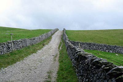
Long Lane lives up to its name! At first you feel pleased but after a while it seems endless with some very steep climbs. On your right Thwaite Scar closes in on you whilst to the left the views are of Ingleborough. In addition you will also see the entrance to Ingleborough Cave in the valley on your left.
At long last you are at the end of Long Lane. What a contrast! After all those stones you are now on soft short grass. There are some rocks on the right that make a good drink stop with an unrestricted view of Ingleborough.
Take the path that gently climbs to the right then swings to the left of Long Scar. The walking now is excellent, the views superb both of Ingleborough on the left and Pen-y-ghent to the right. Look out for a new low stone column on your right, it is one of two you pass, their purpose is to hold traffic signs! The spectacular view from this point is down into Crummack Dale.
After enjoying the view, return to your path heading slightly left to join a high wall on your right with views down of extensive limestone pavements. On reaching Sulber Gate (it is a gate) you will see a small gate on your right that leads on to a small grass viewing area, even a plank to sit on. Return through the gate to rejoin the main path as it drops down from Sulber Gate (Grid ref. SD 775 731) to reach a path crossroads. Turn right through Sulber Nick.
Just after the wall you will reach a path junction (Grid ref. SD 792 731). Turn right to follow the path heading south over a stile and following a wall on your right. Then its over this wall to continue following the path to the Grouse Butts. The path bears left towards the edge but just before a low cairn look for a path down - it is not visible until you are on top of it.
The wide easy path leads gently down into Crummack Dale to join a lane. Once on the lane take the first footpath on your right. This leads you over Austwick Beck footbridge from where you keep a wall on your right. On reaching a stile cross over and continue again in the same direction. This time the wall is on your left. You will see the stiles and footpath ahead of you. Joining a lane (Grid ref. SD 772 707), continue in the same direction down the lane towards Norber Brow. At the lane's corner go over the left stile down the fields to the right of a low barn and up to a gated stile that leads into Thwaite Lane.
If you are returning to Clapham turn right on this lane to the Long Lane junction then go left down to the village.
Returning to Austwick proceed over the gated stile opposite, down the field, over the wall into the farm, through the gate opposite, down some steps through a garden to the village and your start.
Other walks nearby
| Walk 1248 | Trow Gill, Ingleborough & Long Scar | moderate | 9.5 miles |
| Walk 2796 | Ingleborough via Gaping Gill & Norber | moderate | 13.0 miles |
| Walk 3599 | Clapham, Oxenber Woods, Feizor & Settle | easy/mod | 7.5 miles |
| Walk 3094 | Norber & Norber Erractics | easy/mod | 6.3 miles |
| Walk 2649 | Attermire Scar & Malham Tarn from Stainforth | mod/hard | 16.5 miles |
| Walk 1121 | Pen-y-ghent & Plover Hill | moderate | 9.0 miles |
| Walk 1013 | Pen-y-ghent | moderate | 6.5 miles |
| Walk 1500 | Pen-y-ghent via Horton Scar | moderate | 6.8 miles |
| Walk 3433 | Yorkshire Three Peaks from Horton-in-Ribblesdale | very hard | 24.5 miles |
| Walk 2617 | Nappa Cross & Victoria Cave from Langcliffe | moderate | 9.5 miles |
Recommended Books & eBooks
Walking in the Yorkshire Dales: South and West
 Part of a two-book set, this guidebook describes 44 walks in the southern and western Yorkshire Dales, including the famous 23 mile Three Peaks circuit over Pen-y-Ghent, Whernside and Ingleborough. The other, mostly circular routes of 3½ to 13 miles cover the scenic region between Sedbergh, Kirkby Lonsdale, Settle, Skipton and Grassington.
More information
Trail and Fell Running in the Yorkshire Dales
 Guidebook to 40 of the best trail and fell runs in the Yorkshire Dales National Park. Ranging from 5 to 24 miles, the graded runs start from bases such as Ribblehead, Dent, Sedbergh, Malham and Grassington and take in the region's diverse delights, from castles and waterfalls to iconic mountains such as Whernside, Ingleborough and Pen Y Ghent.
More information
Messaging & Social Media
Message Walking Britain and follow the latest news.

Mountain Weather
Stay safe on the mountains with detailed weather forecasts - for iOS devices or for Android devices.