The edges of Combs Moss near Chapel-en-le-Frith
Peak District Walk
Nat Park - Peak District - Kinder Scout Edale
County/Area - Derbyshire
Author - Mike Bexley
Length - 7.5 miles / 12.2 km Ascent - 900 feet / 273 metres
Time - 4 hours 40 minutes Grade - easy/mod
Maps 

| Ordnance Survey Explorer OL24 | Sheet Map | 1:25k | BUY |
| Anquet OS Explorer OL24 | Digital Map | 1:25k | BUY |
| Ordnance Survey Landranger 119 | Sheet Map | 1:50k | BUY |
| Anquet OS Landranger 119 | Digital Map | 1:50k | BUY |
Walk Route Description
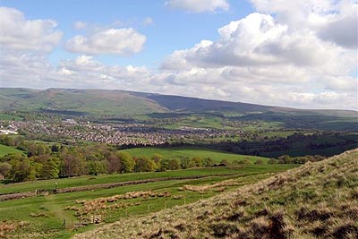
Click image to visit gallery of 7 images.
Walkers motoring between Chapel-en-le-Frith and Buxton must have looked up to this moor on their right, which was always sadly lacking in footpaths with no right-of-ways or public access. Now, thanks to Countryside & Rights of Way Act 2000, this area is "Open Access". This is a Peak District walk with fantastic views so choose a day with good visibility. The walk is also unique as there is only one path with no alternatives so instructions are minimal. A map is only required to pick out the start and the distant farms and peaks. Due the grouse moors dogs are not permitted on sections of this route.
The walk starts at the most northern point of the edge on a narrow lane between Combs village and Dove Holes. There is very limited parking on the side of the road by the new stile (Grid ref. SK052786) south of Bank Hall Farm. There is also a short public footpath from Chapel's Railway Station via Bank Hall Farm to the start.
Head up the very steep hill path to the remains of an Iron Age Fort at Castle Naze. The gritstone cliffs in the vicinity are very popular with climbers. On reaching the top, turn right and follow the narrow path along Combs Edge with views of Combs Reservoir. The path continues to follow the wall. At Pyegreave Brook it cuts back into the moor before bearing west then swinging south east joining a 4x4 track from Allstone Lee Farm leading up to two substantial buildings for Grouse shooting parties.
Still following the wall and edge, the track heads south west to the corner overlooking White Hall Centre and in the distance Fernilee & Errwood Reservoirs in the Goyt Valley. Still keeping the wall on your right, follow the path left to head south. The Old Buxton Road (Roman Road) and the busy newer Buxton A5004 road are clearly visible below.
The path still follows the wall sweeping south towards Moss House Farm, with views now of Buxton and Axe Edge in the distance. Just after Lightwood Reservoir, below, the path cuts left up Flint Clough, no guessing what was found here, then doubles back to follow the wall again. We are now heading north along Black Edge towards the trig point.
Its worth looking back here to see the vast Grouse moor, with the Dove Holes to Buxton road and, in the distance, Kinder Scout. The next name on the map is Hob Tor looking down on Dove Holes village then its Short Edge to the Iron Age Fort and a descent back to your start.
Other walks nearby
| Walk 2534 | Chinley Churn & South Head | easy/mod | 7.5 miles |
| Walk 3407 | Chinley to Edale without a car | moderate | 9.3 miles |
| Walk 2576 | Fernilee Reservoir, Goyt Valley | easy | 6.0 miles |
| Walk 3510 | Shining Tor, Cats Tor & Foxlow Edge | easy/mod | 7.0 miles |
| Walk 1092 | Taxal Edge, Jenkin Chapel & Pym Chair | moderate | 8.5 miles |
| Walk 1896 | Horseshoe Dale & Deep Dale from Wye Dale | easy/mod | 6.4 miles |
| Walk 1852 | Eldon Hill from Peak Forest | easy/mod | 5.0 miles |
| Walk 1728 | Axe Edge Moor & Three Shires Head | easy/mod | 7.2 miles |
| Walk 3136 | Shining Tor & Goyt's Clough | easy/mod | 5.1 miles |
| Walk 1174 | Kinder Low & Mount Famine | moderate | 7.5 miles |
Recommended Books & eBooks
Great Mountain Days in the Pennines
 An inspirational guidebook to 50 classic walks on the rolling Pennine landscape. The graded routes, between 6 and 13 miles in length, cover classic Pennine fells and moorland such as Whernside, Ilkley Moor and Pendle Hill; exploring the North and South Pennines, Yorkshire Dales, Howgills and Dark Peak. Many routes are also suited to fell running.
More information
Dark Peak Walks
 Guidebook to 40 walks in the Dark Peak area of the Peak District National Park. 35 circular routes for most abilities, from 8km to 19km, around Edale, Marsden, Fairholmes, Baslow and Castleton, including Kinder Scout and Mam Tor, and 5 longer (25km to 45km) routes highlighting the best of the Gritstone Edges, High Moorland and Deep Valleys.
More information
Messaging & Social Media
Message Walking Britain and follow the latest news.

Mountain Weather
Stay safe on the mountains with detailed weather forecasts - for iOS devices or for Android devices.