Coombs Ridge, Cown Edge from Broadbottom
Peak District Walk
Nat Park - Peak District - Kinder Scout Edale
County/Area - Derbyshire
Author - Mike Bexley
Length - 7.0 miles / 11.4 km Ascent - 1100 feet / 333 metres
Time - 4 hours 40 minutes Grade - easy/mod
Maps 

| Ordnance Survey Explorer OL1 | Sheet Map | 1:25k | BUY |
| Anquet OS Explorer OL1 | Digital Map | 1:25k | BUY |
| Ordnance Survey Landranger 110 | Sheet Map | 1:50k | BUY |
| Anquet OS Landranger 110 | Digital Map | 1:50k | BUY |
Walk Route Description
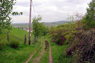
Click image to visit gallery of 3 images.
This short Peak District walk covers an area that sees few walkers. The route twists and turns to use old paths and lanes that past communities needed to attend work and markets. It starts in the historical past, passes lonely farms and outbuildings now redeveloped, climbs over moors to reach the high ridge with its views, before returning through ancient woodlands.
From the lane leading to the Lymefield Visitor Centre & Broad Mills Heritage Site (Grid ref. SJ996936), just off the main Mottram-in-Longdendale to Charlesworth road, proceed to the bottom of this dusty lane and turn right, heading west. The allotments should be on your right and a row of houses on your left. Follow the paths through the historic remains of the Broad Mills. In the 1800's this cotton mill employed over 1200 people and remained in business until the 1930's.
Soon you will join the River Etherow on your left. Cross over the footbridge to follow the path climbing left up to the lane at Warhurst Fold (Grid ref. SJ 992 934). Continue up this lane passing Woodseats. Turn right at the lane junction, then left, to follow the field footpath with a fence on your right that leads to a stile and drops down to a large derelict mill. Keep to the righthand high fence (with danger notices) down to the mill pond then up the drive ahead to the road at Chisworth.
Turn right on the road then left at the footpath by the pub. The footpath climbs steeply to a picnic area where a posh table and benches make a prefect place for your drink stop! Turn right up the stepped bank to the stile then go straight on with the fence on your left to join the road at Hilltop. Proceed up the road ahead and take the farm road left (Grid ref SJ 998 916) leading to Moorside. With Moorside Farm on your left turn right through gates and along the edge of the field to join a bridleway (grid ref SK 000 909) coming up from Gun Road.
Turn left up this bridleway and through the gate at Robin Hood's Picking Rods. These two stones set in their base were once known as The Maiden Stones and are thought to be used in the bending of bows when stringing. Continue up the bridleway passing Far Slack farm on your right and at the left corner, near the top (grid ref SK 013 910) go over the stile and the stile ahead to follow the short path up to the edge.
Now with the fence always on your right, follow the edge round. The views and dangerous drop are too good to hurry but providing you have not crossed over the right fence the path eventually curves left descending down to a stile into the lane leading up from Coombes Farm below on the left.
Go over the stile and the stile opposite to continue descending down The Banks over further stiles. Then join a deep bridleway on you right down to some cottages (Grid ref SK 007 926), then turn left down the lane and over the stile on the right, walk down to the hedge then left to the stile leading to sports fields and the road ahead at Charlesworth (grid ref SK 004 926).
Turn right along the road then take the footpath on the left between the houses, over the stile bearing left then right at the dike to follow a worn path leading to a stile. At the next stile turn right signed 'To Tod Wood '. Keep to the right hand edge of the field descending steeply to a stile into the woods, then steps down through the wood.
Keep to the footpath over footbridges, ignoring signed footpaths to Charlesworth. The path emerges from the wood to join the river bank then through a gate into the church yard and the road. Turn left down this road, over the traffic light controlled bridge, turning left at the next lane then right through Visitors Centre activity area to your start.
Other walks nearby
| Walk 2521 | Hollingworthall Moor & Walkerwood Reservoirs | moderate | 7.0 miles |
| Walk 1703 | Longdendale from Hadfield Station | easy/mod | 9.0 miles |
| Walk 1923 | Cown Edge & Whiteley Nab from Chunal | easy/mod | 6.5 miles |
| Walk 3607 | Reservoirs Walk from Tintwistle | easy/mod | 5.5 miles |
| Walk 2546 | Lantern Pike & Cown Edge from Rowarth | easy/mod | 8.0 miles |
| Walk 1759 | Torside Clough & Longendale from Old Glossop | moderate | 7.4 miles |
| Walk 1486 | Harry Hut, Mill Hill & Doctor's Gate from Glossop | moderate | 11.3 miles |
| Walk 1168 | Old Glossop & Bleaklow | moderate | 9.5 miles |
| Walk 2507 | South Head & Edale Cross from Hayfield | moderate | 8.0 miles |
| Walk 2622 | Sett Valley & Kinder from New Mills | moderate | 10.0 miles |
Recommended Books & eBooks
Walking in the Peak District - White Peak East
 Guidebook describing 42 half-day and day walks in the limestone landscapes of Derbyshire's White Peak, part of the Peak District National Park. One of two volumes, this book covers the east of the region, with potential bases including Bakewell, Eyam, Castleton, Birchover, Matlock and Wirksworth.
More information
Walking in Derbyshire
 Walking guidebook to 60 circular day walks in Derbyshire and the Peak District. Includes the Derwent, Wye and Trent river valleys, near Derby, Matlock, Glossop, Bakewell and Ripley. Routes range from easy to moderate and are between 4 and 14km (2 to 10 miles). Walks focus on places of interest, from Stone Age forts to castles to grand estates.
More information
Messaging & Social Media
Message Walking Britain and follow the latest news.

Mountain Weather
Stay safe on the mountains with detailed weather forecasts - for iOS devices or for Android devices.