Attermire Scar & Malham Tarn from Stainforth
Yorkshire Dales Walk
Nat Park - Yorkshire Dales - Lower Ribblesdale
County/Area - North Yorkshire
Author - Stephen Starkey
Length - 16.5 miles / 26.8 km Ascent - 2260 feet / 685 metres
Time - 10 hours 30 minutes Grade - mod/hard
Maps 

| Ordnance Survey Explorer OL2 | Sheet Map | 1:25k | BUY |
| Anquet OS Explorer OL2 | Digital Map | 1:25k | BUY |
| Ordnance Survey Landranger 98 | Sheet Map | 1:50k | BUY |
| Anquet OS Landranger 98 | Digital Map | 1:50k | BUY |
Walk Route Description
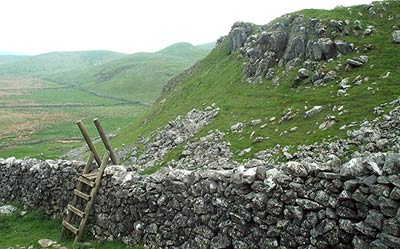
Click image to see photo description.
This Yorkshire Dales walk in the heart of the National Park starts and ends in the village of Stainforth, looping round via some of the main locations in the Malham area. Although bypassing Malham Cove and Gordale Scar, optional diversions to take in one or both would be possible in Spring - Summer months but would involve an additional 2km - 6km distance depending on the route chosen.
From the National Park car park in Stainforth (Grid ref. SD 821672), turn left on to the 'main' road towards Settle. Just after passing Stainforth Youth Hostel on the right, cross a stile on the left to join a waymarked grassy path across pasture land. The path tracks close to the Settle - Carlisle railway line and, after a short while, you come to the Hoffmann Kiln, part of the once thriving lime industry of the area but now part of the Craven Lime Heritage Trail. Though not too well signed at this point, the path passes behind (to left as you approach) the buildings and continues to the hamlet of Langcliffe.
Emerging on to the minor road next to the school and car park, turn left for about 50m to where a signed bridleway leads off up hill to the right before bending round to the right and following the line of a wall. At a small wood next to a wall junction overlooking Settle (Grid ref. SD 824640), turn left to climb the NW slopes of High Hill. Though the climb does not look too bad from either map or the ground, it is surprisingly tough on the calf muscles!
Follow this path east to the spectacular Attermire Scar - a great place for a rest and coffee. Continue east on the path with steep slopes to the left, eventually bending round to the southeast to meet the walled Stockdale Lane bridleway. Turn left along the bridleway on one side of a wide valley, passing Stockdale Farm and Rye Loaf Hill. When opposite the slopes of Kirkby Fell (Grid ref. SD 874640), take the bridleway to the left, following the line of the wall initially.
This path crosses pasture land, passing through limestone pavements typical of the Dales before meeting the Gorbreck Road RUPP. Turning left here would shorten the walk considerably, meeting up in about 1.5 km with the path from Capon Hall used later in the main route. However, the main route turns right at this point for the short descent to the road at Langscar Gate.
From here there are a choice of routes to Malham Tarn, the shortest being to head North on a bridleway through Dean Scar. My preferred route however is the longest of the options, crossing the stile opposite and taking the path along the side of the fence around the foot of Dean Moor Hill then southeast to meet up with the Pennine Way between Comb Hill and Ing Scar Crag. (Descending the valley below Ing Scar Crag will, in just over 1km, bring you to the spectacular but busy tourist location of Malham Cove).
Turn left here to follow the well waymarked route of the Pennine Way to Malham Tarn, which makes for a very pleasant coffee / lunch stop. The Pennine Way is followed around the tarn, passing the Field Studies Centre. When the Pennine Way turns right at a stile / gate (Grid ref. SD 888674), our route continues straight ahead on to a narrow lane, passing a series of stone cottages. Shortly after the cottages turn left down a lane that is also a permissive path to arrive at a minor road.
Continue ahead on the minor road, taking the right hand option at two minor road junctions and passing the impressive looking farm at Capon Hall. Continue up hill on the minor road past Capon Hall until a waymarked path leads off to the left over a stile in the hedge. After about 300m there is a choice of paths - the public footpath continues tracking close to the wall on the right; the more obvious path (not a public path) climbs gently to the South on the slopes of Black Hill. Whichever option you choose, turn right when meeting up with the Gorbreck Road RUPP.
This "road" is followed for some distance as it winds its way across undulating Dales moorland, passing the cavers honeypot of Jubilee Cave (Grid ref. SD 837655) along the way. The path emerges on to a minor road at a sharp bend next to a small woodland. Turn right to walk alongside the minor road, initially up quite a steep hill but then levelling off. Shortly after a cattle grid, look for a path leading off to the left towards Winskill Farm. Depending on the time of year you do this walk, care and confidence may be required near the cattle grid as it is not unusual for a gathering of 10 - 12 of our large bovine brethren to gather there. I'm not saying they are all bulls, but I've never yet seen one of them with udders visible.
Follow the path to the wall that marks the boundary of Upper Winskill Farm (Grid ref. SD 829665), where you turn right to follow the path, initially alongside the wall then winding downhill across open fields, eventually leading to a gate in the bottom left corner of the field. Leave the field via the gate then immediately look for a small gate on the right. Go through the small gate and follow the path winding down a short way to the spectacular, narrow waterfall of Catrigg Force (Grid ref. SD 832671).
From the falls, retrace the steps back to the small gate and then turn right to follow the stony bridleway back to Stainforth and the car park, though the ambience, food, beer and hospitality of The Craven Heifer are strongly recommended for rest & recuperation on the way. If the conditions have been wet / muddy underfoot, you may be pleased to know there is a boot washing facility outside the toilet block in the car park.
Other walks nearby
| Walk 2617 | Nappa Cross & Victoria Cave from Langcliffe | moderate | 9.5 miles |
| Walk 1404 | Oxenber and Wharfe Woods from Langcliffe | moderate | 10.5 miles |
| Walk 2603 | Feizor & Giggleswick Scar from Settle | easy/mod | 8.0 miles |
| Walk 1403 | Attermire Scar and Catrigg Force | easy/mod | 6.5 miles |
| Walk 1105 | Settle Circular | easy/mod | 6.0 miles |
| Walk 1740 | Attermire Scar & Victoria Cave | easy/mod | 5.1 miles |
| Walk 1548 | Rye Loaf Hill from Settle | moderate | 7.6 miles |
| Walk 2082 | Attermire Scar, Catrigg Force & Langcliffe | easy/mod | 7.5 miles |
| Walk 1251 | The Norber Erratics & Sulber Gate | moderate | 8.0 miles |
| Walk 2620 | Sulber Gate & Crummack Dale from Austwick | moderate | 9.5 miles |
Recommended Books & eBooks
Walking in the Yorkshire Dales: South and West
 Part of a two-book set, this guidebook describes 44 walks in the southern and western Yorkshire Dales, including the famous 23 mile Three Peaks circuit over Pen-y-Ghent, Whernside and Ingleborough. The other, mostly circular routes of 3½ to 13 miles cover the scenic region between Sedbergh, Kirkby Lonsdale, Settle, Skipton and Grassington.
More information
Trail and Fell Running in the Yorkshire Dales
 Guidebook to 40 of the best trail and fell runs in the Yorkshire Dales National Park. Ranging from 5 to 24 miles, the graded runs start from bases such as Ribblehead, Dent, Sedbergh, Malham and Grassington and take in the region's diverse delights, from castles and waterfalls to iconic mountains such as Whernside, Ingleborough and Pen Y Ghent.
More information
Messaging & Social Media
Message Walking Britain and follow the latest news.

Mountain Weather
Stay safe on the mountains with detailed weather forecasts - for iOS devices or for Android devices.