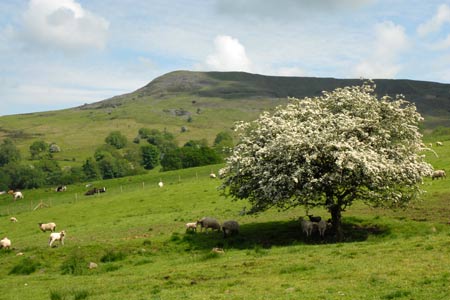
Titterstone Clee Hill & Cleeton St. Mary from Cleehill
Shropshire Hills Walk
Region - Shropshire Hills
County/Area - Shropshire
Author - Lou Johnson
Length - 7.5 miles / 12.2 km Ascent - 1500 feet / 455 metres
Time - 5 hours 20 minutes Grade - moderate
Maps 

| Ordnance Survey Explorer 203 | Sheet Map | 1:25k | BUY |
| Anquet OS Explorer 203 | Digital Map | 1:25k | BUY |
| Ordnance Survey Landranger 137 | Sheet Map | 1:50k | BUY |
| Anquet OS Landranger 137 | Digital Map | 1:50k | BUY |
| Ordnance Survey Landranger 138 | Sheet Map | 1:50k | BUY |
| Anquet OS Landranger 138 | Digital Map | 1:50k | BUY |
Walk Route Description
Click image to visit gallery of 12 images.
This walk visits the summit of Shropshire's second highest hill, crosses some wild moorland and also provides an opportunity to explore some of the industrial heritage associated with the once important granite quarrying industry.
The start is the parking area by the viewpoint on the eastern edge of Cleehill village (grid ref. SO595753). This is alongside the A4117 Ludlow to Cleobury Mortimer road. After parking cross the road and follow the rough road leading up to the Kremiln Inn public house. After a few hundred metres turn left through a gate to follow the former track of one of the railways that served the quarries. Continue on this track to reach Rouse Broughton, a terrace of houses, and a road (grid ref. SO587762). Turn right uphill and at the end of the cottages go through the metal gate opposite into a field (grid ref. SO587762). Careful reference to the OS map is essential and once through the gate, keep the field boundary on your immediate right and continue to a junction of paths including the Shropshire Way (grid ref. SO586765).
Maintain the same direction you have been walking across the next field. The path is not clear on the ground but you gradually descend to a fence with a gate in the left hand corner of the field. There is a basic stile in the fence and you cross this and continue across the next field with the boundary hedge on your immediate left. An improving track develops and this leads you down to a bridge over Benson's Brook. The track climbs out of the valley and through a gate to reach a lane in the hamlet of Titterstone (also known as Bedlam in the past).
Turn left down the lane and then first right up a track (grid ref. SO584773). This clear track climbs and loops round towards a cottage. Just before the cottage take the obvious footpath going off to the left. This leads to the grassy Bitterley Incline, which was once used to haul wagons up and down from the valley to the quarries above. Follow the path onto the incline and head uphill. To your left you can see the bulk of Titterstone Clee Hill and this is the next objective of the walk.
At the top of the incline you reach a flat area with the remains of concrete structures that were once part of the quarry. Bear slightly right and, with the concrete hoppers on your right, continue up the track to reach the car park on the next level. Bear right here and then go left to take the path that curves around the top of this quarry and leads to the trig point. The views are superb with many of Shropshire's hills in the panorama. On a clear day the view expands considerably and includes hills the Malverns and Black Mountains amongst many others.
After enjoying the view and perhaps taking a rest, walk northeast towards the rocky outcrop known as the Giant's Chair. From here a developing path leads down the northern flank of the hill towards Callowgate (grid ref. SO595792). As you descend this section of the Shropshire Way, the view ahead includes Brown Clee Hill, which holds the distinction of being the highest hill in Shropshire. Reaching Callowgate, bear sharp right and with the hedge on your immediate left head southeast on the bridleway towards Cleetongate.
The bridleway continues to reach a lane at Cleetongate (grid ref. SO605788). Turn right and follow the lane uphill into the village of Cleeton St Mary. Turn right just past the church in front of the almshouses. At the end of the terrace turn left onto the signed bridleway (grid ref. SO610786). In places the path is not too clear on the ground but if you keep the hedge or fence on your left you cannot really go wrong.
Where the fence on your left turns sharp left (grid ref SO599773), continue straight ahead. This path leads to the access road to the radar station and the car park visited earlier in the walk. Turn left down the road to reach Rouse Broughton Cottages, where you retrace your route along the old railway station back to the start.
Other walks nearby
| Walk 3334 | Titterstone Clee Hill and Catherton Common | easy/mod | 5.5 miles |
| Walk 3442 | Haws Hill from Tenbury Wells | easy/mod | 6.6 miles |
| Walk 3221 | High Vinnalls, Burrington, & Richard's Castle | mod/hard | 11.0 miles |
| Walk 2840 | High Vinnals & Richard's Castle | easy/mod | 6.0 miles |
| Walk 2633 | Brown Clee Hill | easy/mod | 6.3 miles |
| Walk 2345 | Clee Hills | easy/mod | 6.8 miles |
| Walk 2296 | Brown Clee Hill Circular | easy/mod | 4.5 miles |
| Walk 2248 | Wimperhill Wood and Longdon Orchard, Wyre Forest | easy | 4.0 miles |
| Walk 2288 | Pound Green and Dowles Brook from Hawkbatch | easy | 5.0 miles |
| Walk 2022 | Wenlock Edge & Aston Munslow | moderate | 7.8 miles |
Recommended Books & eBooks
Hillwalking in Shropshire
 Guidebook to 32 walking routes in Shropshire in the West Midlands. The routes range from 3 miles (5km) to 12 miles (19km), taking in highlights such as The Wrekin, Wenlock Edge, Long Mynd and Stiperstones, Castle Ring and Bury Ditches. Many routes start near delightful towns and villages including Church Stretton, Ludlow and Bishops Castle.
More information
Messaging & Social Media
Message Walking Britain and follow the latest news.

Mountain Weather
Stay safe on the mountains with detailed weather forecasts - for iOS devices or for Android devices.