Cairngorm Mountain via Coire an t-Sneachda
Cairngorms Walk
Nat Park - Cairngorms - Cairngorm North
County/Area - Highland
Author - Andy Smith & Alwyn Williams
Length - 6.0 miles / 9.8 km Ascent - 2270 feet / 688 metres
Time - 5 hours 20 minutes Grade - mod/hard
Maps 

| Ordnance Survey Explorer OL57 | Sheet Map | 1:25k | BUY |
| Anquet OS Explorer OL57 | Digital Map | 1:25k | BUY |
| Ordnance Survey Landranger 36 | Sheet Map | 1:50k | BUY |
| Anquet OS Landranger 36 | Digital Map | 1:50k | BUY |
Walk Route Description
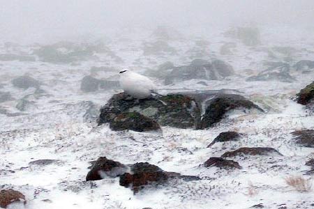
Click image to visit gallery of 9 images.
In winter conditions the possibilities for walkers and mountaineers in the Cairngorms are endless providing a real arctic challenge. The Northern Corries are within easy reach from the Coire na Ciste Ski Centre and consist of a huge ridge containing two Munros stretching from east to west. Without snow and ice this route provides an excellent route to Cairngorm's summit with clear paths and one steepest ascent out of the corrie.
This route includes a grade one winter climb and should only be undertaken by those competent to do so. It is passable without ropes, but two ice axes, crampons and great care is needed as the area is prone to avalanche conditions between October and April. A stop at the ranger station is well worthwhile where advice on the risk assessment that day can be obtained. The station is located in the ski centre car park.
After parking the car at the ski centre (grid ref. NH990060), take the path leading away to the west passing the ski tows. Within ten minutes an upper path splits to the left, this will take you due south towards Ston Coire an t-Sneachda. The crossing of a huge boulder field is quite typical of the Cairngorms and can be tricky as the drops in between are quite precarious! Once the Loch is reached, bear left and swing round the east side of the loch where a faint path appears at NH995033 underneath the Central Gully/Vent. The path starts to climb and cross diagonally towards the Goat Track.
By now the going is quite tough, we took a faint line to the left and straight up due to an avalanche assessment that day, but if you are lucky enough to enter the gully, maintain your line to the left next to the rocks as the snow is at its thinnest providing good axe and foot holds. The climb is quite demanding and you should expect to take around an hour. Constant spin-drifts mean visibility can be impaired so beware of any over-hanging cornices near the top ledge. Again if you stay left, you will be out of danger as most collect in the centre. Once the top is reached, turn left following the edge toward Cairngorm Mountain (not yet in view) as the winds buffet you from all directions!
As you follow the edge it starts to turn northwards and dropping downhill slightly. On a rare clear day you can now see Cairngorm summit with its radio mast slightly south of the summit. Follow the edge leading towards the ski tows. Continue until the 1141 metre spot height is reached marked by a large cairn at NH999039. From here turn directly east and head up the final slope of Cairngorm Mountain. Once you reach the flat summit expect to be slightly off target as it is a little bit hit and miss! The summit marker provides a little break from the wind as you take in the 4081ft giant. When leaving, simply follow the line of large cairns north away from the summit until a roped path appears, although this can be under snow! Within half hour the Ptarmigan Station is reached, the highest building in Britain.
Leave the station and head north with the tows to your right. The route follows the fence for around 500m before slowly turning left where it descends to the rear of the day lodge, where you walk through and onto the car park thinking back on what you have achieved.
Other walks nearby
| Walk 2421 | Braeriach via the Chalamain Gap | hard | 15.0 miles |
| Walk 1605 | Loch an Eilein & Rothiemurchus Forest from Loch Morlich | easy/mod | 10.0 miles |
| Walk 2607 | Lairig Ghru & Chalamain Gap from Glenmore | mod/hard | 11.0 miles |
| Walk 3579 | Meall a'Bhuachaille & Ryvoan Bothy from Glenmore | moderate | 5.5 miles |
| Walk 3218 | Eag a' Chait gap Via Rothiemurchus Lodge from Glenmore | moderate | 8.2 miles |
| Walk 1020 | Glenmore to Linn of Dee via Lairig Ghru & Corrour | hard | 21.0 miles |
| Walk 2412 | Craiggowrie & Creagan Gorm from Loch Morlich | mod/hard | 7.3 miles |
| Walk 1904 | Loch Morlich circular (near Aviemore) | easy | 4.0 miles |
| Walk 1721 | Braeriach via Lairig Ghru | hard | 18.2 miles |
| Walk 3299 | Loch an Eilein from Coylumbridge | easy/mod | 7.0 miles |
Recommended Books & eBooks
Great Mountain Days in Scotland
 Inspirational guidebook to 50 challenging routes for mountaineers, scramblers, hillwalkers and fell runners, many long enough to backpack over 2 days, especially in winter (12 to 25 miles). A mix of classic routes and unsung gems across Scotland from Galloway to the Outer Hebrides in widely differing wild landscapes. With customised OS mapping.
More information
Skye's Cuillin Ridge Traverse
 This 2-volume set provides all the information required to complete the main ridge traverse on Skye's Black Cuillin. Strategy, gear, training, navigation and logistics are covered, and 10 classic scrambles are described. A lightweight second guidebook gives the scrambler detailed maps, topos and route description for the ridge traverse itself.
More information
Messaging & Social Media
Message Walking Britain and follow the latest news.

Mountain Weather
Stay safe on the mountains with detailed weather forecasts - for iOS devices or for Android devices.