Walton & Clent Hills from Nimmings Wood
Worcestershire Walk
County/Area - Worcestershire
Author - Peter Lane
Length - 3.5 miles / 5.7 km Ascent - 800 feet / 242 metres
Time - 2 hours 30 minutes Grade - easy
Maps 

| Ordnance Survey Explorer 219 | Sheet Map | 1:25k | BUY |
| Anquet OS Explorer 219 | Digital Map | 1:25k | BUY |
| Ordnance Survey Landranger 139 | Sheet Map | 1:50k | BUY |
| Anquet OS Landranger 139 | Digital Map | 1:50k | BUY |
Walk Route Description
Click image to visit gallery of 9 images.
This walk visits the popular Clent Hills, but avoids the crowds by taking less popular routes to the summits. The views from these hills are some of the best in the county. Although a short walk, a fair bit of climbing is involved!
The starting point is the National Trust car park at Nimmings Wood SO938807. There is a small charge here (for non NT members), but for impecunious ramblers there is often free roadside parking just outside the car park.
Leave the car park through the main vehicular access and cross the road to a stile virtually directly opposite. Take the footpath signed to the right from the stile, down the hill to the right hand corner of the field. If you inadvertently follow the left hand path, yellow markers on wooden posts will direct you back to the correct path. Cross a stile into a small enclosure within an electrified fence, emerge from this and walk diagonally across a field to a wooden kissing gate and an arched thorn tree. From here, follow the short path into St. Kenelm's churchyard and to the church itself. Here we have another red sandstone church typical of the area.
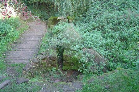
Walk round to the back of the church and go through a gate to discover the spring that marks the source of the river Stour that wends its way through Stourbridge and Kidderminster, eventually joining the mighty river Severn at Stourport-on-Severn. It is at this spot that legend has it that Kenelm, Prince of Mercia was murdered in the ninth century and buried. Retrace back to the churchyard, turning left at the gate and leaving on a footpath running parallel to the main church access to the road. Here turn left to a T-junction, then right at the junction (towards Romsley). After a few metres at "The Wesleys" take a footpath leading uphill towards some trees.
Cross over another electric fence, pass through a metal gate and turn left onto a road. Pass a junction to the left and then shortly on the right take a very muddy bridlepath through a metal gate. Climb steadily up to the summit of Walton Hill. Look at the fantastic views for a while and then turn left to follow the bridlepath along the right hand ridge (not the North Worcestershire Path) as it descends into trees. Ignore all side paths and eventually emerge at a kissing gate into a field. Go diagonally across the field, cross into the neighbouring field on the right and reaching the bottom, locate a secluded wooden kissing gate in the trees at the back of a churchyard. Follow the narrow path to the road junction. Yet another red sandstone church!
Turn right up Vine Lane for a short distance, then take a broad bridlepath sign-posted on the left. Turn off the well marked bridleway onto a footpath signed to the left. At a complex junction turn sharp left and then follow the path as it curves to the right and descends slightly with a barbed wire fence to the left. Ignore the bridlepath that turns off to the right.
Coming to an open area with a wide wooden gate to the left, turn right uphill along a bridlepath. Once you emerge from the sunken bridlepath into an open area, ignore the continuation downhill marked via a red arrow and turn 90 degree left and continue uphill to meet the broad popular tourist route up. Ahead and to the right is an enclosed plantation of a few miscellaneous trees with a bench to its foot. Pass this and straight ahead is an observation area. Look out for the folly on the Hagley Estate.
Retrace from the observation area and turn uphill with the enclosed plantation to your right. Ascend to the prominent four standing stones and admire the panoramic views. Pass the four stones to their left side and continue along a broad stony path, ignoring the North Worcestershire Path as it turns off to the right, you will eventually come to a stone monument to one Jim Hollis and a wooden kissing gate. Below this thick woodland lies the Nimmings Wood car park. Pick your own route down! If you get as far as the road at the bottom of the hill, turn left and in a few metres to re-enter the car park.
Other walks nearby
| Walk 2700 | Yieldingtree from Churchill | easy | 5.5 miles |
| Walk 1501 | Lickey Hills, Barnt Green and the Bittell Reservoirs | easy | 4.5 miles |
| Walk 1480 | Mount Segg & Harvington Hall | easy | 5.8 miles |
| Walk 1806 | Kinver Stroll | easy | 2.0 miles |
| Walk 2024 | Kinver Edge, South Staffordshire | easy/mod | 6.0 miles |
| Walk 3003 | Kinver Edge & Blakeshall from Holy Austin Rock | easy | 4.3 miles |
| Walk 2834 | Kinver Edge circular | easy | 4.2 miles |
| Walk 3241 | Kinver Edge & Holy Austin Rock | easy | 2.6 miles |
| Walk 2874 | Enville Estate and the Sheepwalks | easy | 4.0 miles |
| Walk 1603 | Shatterford Wood and Castle Hill circular | easy/mod | 5.5 miles |
Recommended Books & eBooks
No suggestions for this area.Messaging & Social Media
Message Walking Britain and follow the latest news.

Mountain Weather
Stay safe on the mountains with detailed weather forecasts - for iOS devices or for Android devices.