Shipley to Ilkley via Ilkley Moor
West Yorkshire Walk
County/Area - West Yorkshire - Bradford
Author - Allan Friswell
Length - 10.8 miles / 17.6 km Ascent - 1600 feet / 485 metres
Time - 7 hours 0 minutes Grade - moderate
Maps 

| Ordnance Survey Explorer 288 | Sheet Map | 1:25k | BUY |
| Anquet OS Explorer 288 | Digital Map | 1:25k | BUY |
| Ordnance Survey Explorer 297 | Sheet Map | 1:25k | BUY |
| Anquet OS Explorer 297 | Digital Map | 1:25k | BUY |
| Ordnance Survey Landranger 104 | Sheet Map | 1:50k | BUY |
| Anquet OS Landranger 104 | Digital Map | 1:50k | BUY |
Walk Route Description
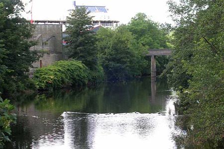
Click image to visit gallery of 7 images.
This linear walk takes you from Shipley, on the northern outskirts of Bradford, across Ilkley Moor and down into Ilkley, where the regular train service is used to return to the start. The start is Shipley Railway Station (grid ref. SE150374). You can either park in the station car park or close by in one of the back streets.
Exit the station and turn right. Walk downhill along the dual carriageway. After crossing over the river bridge take the first left down Green Lane. Follow the road as it bends to the right and then left. Follow it uphill as it bends right past a phone box. A short distance uphill from here is the Cricketers Arms Public House on the right hand side of the road.
Opposite the pub there is a road (Bankside Terrace) that heads away to the left. Go to the top of this short road and then pass to the rear of the terraced houses. At the near end of the terrace a path (usually hard to spot) starts to lead to the right steeply uphill (often under a loaded washing line!). Follow this path for a short distance, and where it meets another much clearer path at a T-junction take it as it heads to the left along a shallower gradient uphill.
When a metal barrier comes into view, turn right to join a tarmac path (Hardaker Lane) that heads northwards. At the end of the lane turn right, and follow the road around as it bends to the left and then almost immediately turn right onto a busier road (West Lane). Follow this road. Opposite a school take a footpath leading to the left. At the end of the footpath turn right on to a road and follow it around. At a crossroads continue on to a T-junction. Turn left at this junction up the hill and when the road bends around to the right take a footpath that leads uphill to the left. This footpath brings you out at Dove Hall Farm.
Turn right onto the driveway of the farm and follow it past Hope Farm (grid ref. SE141395). Just past this farm a path leads to the right and takes you past Baildon Hill. Many paths (oddly, not marked on the OS map) lead up to the trig point on the top of this hill. From the trig point go downhill and walk past the farm and caravan site to the north at Dobrudden Farm. Continue to the north past the farm and down the hill still keeping north - the path is hard to spot, but you are aiming to reach the T junction on the main road (grid ref. SE135406).
Cross the road and take the left hand of the two paths, veering half left and making for Golcar Farm (grid ref. SE132409). This is part of the Dales Link, linking Bradford with the Dales Way, and we will be following this trail for the rest of the walk. At Golcar Farm head north to a house, keep ahead making for the main road, and then turn left at the waymarked stile (grid ref. SE129416)and then right until the road is reached. Turn left down the road until just past the well known Dick Hudson's public house (amazing sandwiches) and turn right to head north across the moors.
What follows is a very pleasant and easy moorland walk. It heads almost exactly northwards, and the path is clear at all times. After a couple of miles of walking the path along the moor you reach the Twelve Apostles Stone Circle, just off the path to the right (grid ref. SE126450). Shortly after this a path leads west to the Trig point on Ilkey Moor, the highest point on the moor at 402 metres (grid ref SE114452).
Rejoin the Dales Link from the trig point and head north again past Gill Head and to the top of Ilkley Crags. At Ilkey Crags the path turns to the northwest and descends steeply past White Wells (sadly, the tea rooms are closed now) and into Ilkley and the railway station (grid ref. SE118476). Here there are trains every 15 minutes back to Shipley.
Other walks nearby
| Walk 1408 | Saltaire - the model village | easy | 1.5 miles |
| Walk 1952 | Five Rise Locks and the River Aire, Bingley | easy | 5.3 miles |
| Walk 1449 | Cullingworth Circular | easy/mod | 6.3 miles |
| Walk 3114 | Haystacks, Twelve Apostles & Idol Stone of Ilkley Moor | easy/mod | 4.5 miles |
| Walk 1584 | Ogden Reservoir | easy | 4.0 miles |
| Walk 2319 | Ilkley to Bingley | easy/mod | 7.0 miles |
| Walk 1307 | Circuit of Ovenden Moor from Oxenhope | moderate | 8.0 miles |
| Walk 1135 | Top Withins and the Bronte Bridge | moderate | 8.0 miles |
| Walk 2705 | Oxenhope to Hebden Bridge without a car | moderate | 11.0 miles |
| Walk 1585 | Haworth Moor circular | easy | 5.0 miles |
Recommended Books & eBooks
The Dales Way
 An essential guidebook to walking the Dales Way. This picturesque 78 mile long distance route through the Yorkshire Dales between Ilkley and Bowness on Windermere is one of the gentlest multi-day walks in Britain. The route is described in both directions, visiting Grassington, Kettlewell, Buckden, Dent, Sedbergh and Staveley en route to Bowness.
More information
Messaging & Social Media
Message Walking Britain and follow the latest news.

Mountain Weather
Stay safe on the mountains with detailed weather forecasts - for iOS devices or for Android devices.