Kinver Edge & Blakeshall from Holy Austin Rock
Staffordshire Walk
County/Area - Staffordshire & Worcestershire - South Staffordshire
Author - Peter Lane
Length - 4.3 miles / 6.9 km Ascent - 770 feet / 233 metres
Time - 2 hours 50 minutes Grade - easy
Maps 

| Ordnance Survey Explorer 218 | Sheet Map | 1:25k | BUY |
| Anquet OS Explorer 218 | Digital Map | 1:25k | BUY |
| Ordnance Survey Explorer 219 | Sheet Map | 1:25k | BUY |
| Anquet OS Explorer 219 | Digital Map | 1:25k | BUY |
| Ordnance Survey Landranger 138 | Sheet Map | 1:50k | BUY |
| Anquet OS Landranger 138 | Digital Map | 1:50k | BUY |
Walk Route Description
Click image to visit gallery of 8 images.
This superb walk visits one of the most interesting parts of South Staffordshire and North Worcestershire. The county boundary cuts the sandstone ridge of Kinver Edge clean in half. The ridge is famous for its troglodyte dwellings: homes cut directly out of the red sandstone. Some of these have been restored by the National Trust and can be visited as part of this route. The views from the ridge itself are magnificent and the woodlands along the route provide superb colour in autumn.
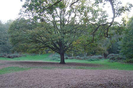
The starting point is the (free) National Trust car park alongside the road at grid ref. SO836836, West of Kinver. This popular spot is likely to be quite busy, but has the advantage of being frequented by an ice cream van on a regular basis! Entering a wide sandy area dominated by a large oak tree, turn right and slightly uphill on a bearing of approximately 235 degrees. The crowds now dissipated, continue along this wooded path as it climbs and then curves gently to the left, turns South and continues gradually uphill. The path here is way-marked with blue-circled posts. At a complex junction of paths, depart from the marker posts and continue on the rightmost path shortly to a brow, then down some steps cut into the ground.
The sandy path undulates through beautiful woodland. After about 1km of going South, a derelict cave dwelling is reached on the left, cut out of the sandstone (see photos). Take a few moments to explore the empty chambers and imagine how it must have felt to live in such a beautiful location! Just beyond the cave dwelling, descend a short distance and as the path forks into two, take the gently rising path to the left. At the next fork, turn left again, rising more steeply to the crest of the ridge.
You are now on the county boundary! The North Worcestershire path continues East and South, while the Staffordshire Way continues North. (Warning: older maps show the Southward route as the Worcestershire Way). Continue South along the North Worcestershire Path, following the pine cone symbol on the marker posts past spectacular views. At a grass covered reservoir, carefully follow the markers around three sides with the reservoir to your right. The path then turns South, with the reservoir directly behind you. Coming to a barrier, here turn right, following the pine cone symbols down a leafy path to a wide, sandy bridlepath at the bottom.
Turn sharp left and follow the broad, sandy bridlepath for some 300 metres where the onward path is through a chicane barrier on the left. This narrow wooded path emerges onto another crossing sandy bridlepath. Depart the North Worcestershire Path here, turning left to Blakeshall Hall. Emerge onto a metalled lane and at the end of the sandstone wall, turn left down a secluded and very muddy track. Emerging on a metalled road, continue for only 30 metres before turning left up a footpath signposted "Kingsford Forest Park".
Take a bearing of 359 degrees (call me petty, but it's not quite due North!) and follow the Nuthatch and Woodpecker trail signs for some distance. When these paths turn off, continue on the 359 degree bearing all the way to a wooden kissing gate at the top of the climb, ignoring the multitude of crossing paths. Turn left out of the kissing gate and gaining the wide summit ridge path, continue along the ridge past a trig point to an old pillbox on the right. This marks the embankment of an ancient earthwork. Although the forces of nature have taken over, the motte and bailey are still discernible.
At the end of the popular ridge path a stone plinth bears an orientation plaque. The panoramic views from here are outstanding. Turn right from the summit and keeping the cliff edge to the left, descend a winding path to a grassy area (the blue circled marker posts make a return appearance), turn left and descend towards the restored National Trust rock houses. The grounds are freely accessible. One of the properties is actually a home. Up to the 1960s, a café used to reside in one of the (now ruined) rock houses passed on the way back down to the car park. The return route to the car park 150m away is to either side of the rock houses, take your choice dependant on whether the property is open or not.
Other walks nearby
| Walk 1806 | Kinver Stroll | easy | 2.0 miles |
| Walk 2024 | Kinver Edge, South Staffordshire | easy/mod | 6.0 miles |
| Walk 2874 | Enville Estate and the Sheepwalks | easy | 4.0 miles |
| Walk 1603 | Shatterford Wood and Castle Hill circular | easy/mod | 5.5 miles |
| Walk 1934 | Highgate Common and Surrounding Country | easy | 6.0 miles |
| Walk 2700 | Yieldingtree from Churchill | easy | 5.5 miles |
| Walk 2466 | The Severn Valley from Trimpley Reservoir | easy | 6.0 miles |
| Walk 1933 | Wyre Forest & River Severn from Upper Arley | easy/mod | 7.6 miles |
| Walk 2092 | Highley from the Severn Valley Country Park | easy/mod | 4.5 miles |
| Walk 3504 | Highley to Bewdley along the River Severn | easy/mod | 7.0 miles |
Recommended Books & eBooks
Walking in the Peak District - White Peak East
 Guidebook describing 42 half-day and day walks in the limestone landscapes of Derbyshire's White Peak, part of the Peak District National Park. One of two volumes, this book covers the east of the region, with potential bases including Bakewell, Eyam, Castleton, Birchover, Matlock and Wirksworth.
More information
Messaging & Social Media
Message Walking Britain and follow the latest news.

Mountain Weather
Stay safe on the mountains with detailed weather forecasts - for iOS devices or for Android devices.