Preston Bagot & Finwood from Henley-in-Arden
Warwickshire Walk
County/Area - Warwickshire
Author - Lou Johnson
Length - 7.0 miles / 11.4 km Ascent - 650 feet / 197 metres
Time - 4 hours 10 minutes Grade - easy/mod
Maps 

| Ordnance Survey Explorer 220 | Sheet Map | 1:25k | BUY |
| Anquet OS Explorer 220 | Digital Map | 1:25k | BUY |
| Ordnance Survey Landranger 151 | Sheet Map | 1:50k | BUY |
| Anquet OS Landranger 151 | Digital Map | 1:50k | BUY |
Walk Route Description
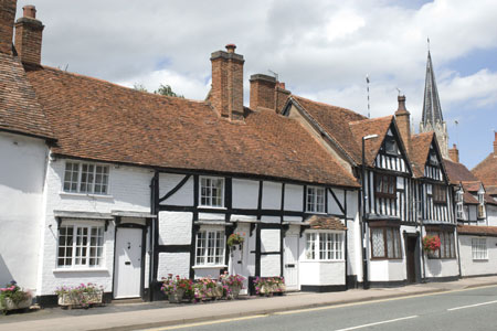
Click image to visit gallery of 12 images.
This walk explores the Warwickshire countryside to the east of Henley-in-Arden using footpaths and towpaths. The walk starts by following clearly marked footpaths across fields to Preston Bagot with its picturesque church. The route continues to the Stratford-upon-Avon Canal and follows the towpath north to Finwood Bridge. The walk returns to Henley-in-Arden following the Heart of England Way.
The start is the High Street in Henley-in-Arden by the church (grid ref. SP151660). On Sundays on-street parking is plentiful although during the week you will need to park at one of the free long stay car parks as there is a 2 hour limit on on-street parking. After parking, walk down Beaudesert Lane on the south side of the church. Follow this lane past a further church and where the road turns right continue ahead on an enclosed footpath. Just after the school playing field (on your right), turn right. The path leads to a cul-de-sac. Cross straight over and continue into a small park. Go through the gate into the park and walk half left to pick up the footpath with steps climbing through some bushes. Enter the field to your right and cross the field keeping the hedge on your left until you reach Edge Lane (grid ref. SP160658). (Incidentally, this is the Southern portion of Edge Lane and at this point is a proper tarmac surface. We will cross the Northern section towards the end of the walk and it's much more rustic).
Cross Edge Lane and follow the track with stables on your left. The path is well-marked and leads to an overgrown lane which in Winter may resemble a muddy stream (grid ref. SP163658). The path does a dog leg through this and emerges into fields on the other side. Good waymarking means that it is difficult to go astray and the route continues across fields to reach a complex path junction with stiles and signs (grid ref. SP167659). Go straight on here and this leads you to a lane with Church farm on your left. Cross the lane and follow the narrow path between hedges up to Preston Bagot church. Keeping the church on your left, walk past the church to reach a lane.
Cross the lane and take the footpath opposite. In the first field aim for the gap in the hedge straight ahead. Once through the gap, bear right and with the hedge on your right continue to a footbridge. Cross the bridge and reach the canal. Turn left (northeast) along the canal. Note the distinctive lifting bridges and barrel roofed cottages by the locks. (David Morgan has suggested they are not lifting bridges but the gap in the deck is to allow the rope to pass through on horse-drawn barges.) Stay on the towpath through pleasant countryside. You pass a number of locks and cross the short Yarningale Aqueduct. This is a very pleasant stretch of canal and the distance soon passes and you reach Lowsonford Bridge with its adjacent lock and lock-keepers cottage. This is a good spot for a mid-walk rest.
Continue on the towpath to the next bridge - Finwood Bridge - where you leave the towpath. Turn west down Mill lane to the road junction. Go straight over following the Heart of England Way signs. The route is never in doubt with effective waymarking and a well trodden path. Do note the dog-leg at grid reference SP182678) where you cross the old railway track. The path then enters a small wood before re-crossing the old railway and joining a lane (grid ref. SP174672).
Turn right down the lane and take the signed path beside the entrance to Holly Bank Farm (now a small cluster of private houses and the field boundaries and effective route of the path appear to have changed since the current 1:25k map was published). Do not follow the driveway to the houses, instead bear slightly left (West) and aim for the corner of the field. The gate into the next field isn't obvious until you've almost reached it. Pass through the gate and continue on the Heart of England Way. The path is generally easy top follow with regular waymarks and clear evidence that the path is regularly walked although this may be less obvious in Winter. When you see Hungerfield Farm (on your right) cross the field straight ahead until you reach Edge Lane, here it is a narrow overgrown path (grid ref. SP163667). Turn left and follow the lane for a few metres before turning right and then emerging at the top of a slope with good views across the Warwickshire countryside on your right. Follow the path as it drops down before crossing one of the earthworks of Beaudesert Castle. The only remains of this Motte and Bailey Castle are the earthworks and you can appreciate the excellent position the defenders had from this hill. The solitary bench on top of the castle mound is a good spot to take a few minutes to admire the view. Descend steeply down the western flank to join the outward route. All that remains is the short stroll back to the High Street.
Other walks nearby
| Walk 2836 | Wootton Wawen | easy/mod | 8.0 miles |
| Walk 3714 | Lapworth & Kingswood Circular | easy/mod | 8.0 miles |
| Walk 3683 | Hockley Heath and Packwood Circular | easy | 4.1 miles |
| Walk 1713 | Packwood House Circular | easy | 4.0 miles |
| Walk 3716 | Morton Bagot & Bannam's Wood from Studley | easy/mod | 8.4 miles |
| Walk 3235 | Studley Circular | easy/mod | 8.3 miles |
| Walk 3702 | Coughton Circular | easy/mod | 6.8 miles |
| Walk 1345 | Alcester Town & Country Circular | easy/mod | 7.0 miles |
| Walk 3711 | Heronfield & Temple Balsall Circular | easy/mod | 7.2 miles |
| Walk 3681 | New End & Cladswell Circular | easy | 3.5 miles |
Recommended Books & eBooks
No suggestions for this area.Messaging & Social Media
Message Walking Britain and follow the latest news.

Mountain Weather
Stay safe on the mountains with detailed weather forecasts - for iOS devices or for Android devices.