Cracknowl and the Monsal Trail from Bakewell
Peak District Walk
Nat Park - Peak District - Bakewell Monsal Trail
County/Area - Derbyshire
Author - Jake Robertson
Length - 3.5 miles / 5.7 km Ascent - 300 feet / 91 metres
Time - 2 hours 0 minutes Grade - easy
Maps 

| Ordnance Survey Explorer OL24 | Sheet Map | 1:25k | BUY |
| Anquet OS Explorer OL24 | Digital Map | 1:25k | BUY |
| Ordnance Survey Landranger 119 | Sheet Map | 1:50k | BUY |
| Anquet OS Landranger 119 | Digital Map | 1:50k | BUY |
Walk Route Description
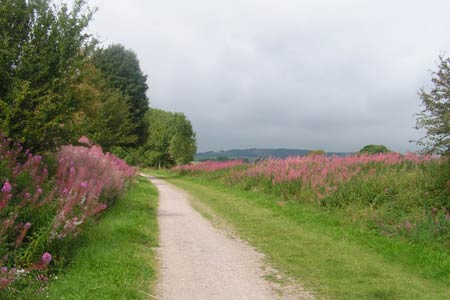
Click image to visit gallery of 4 images.
This is a very gentle Peak Dsitrict walk along the Monsal Trail and over an unassuming but unexpectedly lovely hill pasture. It's an idyllic hour or so escape from the crowds in Bakewell with some beautiful views over the town and surrounding countryside and the Derbyshire Dales.
Park at the Monsal Trail car park at Bakewell Station on Castle Hill (grid ref. SK223689). Walk past the station buildings and turn left onto the Monsal Trail. Follow the trail for about 1 ½ miles until you near the Toll Bar House. It's flat all the way with views opening out towards Longstone Edge once the bookshop and café at Station Farm is passed. Take a walled bridleway on the left (grid ref. SK214707), signposted to Bakewell, and climb gently onto the pasture. After a short climb it undulates for about half a mile to reach the high point at 210m (grid ref. SK 214697).
Although not explicitly named on the maps I've taken to calling this hilltop Cracknowl Hill, it certainly deserves a name. Shy and unobtrusive it does have a quiet charm about it and is a delightful viewpoint for the higher surrounding hills. The view south over Bakewell with it's church spire sticking out of the trees with the mass of Stanton Moor rising impressively to the south is especially good.
Continue along the track which begins to descend, passing though an open field with many fine picnic spots, to a gate. Through the gate the track becomes metalled and there's a steep but short drop down to the road (Holme Lane) by River Wye (grid ref. SK215690). Turn left for a short way until you can take a path on the right down by the riverbanks which is followed underneath the main road to the road bridge (grid ref. SK219687). Cross the main road onto Station Road with the car park only a short five minutes climb at the top of the road.
Other walks nearby
| Walk 2798 | Bakewell to Edale | mod/hard | 18.0 miles |
| Walk 1827 | Ashford-in-the Water,Magpie Mine & Over Haddon | easy/mod | 7.1 miles |
| Walk 1945 | Lathkill Dale & Over Haddon circular | easy/mod | 5.7 miles |
| Walk 3557 | Chatsworth Park from Calton Lees | easy/mod | 6.5 miles |
| Walk 1569 | Lathkill Dale & Bradford Dale | easy/mod | 8.2 miles |
| Walk 1589 | Lathkill & Bradford Dales (short version) | easy/mod | 6.0 miles |
| Walk 1590 | Monyash & Lathkill Dale | easy/mod | 8.2 miles |
| Walk 1651 | Monsal Trail & Ashford-in-the-Water from Lees Bottom | easy/mod | 8.8 miles |
| Walk 3341 | Brushfield, Miller's Dale & Monsal Head from Lees Bottom | easy/mod | 6.5 miles |
| Walk 1014 | Coombs Dale, Longstone Edge & Pilsley from Calver | moderate | 10.0 miles |
Recommended Books & eBooks
Dark Peak Walks
 Guidebook to 40 walks in the Dark Peak area of the Peak District National Park. 35 circular routes for most abilities, from 8km to 19km, around Edale, Marsden, Fairholmes, Baslow and Castleton, including Kinder Scout and Mam Tor, and 5 longer (25km to 45km) routes highlighting the best of the Gritstone Edges, High Moorland and Deep Valleys.
More information
Walking in the Peak District - White Peak East
 Guidebook describing 42 half-day and day walks in the limestone landscapes of Derbyshire's White Peak, part of the Peak District National Park. One of two volumes, this book covers the east of the region, with potential bases including Bakewell, Eyam, Castleton, Birchover, Matlock and Wirksworth.
More information
Messaging & Social Media
Message Walking Britain and follow the latest news.

Mountain Weather
Stay safe on the mountains with detailed weather forecasts - for iOS devices or for Android devices.