Tarn Crag & Harrop Pike from Sadgill
Lake District Walk
Nat Park - Lake District - Lake District Far Eastern Fells
Wainwrights - Grey Crag, Tarn Crag
County/Area - Cumbria
Author - Lou Johnson
Length - 5.5 miles / 8.9 km Ascent - 1780 feet / 539 metres
Time - 4 hours 30 minutes Grade - moderate
Maps 

| Ordnance Survey Explorer OL7 | Sheet Map | 1:25k | BUY |
| Anquet OS Explorer OL7 | Digital Map | 1:25k | BUY |
| Ordnance Survey Landranger 90 | Sheet Map | 1:50k | BUY |
| Anquet OS Landranger 90 | Digital Map | 1:50k | BUY |
Walk Route Description
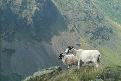
Click image to visit gallery of 5 images.
The Lake District fells to the east of Longsleddale are little walked probably because they are less dramatic than their better known sisters to the west. More in keeping with the character of the Pennine hills, there is some soft ground to negotiate after rain hence my choice of a dry spell to complete this walk. Longsleddale is one of my favourite Lakeland valleys and the scenic drive to the small farming community of Sadgill helps to put you in the right frame of mind for a mountain expedition. Adequate parking is available at the road end (grid ref. NY483057) and from here you have a fine view of the craggy upper sections of the dale.
Pass through the gate in the Eastern wall adjacent to the car parking area, initially following the track up the field and then turn steeply upwards to the stile in the wall at the top of the field that is visible from the car park. Cross the stile and continue straight ahead following the path up an obvious rock strewn gully. At the top you reach a wall. Turn left alongside it on an intermittent path that gradually climbs in a northerly direction towards Tarn Crag. Maintaining the same direction when the wall ends you will reach a fence which you should keep on your left. The summit of Tarn Crag lies ahead and it is a matter of taking the driest route to the summit, which has a survey pillar identical to that on nearby Branstree.
The view from this top is good apart from the western sector containing the Lake District Fells. Away to the east are the Pennines and if you are blessed with good visibility you should be able to pick out many of the high fells. Suitably refreshed, head north-east along a clear path to reach a fence. The cairn on Harrop Pike, our next objective, is clearly seen and to reach it turn right alongside the fence to cross Greycrag Tarn which can be best described as a bog! This area looks as though it will be awful after heavy rain with wet feet a certainty - such are the pleasures of fell walking!
Where the fence turns sharp left follow it out to the large cairn on Harrop Pike from where the view over the desolate Shap Fells, another Wasdale, a less well-known Borrowdale, and Bannisdale is excellent. The next summit of this walk is Grey Crag which lies south-west. retrace your steps back along the fence back to where it turns north-west and continue along an improving path to the small cairn on Grey Crag (also known as Sleddale Fell).
The route back to Sadgill follows the path which leaves Grey Crag. Having crossed the fence, the path heads just south of west for a hundred yards or so and then turns to the south along the low ridge to the summit of Great Howe. The survey post is kept well to the left and soon disappears from view when you pass along the low ridge. From the summit the path turns to the right a little and descends to a stile in a fence. Cross the stile and follow the fence to the right where it soon becomes a wall which is the one you encounter at the top of the rock strewn gully a little further along. All that remains is to follow the outward route back to Sadgill with the high crags of Longsleddale adding a fitting finale to the walk.
Other walks nearby
| Walk 1147 | Longsleddale and Kentmere Pike | moderate | 8.0 miles |
| Walk 2488 | Shipman Knotts & Kentmere Pike | moderate | 6.2 miles |
| Walk 1320 | Shorter Kentmere Horseshoe | mod/hard | 10.5 miles |
| Walk 2652 | Photographer's Kentmere Horseshoe | mod/hard | 13.5 miles |
| Walk 1109 | Harter Fell & Nan Bield Pass | moderate | 4.5 miles |
| Walk 1269 | High Street & Kidsty Pike | moderate | 7.5 miles |
| Walk 1462 | Mardale Head horseshoe | moderate | 8.0 miles |
| Walk 1152 | The Corpse Road and Selside Pike | moderate | 6.0 miles |
| Walk 3453 | Whinfell Beacon & Borrowdale | moderate | 8.4 miles |
| Walk 2464 | Kentmere Valley Circular | moderate | 10.0 miles |
Recommended Books & eBooks
Walking the Lake District Fells - Langdale
 Part of the Walking the Lake District Fells series, this guidebook covers a wide range of routes to 25 Lakeland summits that can be climbed from the Great Langdale valley, Ambleside and Grasmere, with highlights including Scafell Pike, Bowfell, the Langdale Pikes and Helm Crag (the Lion and the Lamb). Includes suggestions for longer ridge routes.
More information
Lake District: Low Level and Lake Walks
 This guidebook describes 30 of the best low-level walks in the Lake District. From delightful wooded glades and sparkling tarns, to waterfalls and glacier-carved valleys towered over by craggy mountains. The walks described aim to seek out the best walking that the lower areas of the Lake District have to offer.
More information
Messaging & Social Media
Message Walking Britain and follow the latest news.

Mountain Weather
Stay safe on the mountains with detailed weather forecasts - for iOS devices or for Android devices.