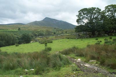
Yr Elen & Carnedd Dafydd from Gerlan
Snowdonia/Eryri Walk
Nat Park - Snowdonia - Western Carneddau
County/Area - Gwynedd
Author - Lou Johnson
Length - 9.0 miles / 14.6 km Ascent - 3680 feet / 1115 metres
Time - 8 hours 10 minutes Grade - hard
Maps 

| Ordnance Survey Explorer OL17 | Sheet Map | 1:25k | BUY |
| Anquet OS Explorer OL17 | Digital Map | 1:25k | BUY |
| Ordnance Survey Landranger 115 | Sheet Map | 1:50k | BUY |
| Anquet OS Landranger 115 | Digital Map | 1:50k | BUY |
Walk Route Description
Click image to visit gallery of 9 images.
This round in the northern Carneddau includes some sections where good navigational skills are required as there is no obvious path. Apart from the section along the main Carneddau ridge, you will see few other walkers.
The start is a small lay-by (Grid ref. SH637660) at the end of the lane running south-east from the village of Gerlan, which is located to the east above Bethesda. Should this space be full then further limited parking can be found further back towards Gerlan adding about a mile to the distance. After parking cross the bridge over the Afon Lafar to take the signed right of way heading past the water works and along its southern bank towards the Carneddau.
You climb steadily with the view ahead, including the northern flanks of the Carneddau, with Yr Elen clearly in view. You reach 'open country' (Grid ref. SH648654) where you continue on the path with the Afon Lafar to your left. Continue on the clear valley path with the dramatic crags of Ysgolion Duon rising ahead. Reaching a confluence of streams (Approx. grid ref. SH664640), find a suitable place to cross and continue east over rough terrain to reach the base of the western slopes of Yr Elen. Turn north and climb steadily across the face. Do not head straight up instead aim to reach the northwest ridge of Yr Elen just east of Foel Ganol (Grid ref. SH670654). From here turn south east up the ridge towards the summit cairn choosing the easiest line through crags, grass and rocks.
With the hard work over, leave Yr Elen on the clear path to Carnedd Llewelyn. This route omits the latter peak (which adds about 500 feet of ascent and half a mile to the route as described.) Once across the connecting col bear right, and contour across the slope to join the main path descending from Carnedd Llewelyn. Turning south continue on the main ridge path to Carnedd Dafydd with the crags of Ysgolion Duon dropping away to your right.
Leave the summit of Carnedd Dafydd in a northwesterly direction to join a narrow but well defined path that descends along a line of crags that drop east towards the Afon Lafar below and to your right. The path is mostly over grass and the going good. You soon join the outward route (Grid ref. SH651652) which is retraced back to the start.
Other walks nearby
| Walk 2115 | Yr Elen, Carnedd Llewellyn & Carnedd Dafydd | hard | 9.5 miles |
| Walk 2558 | Carnedd Dafydd & Pen yr Ole Wen from Bethesda | mod/hard | 8.0 miles |
| Walk 1074 | The Glyders Traverse | very hard | 12.0 miles |
| Walk 2833 | Moel Faban, Gyrn & Moel Wnion from Rachub | easy/mod | 5.0 miles |
| Walk 1315 | Drosgl and Gyrn Wigau from Rachub | moderate | 7.5 miles |
| Walk 1453 | Elidir Fawr, Mynydd Perfedd & Marchlyn Mawr reservoir | moderate | 6.0 miles |
| Walk 1088 | Glyder Ridge traverse | hard | 5.5 miles |
| Walk 1186 | Y Garn | mod/hard | 4.5 miles |
| Walk 3019 | Y Garn & Carnedd y Filiast Ogwen Cottage | hard | 8.5 miles |
| Walk 3062 | Pen yr Ole Wen | moderate | 5.0 miles |
Recommended Books & eBooks
Snowdonia: 30 Low-level and easy walks - South
 Guidebook describing 30 walks in Snowdonia, Wales. Routes are mostly low level and on clear paths and showcase the region's beautiful scenery and rich history and culture. Part of a 2-volume set, this southern volume includes Trawsfynydd, Bala, Dolgellau, Machynlleth, the Harlech Coast and the valleys of the Mawddach and Dyfi.
More information
Snowdonia: 30 Low-level and easy walks - North
 Guidebook describing 30 walks in Snowdonia, Wales. Routes are mostly low level and on clear paths and showcase the region's beautiful scenery and rich history and culture. Part of a 2-volume set, this northern volume includes the Snowdon area, the Ogwen and Conwy Valleys, Betws-y-Coed, Beddgelert, Ffestiniog and the coast.
More information
Messaging & Social Media
Message Walking Britain and follow the latest news.

Mountain Weather
Stay safe on the mountains with detailed weather forecasts - for iOS devices or for Android devices.