Bwlch Sych and Tynygarreg from Lake Vyrnwy
Powys Walk
County/Area - Powys - Powys North
Author - Lou Johnson
Length - 8.5 miles / 13.8 km Ascent - 1500 feet / 455 metres
Time - 5 hours 50 minutes Grade - moderate
Maps 

| Ordnance Survey Explorer 239 | Sheet Map | 1:25k | BUY |
| Anquet OS Explorer 239 | Digital Map | 1:25k | BUY |
| Ordnance Survey Landranger 125 | Sheet Map | 1:50k | BUY |
| Anquet OS Landranger 125 | Digital Map | 1:50k | BUY |
Walk Route Description
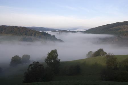
Click image to visit gallery of 12 images.
This circuit takes you onto the hills to the north east of Lake Vyrnwy and begins from near the dam across this large reservoir. Circular walks in this area are few and far between and this route does use some paths that see very few walkers and a good sense of direction and the ability to use a map is important. Recently it has been noted that there is a path diversion at Bwlch Sych farm so care is needed here to locate the onward path. There is also forestry work in progress in this area so paths may close at short notice.
The start is reached by driving on the B4396 to Llanwddyn and continuing to the dam wall. Turn left across the dam and then left again to the small car park (grid ref. SJ017190) by the café and RSPB viewing point. After parking walk across the dam and turn right into Llanwddyn taking care as this can be a busy road and there is no separate footpath. After a few hundred metres take the private tarmac drive (grid ref. SJ021191) that leads up to the church.
Continue past the church, which is on your left, and continue ahead to reach the hotel. Keeping the main buildings on your left, continue straight ahead to reach a gate with waymarks for the bridleway and the Pererindod Melangell Walk. The path/track climbs steadily and leads to a gate into a large plantation (Grid ref. SJ029206). Stay on the main track through the forest taking care to follow the partly hidden waymark at a junction of tracks (grid ref. SJ031215 approx). There are some gaps in the trees from where you get views of the surrounding hills.
Leaving the forest the track reached the isolated farm of Bwlch-sych (Grid ref. SJ031225). Go through the farm yard and descend on a track over a ford (Grid ref. SJ034225). Where the track turns sharp right, go left over the stile and start to climb towards the col of Bwlch Sych. From this point on, the paths see few walkers and the solitude is wonderful. Passing the sheepfold continue ahead to a junction of paths marked by a post (Grid ref. SJ028231). Go straight across here and contour around the hillside gaining height to reach a fence line on the main ridge (Grid ref. SJ024237). Turn left along the fence and continue west for about a kilometre.
Reaching a path junction (Grid ref. SJ014237), turn left. The path is indistinct and as shown on the OS map does not follow the line of the right of way but makes a large loop to avoid some wetter ground. Care is needed on this section to avoid losing the path and frequent checks with the map are essential. Eventually the path trends southeast and reaches a boundary fence and gate (Grid ref. SJ010217). Continue and drop down towards the corner of the plantation in view below (Grid ref. SJ008214). Continue to descend alongside the forest veering eastwards as you approach the end of the lane (Grid ref. SJ009212), which is followed through Tynygarreg and down to the road alongside the reservoir. Turn left and continue to the dam. Turn right across this and then left back to the start of the walk.
Other walks nearby
| Walk 1086 | Post Gwyn and Craig-y-Mwn from Pistyll Rhaeadr | moderate | 6.5 miles |
| Walk 3053 | Berwyn Tops from Tan Y Pystyll | moderate | 14.0 miles |
| Walk 3031 | Cadair Berwyn | moderate | 9.3 miles |
| Walk 1190 | Aran Fawddwy | mod/hard | 7.5 miles |
| Walk 3055 | Glasgwm | moderate | 4.5 miles |
| Walk 1255 | The Aran Ridge | hard | 11.2 miles |
| Walk 1400 | The Arans | hard | 14.0 miles |
| Walk 3017 | Aran Benllyn & Aran Fawddwy from Llanuwchllyn | mod/hard | 10.0 miles |
| Walk 1256 | Cadair Bronwen | moderate | 9.5 miles |
| Walk 1989 | Llanarmon Dyffryn Ceiriog Circular | moderate | 6.0 miles |
Recommended Books & eBooks
The Cambrian Way
 Guidebook to the Cambrian Way, a challenging three-week mountain trek through Wales from Cardiff to Conwy. The 470km un-waymarked route is presented from south to north. Often sticking to long, beautiful ridgelines, it crosses wild and rugged terrain and visits many of Wales's highest mountains, including Snowdon.
More information
Messaging & Social Media
Message Walking Britain and follow the latest news.

Mountain Weather
Stay safe on the mountains with detailed weather forecasts - for iOS devices or for Android devices.