Alfriston to Rodmell by the South Downs Way
South Downs Walk
Nat Park - South Downs
County/Area - East Sussex
Author - Barry Mackie
Length - 9.0 miles / 14.6 km Ascent - 1010 feet / 306 metres
Time - 5 hours 30 minutes Grade - moderate
Maps 

| Ordnance Survey Explorer OL25 | Sheet Map | 1:25k | BUY |
| Anquet OS Explorer OL25 | Digital Map | 1:25k | BUY |
| Ordnance Survey Landranger 198 | Sheet Map | 1:50k | BUY |
| Anquet OS Landranger 198 | Digital Map | 1:50k | BUY |
| Ordnance Survey Landranger 199 | Sheet Map | 1:50k | BUY |
| Anquet OS Landranger 199 | Digital Map | 1:50k | BUY |
Walk Route Description
Click image to visit gallery of 7 images.
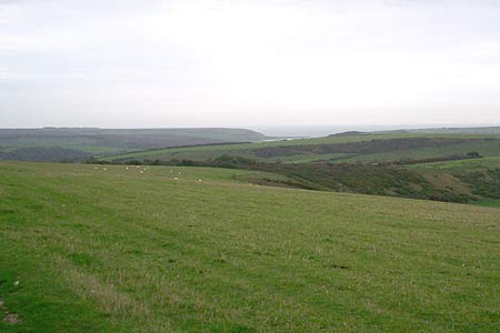
This is a pleasant East Sussex walk between two attractive villages set within the South Downs in East Sussex. Whilst most of the walk follows the gentle undulations on the crest of the slope over typical grassed downs, there is a fairly long ascent to be undertaken near the start to get from the bottom of the Cuckmere Valley, and then at the end, a steep descent into the Ouse Valley. Look out for the SDW waymarkers along the walk, these will be the acorn symbol, and as this section is a bridleway, they are generally coloured blue.
Starting from the village of Alfriston at the Market Cross (grid ref TQ520031), go south along the High Street to reach the Star Inn on the right. Immediately past the inn, turn right into Star Lane, and continue along King's Ride steadily gaining height. Maintain this westerly direction now on a rough flint track, still ascending the slope to grid ref TQ512029. Here the waymarker directs you initially on a north/northwest bearing then easing northwest, to the brow of Bostal Hill. From here, at 624ft high, you get a last good look at the Cuckmere Haven to the southeast. Move on from here across the open grassed slope to reach the highest part of this walk, Firle Beacon (716ft) and its trig point. This hill is something of a rarity, being one of only fifteen in Southeast England to have the status of a Marilyn (see footnote). The views from this (relatively) lofty height are excellent, particularly looking north over the High Weald of East Sussex.
This is essentially the "flatlands" or plains between the foot of the northern slope of the South Downs that then stretch north to reach the North Downs some 25-30 miles away. The Weald is a constant companion to your right for much of this section, and the simplest and most accurate way to describe this scenery is mesmerising. From here the way heads west and in the distance are two radio masts on Beddingham Hill. Head towards these masts, and pass them just to the right side. Once past this point, the route soon starts to veer southwest and another trig point is passed at the dry Red Lion Pond.
Continue west to reach the summit of Itford Hill and some marvellous views across the Ouse Valley and the port of Newhaven to your left. The direct route down the slope of this hill is extremely steep, making a straight descent quite awkward. However there are waymarkers and signs here that direct you to the left, allowing you to take a more gradual route off the hill. Do this and then pick up the deep eroded track (not visible from the summit) that sweeps back to the right and brings you safely to the foot of the hill, near to Itford Farm. Here at grid ref TQ433056, there should be a tap where you can refill your water bottles, but we were neither in need nor noticed it as we passed through.
Cross over the A26 trunk road, using the footbridge, to reach Southease railway station and continue along the lane, crossing the River Ouse to reach the road and the hamlet of Southease. Do have a look at the church here with its round tower; apparently there are only three like it in the county and all are within the Ouse Valley. Turn right at the road, and less than a kilometre away, arrive at Rodmell and the finish of this walk.
Transport - There are various options depending on where you need to get to. If, like us, you decided to walk from the start of the trail at Eastbourne, using Walk 3516, then take the train from Southease to Eastbourne changing at Lewes. To get back to Alfriston, then the easiest way will be from the bus stop near Itford Farm on the A26. Alternatively there is a bus route from Rodmell, adjacent to the Abergervenny Arms, but this will take longer and is more intermittent.
Footnote - A Marilyn is a hill of any height with a drop of 150m or more on all sides. In other words, a relatively high hill to its surrounding area
Other walks nearby
| Walk 3574 | Firle Beacon & Cuckmere Valley | moderate | 10.4 miles |
| Walk 3575 | High and Over White Horse | easy | 2.0 miles |
| Walk 1357 | The Seven Sisters from Exceat | moderate | 14.0 miles |
| Walk 1015 | Ouse Valley & Beddingham Hill | moderate | 12.0 miles |
| Walk 1633 | Charleston Farm & Firle Beacon | easy/mod | 4.6 miles |
| Walk 2227 | East Dean Circular | moderate | 11.0 miles |
| Walk 1638 | Beachy Head & Eastbourne | easy/mod | 6.2 miles |
| Walk 2419 | Southease, Ditchling Beacon & Lewes | mod/hard | 17.0 miles |
| Walk 1038 | Firle Beacon | moderate | 13.3 miles |
| Walk 3516 | Eastbourne to Alfriston by the South Downs Way | mod/hard | 12.5 miles |
Recommended Books & eBooks
Walks in the South Downs National Park
 Guidebook with 40 circular walks throughout the South Downs National Park, exploring the beautiful chalk hills between Eastbourne and Winchester. The walks range from under 5 miles to 11 miles, including Beachy Head and the Seven Sisters, Ditchling Beacon and hundreds of prehistoric sites. Accessible all year, but wild flowers best in spring.
More information
The South Downs Way
 Guidebook to walking the South Downs Way National Trail, a 100 mile (160km) route between Winchester and Eastbourne through the South Downs National Park, described in both directions over 12 stages. Easy walking on ancient and historical tracks, taking in wooded areas, delightful river valleys and pretty villages. With 1:25K OS map booklet.
More information
Messaging & Social Media
Message Walking Britain and follow the latest news.

Mountain Weather
Stay safe on the mountains with detailed weather forecasts - for iOS devices or for Android devices.