Gummers How via Chapel House Wood, South Lake District
Lake District Walk
Nat Park - Lake District - Lake District Lesser Fells
County/Area - Cumbria
Author - Andy Smith
Length - 5.5 miles / 8.9 km Ascent - 1400 feet / 424 metres
Time - 4 hours 10 minutes Grade - easy/mod
Maps 

| Ordnance Survey Explorer OL7 | Sheet Map | 1:25k | BUY |
| Anquet OS Explorer OL7 | Digital Map | 1:25k | BUY |
| Ordnance Survey Landranger 97 | Sheet Map | 1:50k | BUY |
| Anquet OS Landranger 97 | Digital Map | 1:50k | BUY |
Walk Route Description
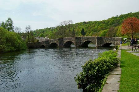
Click image to visit gallery of 9 images.
Lake Windermere suffers from its own popularity with over 1.5 million visitors each year. However there are fine walks around the lake which often become overlooked by many enabling you to avoid the crowds. This Lake District walk includes some fine forest walking and takes in the outlet from Lake Windermere and also offers stunning views from the southernmost viewpoint of Gummers How. After taking the A592 Windermere road from Newby Bridge, turn right up a steep road signed Fell Foot Park where there is a large free car park on the right marked Gummers How (Grid ref. SD389876).
Exit the car park and turn left and walk back down the road leaving the crowds behind you. Do take care as it can be quite a busy road. About half a kilometer take a footpath signed Staveley-in-Cartmel on the left. Cross the wall and follow the path into the woods. The going ahead is obvious and well walked by the locals. Follow this for 15 minutes until you reach the road near Line Riggs. Turn left here and after a very short while you reach the tiny village where you turn left past the phone box. Walk up the marked bridleway and go though a gate leading uphill towards the steep forest. The climb is quite demanding and seems to last a while as you ascend through the plantation towards the Forestry Commission track.
Once the track is reached, cross over following the way marker deep into the forest (Grid ref. SD386858). Like all sustainable forests, this one is quite active at times and when this walk was completed in Spring 2007) half the wooded area on the summit had been felled blocking the path in places. However the waymarks were still in place and lead you eastbound past Raven Scar and onto Simpson Ground Reservoir. From here follow along the dam until the outlet is reached. Turn hard right onto a tiny track leading out the forest to a stone wall where the route follows running parallel to the wall. Once the corner is reached, cross the stile into an open field and bear left through the rocks to a gate on the left. Walk through the gate and follow the farm track through to Sow How Lane.
Within minutes turn left at the road junction and walk along for 300 meters until the entrance to Gummers How is reached. Expect this point to be busy on a fine day. There now follows a steep climb to the 321m summit so the shaded woods here make a useful stopping point before tackling the climb. Once the rock face is reached you have two main options. Either turn right along the main track which winds its way around to the summit or simply scramble up the rocks along the many routes. Either way the general direction is up!
Once on top (on a clear day!) the views are superb. Lake Windermere looks stunning stretching 12 miles away to the north whilst to the south you can take in the forest you walked through to reach here with the River Leven flowing through the pleasant hamlet of Newby Bridge. Morecambe Bay can be seen along with Coniston, which is just visible on the eastern horizon. After enjoying the view, simply retrace your steps back to the road and turn right towards the car park.
Other walks nearby
| Walk 3452 | Ghyll Head & Strawberry Bank Circular | moderate | 7.6 miles |
| Walk 2143 | Whitbarrow & Lord's Seat | easy/mod | 5.4 miles |
| Walk 3638 | Satterthwaite Bridge Circular | easy | 3.2 miles |
| Walk 3199 | Whitbarrow Fell from Mill Side | moderate | 7.0 miles |
| Walk 3549 | Whitbarrow Scar from Mill Side | moderate | 6.5 miles |
| Walk 2053 | Claife Heights & Near Sawrey | easy | 2.5 miles |
| Walk 3320 | Grizedale Tarn circular | easy | 2.5 miles |
| Walk 3451 | Underbarrow, Lord's Lot and Crossthwaite | easy/mod | 5.6 miles |
| Walk 2721 | Scout Scar Limestone Ridge | easy/mod | 5.0 miles |
| Walk 1058 | Beacon Fell & Beacon Tarn Circular | easy/mod | 4.0 miles |
Recommended Books & eBooks
Walking the Lake District Fells - Buttermere
 Part of the Walking the Lake District Fells series, this guidebook covers a wide range of routes to 32 Lakeland summits that can be climbed from the Buttermere, Lorton and Newlands valleys, with highlights including Haystacks, High Stile, Grasmoor and the fells of the Coledale Round. Suggestions for longer ridge routes are also included.
More information
Hadrian's Wall Path
 Hadrians Wall Path guidebook to walk the 84 mile National Trail. Described in both directions, the main description is west to east between Bowness-on-Solway and Wallsend, Newcastle, with extensions to Maryport and South Shields. With extensive historical information related to this World Heritage site and separate 1:25,000 OS map booklet included.
More information
Messaging & Social Media
Message Walking Britain and follow the latest news.

Mountain Weather
Stay safe on the mountains with detailed weather forecasts - for iOS devices or for Android devices.