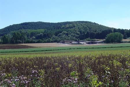
Woodbury and Abberley Hills from Great Witley
Worcestershire Walk
County/Area - Worcestershire
Author - Peter Lane
Length - 5.3 miles / 8.5 km Ascent - 1200 feet / 364 metres
Time - 3 hours 50 minutes Grade - easy/mod
Maps 

| Ordnance Survey Explorer 204 | Sheet Map | 1:25k | BUY |
| Anquet OS Explorer 204 | Digital Map | 1:25k | BUY |
| Ordnance Survey Landranger 150 | Sheet Map | 1:50k | BUY |
| Anquet OS Landranger 150 | Digital Map | 1:50k | BUY |
Walk Route Description
Click image to visit gallery of 6 images.
This walk boasts fantastic views of the Worcestershire countryside along one of the most spectacular sections of the Worcestershire Way (aside from the Malverns themselves) as well as the remote hill fort earthwork at Woodbury Hill.
Park either at the Hundred House Hotel at Great Witley (if you wish to become a patron) or the lay-by with the public telephone opposite on the A443, grid reference SO751662. From the lay-by take the public footpath turning sharp right across the field and then cross a stile onto a minor road, turning South (left). (The footpath going due South from the lay-by is an equally suitable alternative when the fields are not growing crops (or weeds) - but I have found it at various times impassable, hence the recommendation of the alternative).
Proceed along this lane to a road junction with a narrow footpath leading steadily uphill at the corner. The path widens steadily, reaching a signboard with civil war history at the summit. You are now in the motte and bailey earthwork on the summit of Woodbury Hill. At the other end, another signboard charts the ancient history of the fort which was occupied in the 4th to 1st centuries BC and remains as a landmark. Only a single rampart survives now. Carry on a few yards downhill and then follow the narrow way-marked path to the right leading downhill to a cross-roads of footpaths at a gate.
Turn right along a beautiful avenue towards Birch Berrow with stunning views South to the Malverns. At the end of the avenue pay careful attention to the way-marks directing you through a field to the left of the farmhouse and buildings and then across a stile on a narrow footpath running parallel to the farm drive. Over a stile, turn left, over a stile and pick up the well marked Worcestershire Way, denoted by the green pear symbol. Proceed West downhill through steep woodland, reaching a minor road with spectacular views to the West.
Follow the green pear way-marks along the road a short distance and then turn uphill to the right along a footpath. As the path does a "Z bend" near the top, take care not to be confused by a way-mark on a gate implying that the onward route is through a field. It isn't. Continue due North through the trees, opening up on to a most spectacular ridge. Follow the ridge until the path opens up with grand views of the Abberley Hall clock tower. Descend to the stile, turn right down to the main B4203. Turn left and then right through the iron gates past Abberley Hall school and the monumental clock tower.
Cross the A443 and ascend the lane opposite to the brow of the hill where the Worcestershire Way turns off steeply uphill to the right along a narrow footpath. At the top there is a whitewashed trig point, lovingly adopted by Bournville Ramblers. The path then opens up to a spectacular viewpoint with a retrospective to the clock tower. From the trig point it is worth pacing out the next 600 metres to the return path. The route back down to the Hundred House is obscure and not way-marked. (OK, I missed it!). Don't panic if you miss it, the first way-marked route to the right descends to the A451, 700 metres East of the Hundred House.
Other walks nearby
| Walk 1099 | Abberley Hills - Worcestershire Way Circular | easy/mod | 4.0 miles |
| Walk 3662 | Abberley Circular | easy/mod | 4.8 miles |
| Walk 1969 | Clifton Upon Teme Circular | easy/mod | 5.8 miles |
| Walk 3217 | Bewdley and Snuffmill Dingle | easy | 5.0 miles |
| Walk 1830 | Ombersley, the Droitwich Canal, Salwarpe & the Severn | easy/mod | 11.0 miles |
| Walk 2248 | Wimperhill Wood and Longdon Orchard, Wyre Forest | easy | 4.0 miles |
| Walk 2142 | Severn Valley from Grimley | easy | 5.0 miles |
| Walk 2131 | Wyre Forest National Nature Reserve, Bewdley | easy | 3.3 miles |
| Walk 2288 | Pound Green and Dowles Brook from Hawkbatch | easy | 5.0 miles |
| Walk 2466 | The Severn Valley from Trimpley Reservoir | easy | 6.0 miles |
Recommended Books & eBooks
No suggestions for this area.Messaging & Social Media
Message Walking Britain and follow the latest news.

Mountain Weather
Stay safe on the mountains with detailed weather forecasts - for iOS devices or for Android devices.