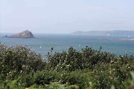
Gara Point & Stoke Point from Noss Mayo
Devon Walk
County/Area - Devon
Author - Paul Deane
Length - 7.0 miles / 11.4 km Ascent - 1400 feet / 424 metres
Time - 4 hours 50 minutes Grade - easy/mod
Maps 

| Ordnance Survey Explorer OL20 | Sheet Map | 1:25k | BUY |
| Anquet OS Explorer OL20 | Digital Map | 1:25k | BUY |
| Ordnance Survey Landranger 202 | Sheet Map | 1:50k | BUY |
| Anquet OS Landranger 202 | Digital Map | 1:50k | BUY |
Walk Route Description
Click image to visit gallery of 5 images.
The area around Noss Mayo and Newton Ferrers is fairly unique for the south coast as it seems to be off the beaten tourist track. The area can boast that it has no hotels, few guest houses and only one campsite! Parking is also very restricted. It's situated in the South Devon Area of Outstanding Natural Beauty and by looking at some of the local scenery it's easy to see why.
From the car park in Coach Road (Grid ref. SX547474) walk NW then turn N along Hillhead. Cross straight over at the crossroads into Passage Road. Follow Passage Road as it bears left along the south bank of Newton Creek. On the North Bank you can see the picturesque village of Newton Ferrers.
Continue on Passage Road for 1/2 mile through Ferry Wood where you will join the South West Coat Path at the ferry (Grid ref. SX541478). The route now follows the South West Coast Path to Ferry Cottage where it leaves the tarmac road and branches off right through some houses, before entering Passage Wood. The track snakes around Battery Cottage and doubles back west into Brakehill Plantation before breaking into more open heathland. It's worth taking a break to look around here with lovely views of the Yealm estuary to your right.
The dramatic views continue as you round Gara Point and walk along the clifftops ESE for approximately 3 miles through the Warren (National Trust) before turning North at Stoke Point. The path enters a wooded area (Grid ref. SX562461) and skirts a caravan park before entering Centry Wood. Leave the South West Coast Path at the car park near Stoke House (Grid ref. SX562467) and climb Stoke Road to the crossroads where you will carry straight on NW along Stoke Road.
The large house visible on the left as you reach the crest of the hill is Rowden Court. Just before you reach Rowden Court, take the signposted footpath to the right (Grid ref. SX556471). The footpath heads NNW, trending downhill across farmland, until it reaches another area of woodland where it descends steeply. Take care at this point because small fallen twigs on the already steep footpath make for tricky footing. Turn left where the path emerges from between some houses and then left again, back on to Stoke Road (Grid ref. SX554479). Follow Stoke Road for 200m then fork right on to Pillory Hill. To return to the car park, turn left at the SW end of Pillory Hill on to Hillhead, then right on to Coach Road.
Other walks nearby
| Walk 2012 | Wembury Bay & St Peter's Church from Noss Mayo | easy/mod | 6.0 miles |
| Walk 2018 | Saltram Park & Hardwick Wood, Plymouth | easy | 5.0 miles |
| Walk 2230 | Exploring Plymouth | easy | 6.5 miles |
| Walk 3657 | Bigbury-on-Sea, Arymer Cove & Burgh Island | easy/mod | 5.0 miles |
| Walk 1975 | Erme Mouth | moderate | 9.0 miles |
| Walk 2013 | The Plym Valley | easy | 5.0 miles |
| Walk 3041 | Thurlestone circular | easy | 4.0 miles |
| Walk 2461 | Warren Point & Bolt Tail from Bantham | moderate | 9.0 miles |
| Walk 3387 | Upper Erme Valley & Ugborough Moor | moderate | 9.3 miles |
| Walk 2015 | The Meavy & Plym valleys from Shaugh Bridge | moderate | 6.0 miles |
Recommended Books & eBooks
The South West Coast Path
 Guidebook to walking the entire South West Coast Path National Trail. The route runs for 630 miles from Minehead to Poole along the north Devon, Cornish, south Devon and Dorset coastline. Divided into 45 stages, this long-distance coastal trek could be completed within 4 weeks, or walked in sections. Guide includes maps and essential information.
More information
South West Coast Path Map Booklet - St Ives to Plymouth
 Map of part of the southern section of the 630 mile (1014km) South West Coast Path National Trail. Covers the trail from St Ives to Plymouth along the west Cornwall and Devon coastline. This convenient and compact booklet of Ordnance Survey 1:25,000 maps shows the route, providing all of the mapping you need to walk the trail in either direction.
More information
Messaging & Social Media
Message Walking Britain and follow the latest news.

Mountain Weather
Stay safe on the mountains with detailed weather forecasts - for iOS devices or for Android devices.