Blackstone Edge from Hollingworth Lake
South Pennines Walk
Region - South Pennines
County/Area - Greater Manchester - South Pennines
Author - Lou Johnson
Length - 9.0 miles / 14.6 km Ascent - 1500 feet / 455 metres
Time - 6 hours 0 minutes Grade - moderate
Maps 

| Ordnance Survey Explorer OL21 | Sheet Map | 1:25k | BUY |
| Anquet OS Explorer OL21 | Digital Map | 1:25k | BUY |
| Ordnance Survey Landranger 109 | Sheet Map | 1:50k | BUY |
| Anquet OS Landranger 109 | Digital Map | 1:50k | BUY |
Walk Route Description
Click image to visit gallery of 12 images.
The South Pennines, despite the industrial development in the valleys, still retain an air of wilderness. From the summits of the hills you are reminded of the many towns and cities that flank the Pennine hills, yet often you can enjoy the view in total silence uninterrupted by other people. This walk starts from the shores of a lake that was once very popular with the inhabitants of the local mill towns and climbs gently onto the Pennine Ridge. Walking north there are grand views to be enjoyed before returning by an interesting old road to the lake.
The start is the large car park (Grid ref. SD939153) adjacent to the visitor centre on the northern side of Hollingworth Lake. In addition to information, refreshments are available at peak times. From the car park walk back towards the Lake and turn left and follow the path south along the shore. Continue on this road to reach the entrance to Littleborough Rugby Club. Turn right into this access road. The right of way actually goes around the ground but there seems to be an alternative unofficial route going half left across the ground to reach a gap in a wall. Once through the wall, turn left and follow the path towards the M62 viaduct ahead. At the first junction of paths, bear left and continue under the motorway.
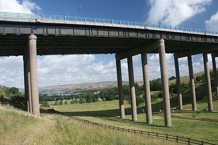
At the next junction bear right and climb across the flank of Dick Hill. Reaching a track, go straight across to reach Tunshill Lane. Go left along this old packhorse way from Rochdale to Marsden. Reaching a junction of tracks (Grid ref. SD960133), turn left (north) to walk parallel with the M62. The onward route is clear and you climb steadily towards the radio masts on Windy Hill. Walk past the masts towards the A672 and just before reaching this road turn left onto the Pennine Way to cross the M62 by a superb concrete bridge high above the carriageway.
The going on a well maintained path improves and you can make steady progress toward the next objective, Blackstone Edge. Reaching the summit area the path weaves its way through large millstone grit boulders that have weathered to black with age. The trig point is a perfect place to rest with a fine view west and northwest. Continuing, stay with the Pennine Way, heading north to reach the Aiggin Stone. Reaching this landmark turn left and follow the clear paved "Roman Road" as it descends quite steeply. Crossing a water leat used to collect water from the moors, continue to ascend towards the A58.
The path continues towards a row of cottages at Lydgate. Just past the cottages turn left down the access road to the golf club. At the first junction (Grid ref. SD954159) turn right. Continue straight ahead ignoring the tracks right to Shore Lane Farm and Owlett Hall. Continue across a section of the golf course to reach a gate. Once through this gate turn left alongside the stream. Cross a wooden footbridge and continue towards Lane Foot cottage and some modern houses. The path climbs towards the right and then descends by some steps to a lane that leads north to Ealees. Turn left (south) on this lane and turn right onto a signed footpath by a concrete bridge (grid ref. SD944159). The path now follows the stream. Crossing a footbridge you pass through a picnic area before reaching the car park and visitor centre from where the walk started.
Other walks nearby
| Walk 1849 | Blackstone Edge and the Pennine Way without a car | moderate | 8.0 miles |
| Walk 2260 | White Hill from Hollingworth Lake | moderate | 11.2 miles |
| Walk 3719 | Ramsden Wood & Hades Hill from Walsden | easy/mod | 6.1 miles |
| Walk 1411 | Walsden & Warland Reservoir | easy/mod | 6.5 miles |
| Walk 1619 | Cheeseden Brook & Pooley Bridge from Heywood | easy/mod | 7.4 miles |
| Walk 3015 | Stoodley Pike & Withens Clough Reservoir from Lobb Mill | moderate | 9.0 miles |
| Walk 1458 | The Rossendale Way from Greave | easy/mod | 7.0 miles |
| Walk 2183 | Irwell Sculpture Trail | easy | 4.5 miles |
| Walk 1421 | Turf Moor & Black Hill | moderate | 10.5 miles |
| Walk 3691 | Scout Moor from Ashworth Moor Reservoir | easy/mod | 4.5 miles |
Recommended Books & eBooks
The Pennine Way
 Guidebook to the Pennine Way National Trail with OS map booklet. The 265 mile route from Edale to Kirk Yetholm takes three weeks to walk and is suitable for fit and experienced long distance walkers. The route crosses the Peak District, Yorkshire Dales and North Pennines National Parks. Includes separate OS 1:25,000 map booklet of the route.
More information
Pennine Way Map Booklet
 Map of the 270 miles (435km) Pennine Way National Trail, between Edale in the Peak District and Kirk Yetholm in the Scottish Borders. This booklet is included with the Cicerone guidebook to the trail, and shows the full route on Ordnance Survey 1:25,000 maps. This popular long-distance route typically takes three weeks to complete.
More information
Messaging & Social Media
Message Walking Britain and follow the latest news.

Mountain Weather
Stay safe on the mountains with detailed weather forecasts - for iOS devices or for Android devices.