The Stiperstones Ridge from the Knolls
Shropshire Hills Walk
Region - Shropshire Hills
County/Area - Shropshire
Author - Lou Johnson
Length - 5.5 miles / 8.9 km Ascent - 660 feet / 200 metres
Time - 3 hours 30 minutes Grade - easy/mod
Maps 

| Ordnance Survey Explorer 216 | Sheet Map | 1:25k | BUY |
| Anquet OS Explorer 216 | Digital Map | 1:25k | BUY |
| Ordnance Survey Explorer 217 | Sheet Map | 1:25k | BUY |
| Anquet OS Explorer 217 | Digital Map | 1:25k | BUY |
| Ordnance Survey Landranger 137 | Sheet Map | 1:50k | BUY |
| Anquet OS Landranger 137 | Digital Map | 1:50k | BUY |
Walk Route Description
Click image to visit gallery of 12 images.
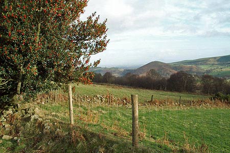
This walk includes the majority of the main path that runs the length of Stiperstones Ridge. Rising to 536 metres, the quartzite outcrops that are characteristic of this Shropshire hill offer excellent vantage points for views across the surrounding countryside including the Long Mynd, Corndon Hill and mid-Wales. The rugged nature of this the second highest hill in Shropshire adds scenic interest to upland heather moors that cover the high ground of the ridge. The Stiperstones Ridge is a National Nature Reserve and lies within the Shropshire Hills AONB.
The start for this walk is the Knolls Car Park (grid ref SO369976). Here an information board illustrates the geology and wildlife of the Stiperstones. Do not go through the gate leading directly to the Stiperstones but instead exit the car park at its northern end and follow the bridleway. This leads through Gatten Plantation to reach a junction of tracks above the Hollies (grid ref SO376991). Go straight across here and ignore the left fork a few metres further on. At the next junction (Grid ref. SO378994) bear left and then continue ahead following a path (not marked as a right of way on OS maps) that rises slowly across the hillside. Some route finding may be necessary on this section although the path was generally clear on the ground when this walk was researched.
Joining a bridleway (Grid ref. SJ379001), follow this north with pleasant views opening up ahead as it contours around the northern end of the Stiperstones Ridge. At a junction of tracks (Grid ref. SJ380011) bear left and start to climb above Blakemore Gate. At the next junction bear left and start to climb more energetically. This path climbs steadily towards the Shepherd's Rock and continues on the main Stiperstones ridge path climbing gently towards the Devil's Chair and Manstone Rock.
The views are now superb. On your right you are able to see the deep steep-sided valleys that cut into the ridge. Further afield the views extend into mid-Wales. The path becomes quite rocky underfoot and progress slows. However you soon arrive at Manstone Rock with its concrete trig column. This is the highest point on the Stiperstones ridge (536 m). Staying with the main ridge path you start to descend with the option of making a short diversion to the Cranberry Rock. Soon the path reaches the Knolls car park and the end of the walk.
Other walks nearby
| Walk 1809 | Shelve & the Stiperstones from The Bog | moderate | 9.0 miles |
| Walk 2083 | Linley Hill and Linley from The Bog | moderate | 8.5 miles |
| Walk 2745 | Betchcott Hills & Pole Bank | moderate | 9.0 miles |
| Walk 1205 | Adstone Hill, Medlicott and the Long Mynd | moderate | 9.5 miles |
| Walk 1072 | Stiperstones low level circular | easy | 4.0 miles |
| Walk 3529 | Stiperstones from Snailbeach | easy/mod | 7.0 miles |
| Walk 1871 | Snailbeach & the Stiperstones | moderate | 7.0 miles |
| Walk 2054 | Linley Hill & Beeches from Wentnor | easy/mod | 7.0 miles |
| Walk 1832 | The Hollies & Poles Coppice from near Habberley | easy/mod | 5.0 miles |
| Walk 2814 | Corndon Hill from Priest Weston | easy | 1.5 miles |
Recommended Books & eBooks
Hillwalking in Shropshire
 Guidebook to 32 walking routes in Shropshire in the West Midlands. The routes range from 3 miles (5km) to 12 miles (19km), taking in highlights such as The Wrekin, Wenlock Edge, Long Mynd and Stiperstones, Castle Ring and Bury Ditches. Many routes start near delightful towns and villages including Church Stretton, Ludlow and Bishops Castle.
More information
Messaging & Social Media
Message Walking Britain and follow the latest news.

Mountain Weather
Stay safe on the mountains with detailed weather forecasts - for iOS devices or for Android devices.