Buxhall to Drinkstone Green
Suffolk Walk
County/Area - Suffolk
Author - Annya & Steve Stoddart
Length - 7.5 miles / 12.2 km Ascent - 400 feet / 121 metres
Time - 4 hours 10 minutes Grade - easy/mod
Maps 

| Ordnance Survey Explorer 211 | Sheet Map | 1:25k | BUY |
| Anquet OS Explorer 211 | Digital Map | 1:25k | BUY |
| Ordnance Survey Landranger 155 | Sheet Map | 1:50k | BUY |
| Anquet OS Landranger 155 | Digital Map | 1:50k | BUY |
Walk Route Description
Click image to visit gallery of 3 images.
There are 2 potential starting points for this walk, depending on whether or not you want to start/end at a pub or at the village playing field. The playing field car park in Buxhall, opposite the old village school, now the village hall (Grid ref. TL995576).
The pub starting point is at The Crown in Buxhall (Grid ref. TL997578). If you are starting from the playing field, turn right out of the car park and walk to the end of the road. You will see the Primitive Methodist chapel straight ahead (now converted into a house) and the distinctive outline of the old windmill tower. Turn left at the end of the road and then in about 20 yards, turn right onto the footpath along the field boundary. If you are starting from the pub, just turn left out of the car park and the footpath is on your right in about 50 yards.
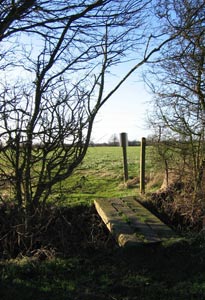
As you walk down the path, make sure you look over to the right where you will have a view of the tower of Buxhall church and the spire of Finborough church. At the bottom of the field, walk past an overgrown stile and into the meadow beyond. A natural spring comes up here, so this part of the field can be very boggy. Take the path that bears off to your left, to the stile in the far left corner of the field. Carry on walking in a generally north-westerly direction along the margins of several cultivated fields until you turn right across a sleeper bridge (Grid ref. TL994582).
Keep an eye out along whole of the walk for fallow deer, we saw 3 small herds out grazing or dashing off for cover on the day we recorded this route in January. The hedgerows are filled with sloe bushes, rosehips and crab apples along much of the route. Apart from the birds they attract, they can also be good photography subjects as well.
Note some walkers have found this section of the walk difficult to follow.Any help would be appreciated to improve the walk description of this section. At the top of the field, turn left over another little sleeper bridge and immediately circle round to your right. This is a permissive footpath opened up as part of the Countryside Stewardship Scheme. Follow the boundary of this field until you reach a footbridge. Cross in into the next field and walk down towards the Stowmarket to Rattlesden Road. You have a good view of the Rattlesden River Valley opening up before you, with pockets of woodland, green fields and river meadow.
Walk along the bank running parallel to the road, heading towards the village of Rattlesden. Where the road chicanes, drop down off the bank and immediately turn left, at the footpath sign, into the river meadow.
The house on the other side of the river has free range chickens roaming about and a small flock of sheep which sometimes graze the meadow. Looking straight ahead you get a glimpse of Rattlesden Church tower. Go over 2 stiles and shortly after the second, drop down onto another permissive path in the field below (Grid ref TL983593). Access is via a couple of steps which can be very muddy and slippery when it has rained, so take care. Follow the path round the field and along the Rattlesden River. At the end of the path, veer left into the sports-field rather than going up onto the road, which is quite narrow and has no footpath.
Head to the top right hand corner of the sports field until you get reach the road - Bird Green, in the village of Rattlesden. This has a row of lovely little thatched cottages, some of them traditional Suffolk pink. When you get to the end of the road, as you look straight ahead you can see the Brewers Arms pub on the left and as you look to your right you can see a fabulous black and white Tudor house, with Rattlesden Church set behind it. Walk towards the church and follow the tarmac path along side a brick wall at the bottom of the graveyard. This church has a fantastic nave, with lovely flint work and intricate arches in the windows. At the end of the path you inevitably see a cottage called Church View, and next to that a dinky little place, looking like a one up one down. Next to this is a small gate which you go through and follow a path up a hill.
On the way, is a pond that is quite overgrown and has a real primordial feel about it. Continue past the pond, through some paddocks and out onto a path that turns right, to pass through the middle of a field. Looking back across the valley and over Rattlesden you have a real feeling of the Suffolk countryside - green fields, pockets of trees and looking quite lush, even in January. Looking towards the east you can just see Great Finborough church spire. Continue across the clearly defined path to the wooded hedge at the other end of the field and then turn right and follow the hedge line round to the left. Soon you will come to a footpath junction (Grid ref. TL974596). Continue on the path to your left towards Pegg's Farm and then towards Garden House Farm.
Continue with the hedge on your left till you reach an opening next to a pylon. Keep an eye out for a couple of goats which can be tethered along here. Walk through into the next field and turn right. Follow the field boundary, ignoring the footbridge, and continue round the field to grid ref. TL967596. Ignore the path off to the left and continue ahead alongside a deep ditch until, within about 20 yards you end up on the moss covered Garden House Lane. Turn left and walk towards the Drinkstone Green to Rattlesden road.
Turn right and walk along the road for passing an immaculately kept Leylandii hedge. After about a quarter of a mile, take the footpath signposted on your right, walking between substantially fenced paddocks. Keep going between the paddocks until the path splits giving you the option of going straight ahead or turning right. Turn right and walk towards an interesting green mound which looks a bit like a golf tee or something surrounding a reservoir but which turns out to be a piece of landscaping framing a pond with a pontoon and a little house for ducks.
Note again some walkers have experienced problems with this paragraph too. Any help would be appreciated in making the instructions clearer. Keep going almost to the corner of the field and you will see the footpath off to your right, across a footbridge (Grid ref. TL967599) and continue along the footpaths towards the Woolpit to Rattlesden road heading towards Clopton Green Farm. The next quarter of a mile is along the road so take care since there is no footpath. At Clopton Green farm, turn right off the road and take a moment to look at the avenue of trees, a big Green and the houses on the far side. Stick to the roadway past the farm buildings. It splits a short way further on so follow it round to the right, past Clopton Hall and down the hill ending up on Back Road. Along a fair bit of the return walk you can see the 1000 foot Mendlesham mast, which is lit with anti collision lights at night. In reality it is a good 15 to 20 miles away but it looks a lot closer.
Continue walking ahead along Back Road and turn left into Gipsy Lane, a wooded track way. Look out for a pathway on your right which takes you through wooded water meadow (Grid ref. TL995595), across the Stowmarket Road and up the farm track opposite toward Wood Hall. Near to the top of the hill turn left off the concreted track, into a field. At this point, bear right and follow the path that passes to the left of the little wooded area bordering the Hall. At the field track, turn left and then in about 300 yards, right down a pathway between two rows of wooded hedgerow. At the end, turn left onto a field with Fenn Hall close by. Follow the hedge ahead keeping it on your right, at the lower right hand corner of the field, look for a gap. Walk through the gap into the next field and then down the hill in a southerly direction. Soon you will rejoin the path you took at the early stages of the walk. At this point you may want to consider heading towards the Crown pub before returning to your car!
Other walks nearby
| Walk 3245 | Woolpit and Rattelesden circular | easy/mod | 6.0 miles |
| Walk 3618 | Brent Eleigh from Lavenham | easy | 5.0 miles |
| Walk 1448 | Lavenham circular from Long Melford | easy/mod | 9.8 miles |
| Walk 1445 | Historic Long Melford | easy/mod | 8.0 miles |
| Walk 1446 | Sudbury circular from Long Melford | easy | 5.5 miles |
| Walk 3724 | River Box from Stoke-by-Nayland | easy | 6.0 miles |
| Walk 3660 | Stour Valley & Dedham from Flatford Mill | easy | 3.5 miles |
| Walk 2374 | Freston Circular | easy/mod | 6.6 miles |
| Walk 3263 | Clare and Cavendish Circular | easy/mod | 7.7 miles |
| Walk 2096 | Alton Water, Stutton & Tattingstone | easy | 5.5 miles |
Recommended Books & eBooks
Suffolk Coast and Heath Walks
 Guidebook to three long-distance routes exploring the varied landscapes of the Suffolk Coast and Heaths AONB. The Suffolk Coast Path covers 55 to 60 miles from Lowestoft to Felixstowe. The Stour and Orwell Walk is 40 miles from Felixstowe to Cattawade near Manningtree, while the Sandlings Walk is 59 miles from Ipswich to Southwold.
More information
Messaging & Social Media
Message Walking Britain and follow the latest news.

Mountain Weather
Stay safe on the mountains with detailed weather forecasts - for iOS devices or for Android devices.