Two Rivers Walk to Powick and Worcester
Worcestershire Walk
County/Area - Worcestershire
Author - Peter Lane
Length - 6.5 miles / 10.6 km Ascent - 250 feet / 76 metres
Time - 3 hours 30 minutes Grade - easy
Maps 

| Ordnance Survey Explorer 204 | Sheet Map | 1:25k | BUY |
| Anquet OS Explorer 204 | Digital Map | 1:25k | BUY |
| Ordnance Survey Landranger 150 | Sheet Map | 1:50k | BUY |
| Anquet OS Landranger 150 | Digital Map | 1:50k | BUY |
Walk Route Description
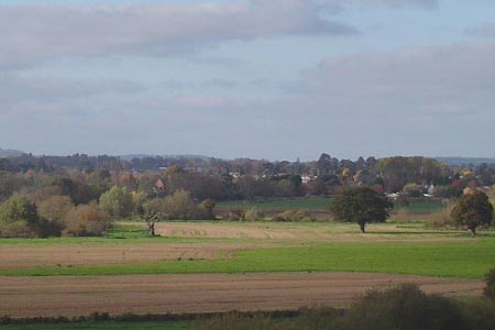
Click image to visit gallery of 12 images.
This completely flat walk follows the River Teme along its flood plain to Powick and then retraces to its confluence with the River Severn. From there it heads North along the West bank to the beautiful city of Worcester with its prominent Cathedral and returns along the East bank. This route provides an enjoyable way to explore the city of Worcester and also to get into the rural plains of Worcestershire without the need for expert navigational skills.
A straightforward walk following the course of the Rivers Teme and Severn, route finding should present no serious difficulties to anyone who has an idea of how to read a map. The start point is the free car park at the Ketch viewpoint at the A38 and A4440 intersection next to the River Severn South of Worcester, grid reference SO853516. It is approached from the A38, South of the roundabout.
The viewpoint at the car park looks over the site of the English Civil War Battle of Worcester, 1651. From there, descend to the busy roundabout and cross the road to the upstream side of the road bridge. Cross over the River Severn on the pavement and, coming to a lane that doubles back on the right, drop down to the flood plain below. Cross two stiles and turn left along the field boundary, with the ever-present A4440 just above you to your left. Coming to a small wood, the path crosses a stile on the left and continues to follow the A4440 until it reaches a fence. Cross the stile and trend towards the double-arched road bridge at Powick over the Teme. Pass under the diminutive arch and make your way to the elegant old Powick bridge with the imposing mill dominating its North end.
After crossing the Teme, immediately on the right descend back to the river, signed the Monarch's Way. Now simply follow the Teme until it heads South in a huge loop. At this point, cut out the loop and continue to follow the Teme to its confluence with the Severn. A boundary stone at this point marks the extent of the City of Worcester. Now head North up the Severn, admiring the weir at Diglis and the ever nearer Cathedral on the horizon. Tree lined avenues adorn the approach to the city and the views become ever better as it approaches.
At the main road bridge over the Severn, cross and start the return leg on the opposite bank, past the Cathedral. Or, if desired, take some time to explore the city and perhaps visit the Cathedral, the Commandery or the shops!
The return route is normally a straightforward matter of following the Severn Way along the riverbank all the way back to the Caravan Park below the Ketch Inn opposite the start point. However, at the time of writing (late 2007), significant redevelopment of the Diglis Basin was being carried out, necessitating a diversion. The diversion (if required) starts just before the Diglis Hotel. Follow Severn Street and turn first right along Mill Street. Cross the Worcester and Birmingham Canal and then turn right down Diglis Road. At the corner of Diglis Dock Road and Diglis Lane, enter the park. Walk to the far end of the park and follow the track as it skirts the end of the Industrial Estate and returns to the River Severn.
After about 500 metres, the Severn Way makes a short incursion into a wood, crossing a small (but steep banked) stream over a footbridge before returning to the river bank. Upon reaching the Caravan Park, keep to the bank and from the car park double back up the tarmac access road for a few metres until a steep path on the right leads up to the Ketch Inn. Take this up to the A38, cross at the roundabout and return to the start point.
Other walks nearby
| Walk 1355 | Stoulton Circular | easy/mod | 7.5 miles |
| Walk 3692 | Egdon, Stoulton & White Ladies Aston | easy | 6.3 miles |
| Walk 1313 | White Ladies & Aston circular | easy | 5.5 miles |
| Walk 2313 | Upton Snodsbury Circular | easy/mod | 7.5 miles |
| Walk 3680 | Broughton Hackett and Upton Snodsbury | easy | 3.0 miles |
| Walk 2142 | Severn Valley from Grimley | easy | 5.0 miles |
| Walk 1556 | The Malverns - end to end | hard | 10.0 miles |
| Walk 1658 | Malverns circular from Noirth Hill | very hard | 18.0 miles |
| Walk 2445 | Upton-upon-Severn Circular | easy/mod | 6.8 miles |
| Walk 1211 | The Worcestershire Beacon | easy/mod | 4.5 miles |
Recommended Books & eBooks
No suggestions for this area.Messaging & Social Media
Message Walking Britain and follow the latest news.

Mountain Weather
Stay safe on the mountains with detailed weather forecasts - for iOS devices or for Android devices.