Deepdale and the deserted village of Wharram St. Percy
Yorkshire Wolds Walk
Region - Yorkshire Wolds
County/Area - North Yorkshire - Yorkshire Wolds
Author - Lou Johnson
Length - 5.0 miles / 8.1 km Ascent - 450 feet / 136 metres
Time - 3 hours 0 minutes Grade - easy
Maps 

| Ordnance Survey Explorer 300 | Sheet Map | 1:25k | BUY |
| Anquet OS Explorer 300 | Digital Map | 1:25k | BUY |
| Ordnance Survey Landranger 100 | Sheet Map | 1:50k | BUY |
| Anquet OS Landranger 100 | Digital Map | 1:50k | BUY |
| Ordnance Survey Landranger 101 | Sheet Map | 1:50k | BUY |
| Anquet OS Landranger 101 | Digital Map | 1:50k | BUY |
Walk Route Description
Click image to visit gallery of 6 images.
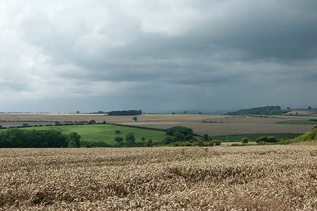
The rolling hills and dales of the Yorkshire Wolds are, to some walkers, one of the best kept secrets in the country. Benefiting from generally excellent waymarking, wide ranging views and some interesting things to see, it soon becomes evident why this area is held in such high regard. This particular route includes some of the typical scenic features of the area and also visits the deserted village of Wharram St. Percy, which is maintained by English Heritage.
The walk starts from the small EH car park (Grid ref. SE866644). Exit the car park onto the lane and turn right (south), following the Centenary Way. The road turns right and then left. Turn right here onto the Centenary Way, although before continuing it is worth walking down the road a short way to look into Fairy Dale, which exhibits many of the scenic characteristics of this area. Following the track west take the first signed bridleway on your left. This descends with the field boundary on your immediate right offering improving views into William Dale.
After 400 metres the bridleway turns right through a gap (Grid ref. SE865630) and continues to contour across the slopes of William Dale. The bridleway becomes a more visible track and continues to descend to reach a bridleway sign directing you right off this farm track. The onward route is well marked and you reach a junction of bridleways (Grid ref. SE849625). Turn right here and continue uphill to reach the Yorkshire Wolds Way at a further junction (Grid ref. SE848628). Turn right and continue along the path with Deepdale becoming deeper as you proceed.
Reaching a gate (Grid ref. SE858631), bear left and continue along the rim of Deepdale. From here you get your first sight of the ruined church of Wharram St. Percy. The path descends towards the church with the small pond on your left. There are a number of information boards relating the history of the village and offering reasons for its sad demise. The site of the village is one of the most researched of its kind in Britain. For the visitor there is ample evidence to explore and you are also provided with an artist's impression of how the village looked at its height of success.
Continue past the derelict church and the 18th century farm house and descend to the trackbed of the old railway (Grid ref. SE861645). Do not turn left along the railway but instead go up through the gate ahead and begin the climb back to the start. The path is the continuation of the Yorkshire Wolds Way and you are soon back at the car park.
Other walks nearby
| Walk 2703 | Thixendale & Kirby Underdale | easy/mod | 8.5 miles |
| Walk 1990 | Settrington from North Grimston | easy/mod | 7.3 miles |
| Walk 2655 | Wayram To Fridaythorpe Circular | easy/mod | 7.5 miles |
| Walk 2906 | Circular from Wayrham Through Painsthorpe | moderate | 8.5 miles |
| Walk 3349 | Pasture Dale, Frendal Dale and Horsedale from Huggate | easy/mod | 9.1 miles |
| Walk 1779 | Horse Dale, Holm Dale, Tun Dale and Frendal Dale from Huggate | easy/mod | 9.0 miles |
| Walk 3740 | Cowlam & Cottam Circular | easy/mod | 8.0 miles |
| Walk 3126 | Kirkham Priory & Pretty Wood from Low Hutton | moderate | 11.0 miles |
| Walk 3127 | Bishop Wilton & Millington | moderate | 13.4 miles |
| Walk 3733 | Coneysthorpe & Castle Howard from Welburn | easy/mod | 9.0 miles |
Recommended Books & eBooks
Trail and Fell Running in the Yorkshire Dales
 Guidebook to 40 of the best trail and fell runs in the Yorkshire Dales National Park. Ranging from 5 to 24 miles, the graded runs start from bases such as Ribblehead, Dent, Sedbergh, Malham and Grassington and take in the region's diverse delights, from castles and waterfalls to iconic mountains such as Whernside, Ingleborough and Pen Y Ghent.
More information
Messaging & Social Media
Message Walking Britain and follow the latest news.

Mountain Weather
Stay safe on the mountains with detailed weather forecasts - for iOS devices or for Android devices.