Gordale Scar & Malham Cove (Route 2)
Yorkshire Dales Walk
Nat Park - Yorkshire Dales - Malhamdale
County/Area - North Yorkshire
Author - Lou Johnson
Length - 7.0 miles / 11.4 km Ascent - 900 feet / 273 metres
Time - 4 hours 20 minutes Grade - moderate
Maps 

| Ordnance Survey Explorer OL2 | Sheet Map | 1:25k | BUY |
| Anquet OS Explorer OL2 | Digital Map | 1:25k | BUY |
| Ordnance Survey Landranger 98 | Sheet Map | 1:50k | BUY |
| Anquet OS Landranger 98 | Digital Map | 1:50k | BUY |
Walk Route Description
Click image to visit gallery of 6 images.
The village of Malham has become a focal point for exploring the limestone scenery of the southern half of the Yorkshire Dales. This popularity is solely due to the spectacular nature of the surrounding countryside with Malham Cove of particular note. An alternative but shorter route is described in walk 1239 and a longer version in walk 2602.
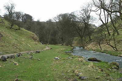
This Yorkshire Dales walk includes all the highlights of Malham's limestone scenery. The walks starts in the National Park car park (grid ref. SD 900627) which has toilets and an information centre. Exit the car park and turn left into the village. After 200 metres cross the road and follow Malham Beck upstream to the first pedestrian bridge. Cross this and head downstream following the Pennine Way until a path junction near Mires Barn (grid ref. SD 902624). Turn left and follow the well maintained path east and then north to enter pleasant woodland with Gordale Beck on your right.
The path continues easily to Janet's Foss, a pretty waterfall cascading into a pool. Climb the path to the left of the waterfall and join Gordale Lane. Turn right and continue along the lane until you reach the gate that leads to Gordale Scar. The broad path soon enters a narrow chasm. Ahead Gordale Beck cascades down from a ledge. You need to scramble up to the left of the waterfall where plenty of hand holds assist the short climb. Beware of slippery rock and remember that some agility is required to get up this obstacle! If you cannot make it then retrace your steps to the lane and turn right. This will bring you to where the footpath exits the top of Gordale Scar's waterfall. Note - one walker commented this section could be described as a short severe climb and this may be true if there is plenty of water running over the fall.
Assuming you have made it to the top, continue along the well used path. This climbs out of the valley and after a mile joins a lane. Rather than follow the metalled road, fork right and head north to Street Gate continuing in the same direction to reach a small stand of trees. Turn left in front of them and continue west towards the shores of Malham Tarn, which is delightfully located.
There are a number of paths but you need to reach the road (grid ref. 893658) where the path heads south to Malham Cove. With the stream on your left continue past the point where it disappears underground following the clear and ignoring the path off to the left. The immediate scenery will suddenly change as you enter a wonderful limestone gorge. The path swings right and then turns sharp left to descend via steps into Watlowes dry valley. This leads without further problems to the limestone pavement above Malham Cove.
Reaching the cliff turn right but do be careful as it is a fair drop into the cove and the rock slabs can be slippery. Reaching the west end of the cliff a stepped path takes you down into the valley. At the first fork trend right and this path brings you out on Cove Road. Turn left into the lane and all that remains is a gentle downhill stroll back to the start.
Other walks nearby
| Walk 1282 | Malham Tarn & Arncliffe | moderate | 12.5 miles |
| Walk 3092 | Malham Cove, Malham Tarn & Watlowes | easy | 4.4 miles |
| Walk 2385 | Airton & Bell Busk Circular | easy/mod | 6.8 miles |
| Walk 1377 | Calton and Hanlith Moors | easy/mod | 6.5 miles |
| Walk 2066 | Winterburn Reservoir circular | easy | 6.0 miles |
| Walk 1701 | Bordley Hall & Malham Moor from Threshfield Moor | easy/mod | 7.0 miles |
| Walk 2332 | Mastilles Lane & Bordley from Kilnsey | easy/mod | 6.8 miles |
| Walk 3107 | Flasby Fell from Flasby | easy/mod | 6.5 miles |
| Walk 3109 | Rylstone Edges & Cracoe from Rylstone | easy/mod | 6.0 miles |
| Walk 2617 | Nappa Cross & Victoria Cave from Langcliffe | moderate | 9.5 miles |
Recommended Books & eBooks
Walking in the Yorkshire Dales: South and West
 Part of a two-book set, this guidebook describes 44 walks in the southern and western Yorkshire Dales, including the famous 23 mile Three Peaks circuit over Pen-y-Ghent, Whernside and Ingleborough. The other, mostly circular routes of 3½ to 13 miles cover the scenic region between Sedbergh, Kirkby Lonsdale, Settle, Skipton and Grassington.
More information
The Pennine Way
 Guidebook to the Pennine Way National Trail with OS map booklet. The 265 mile route from Edale to Kirk Yetholm takes three weeks to walk and is suitable for fit and experienced long distance walkers. The route crosses the Peak District, Yorkshire Dales and North Pennines National Parks. Includes separate OS 1:25,000 map booklet of the route.
More information
Messaging & Social Media
Message Walking Britain and follow the latest news.

Mountain Weather
Stay safe on the mountains with detailed weather forecasts - for iOS devices or for Android devices.