Berkshire WalksWalking Routes & Hiking Trails
Find Berkshire walks from the list below which features the best walking routes in the area. Most are circular walks and are listed from the shortest and easiest to the longest more challenging routes.
The Berkshire walks listed below vary from easy circular walks to more demanding and longer routes. All walks are free to download and print and all routes have GPS files. The walks cover most of the attractive countryside in the County including the Thames Valley and across the Berkshire Downs. Many of the walks include attractive villages and historic buildings. Long distance footpaths including the Thames Path, Chiltern Way and the Ridgeway offer an excellent basis for shorter circular walks.
| Walk | Description | Grade | Miles |
|---|---|---|---|
| 1901★ | Around Aldermaston | easy | 5.00 |
| 1982★ | Hurley Circular | easy | 5.10 |
| 2660★ | Lowbury Hill & Roden Downs from Compton | easy/mod | 6.00 |
| 1947★ | Coombe Gibbet & Walbury Hill near Inkpen | easy/mod | 6.20 |
| 2180★ | Hamstead Park from Kintbury | easy/mod | 7.30 |
| 1737★ | West Berkshire downs from East Garston | easy/mod | 7.40 |
| 3484★ | The Fair Mile & Unhill Bottom, near Streatley | easy/mod | 7.80 |
| 2275★ | Lowbury Hill & The Fair Mile from Aldworth | easy/mod | 7.80 |
| 3731★ | Chaddleworth from Great Shefford | easy/mod | 8.00 |
| 2344★ | Newbury to Hungerford via Kennet & Avon Canal | easy/mod | 9.00 |
| 3572★ | Lambourn Valley & Great Shefford | easy/mod | 9.00 |
| 3259★ | Windsor Great Park Circular | moderate | 10.20 |
| 1385★ | Windsor & Runnymede circular | easy/mod | 11.50 |
| 3420★ | Cookham to Gerrards Cross via Burnham Beeches | moderate | 12.50 |
Walks that start in adjacent counties / areas.
Walks that start in adjacent counties or areas but cross the boundary and include sections of the route within Berkshire.
| Walk | Description | Starts In |
|---|---|---|
| 2114★ | Hampshire and Berkshire Heights | Hampshire |
| 1419★ | The Lambourn Downs from near Astbury | Oxfordshire |
| 1720★ | Henley-on-Thames to Marlow along the Thames Path | Oxfordshire |
| 3128★ | Henley-on-Thames, Aston and Hambleden | Oxfordshire |
| 3720★ | Ham, Inkpen Hill & Lower Green Circular | Wiltshire |
| 1814 | Staines to Windsor along the River Thames | Surrey |
★ GPS file ☩ Route profile
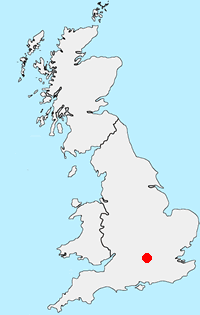
Location Map
Berkshire Guide
The County of Berkshire is bisected by the Thames Valley with higher land rising to the north and south of this great river. The county has mane areas of woodland with trees that prefer acid soils. These include Bracknell Forest, Windsor Great Park, Crowthorne and Stratfield Saye Woods. The highest land lies along the Hampshire border to the south The highest point in the county is Walbury Hill at 297 metres above sea level. The open upland areas compete with Newmarket (Suffolk) for horse racing training and breeding. Away from the towns cereal crops are widespread. The major towns and centres of population include Ascot, Eton, Maidenhead, Newbury, Reading, Slough and Windsor.
Other walks in Britain - For a list of all the areas where walks are available go to the Main Walk Index.
Walk grading - Learn how each walk is assessed and select a walk to suit your ability and experience by going to Walk Grading Details.
Messaging & Social Media
Message Walking Britain and follow the latest news.

Mountain Weather
Stay safe on the mountains with detailed weather forecasts - for iOS devices or for Android devices.