Cairngorms WalksWalking Routes & Hiking Trails
Find Cairngorms walks from the list below which features the best walking routes in the area. Most of routes are circular walks although there are a few linear hikes. The walks are listed from the shortest and easiest to the longest more challenging routes. The walks are divided into sub areas so you can find specific walks.
The great Cairngorms National Park walks listed below cater for walkers of all abilities from easy walks to challenging mountain walks in remote areas. All walks are free to download and print and all routes have GPX files. The routes cover some of the highest mountains in Britain which are for experienced walkers only. In contrast lower level walks are also featured.
Cairngorms North Walks
Cairngorms North is centered on the regional centre of Aviemore where there are a wide range of amenities for walkers. The routes below include some of the highest summits in Britain and need to be treated with respect. Many routes take you into wild terrain and are for experienced walkers only. In winter snow and ice can provide a challenging environment for walking and necessary precautions should be taken.
| Walk | Description | Grade | Miles |
|---|---|---|---|
| 1906★ | Lochan Mor & Rothiemurchus Forest from Inverdruie | easy/mod | 3.60 |
| 1904★ | Loch Morlich circular (near Aviemore) | easy | 4.00 |
| 2067★ | Rothiemurchus Forest via Balvattan from Coylumbridge | easy/mod | 4.60 |
| 1505★☩ | Craigellachie National Nature Reserve from Aviemore | easy/mod | 5.00 |
| 3579★☩ | Meall a'Bhuachaille & Ryvoan Bothy from Glenmore | moderate | 5.50 |
| 1390★☩ | Cairn Lochan via the Fiacaill Buttress from Ski Centre | very hard | 5.70 |
| 2672★☩ | Cairngorm Mountain via Coire an t-Sneachda | mod/hard | 6.00 |
| 2931★ | Creagan an Fhithich from Falls of Truim | easy/mod | 6.30 |
| 3299★ | Loch an Eilein from Coylumbridge | easy/mod | 7.00 |
| 2412★☩ | Craiggowrie & Creagan Gorm from Loch Morlich | mod/hard | 7.30 |
| 3218★☩ | Eag a' Chait gap Via Rothiemurchus Lodge from Glenmore | moderate | 8.20 |
| 1777★☩ | Carn Daimh from Glenlivet | moderate | 8.50 |
| 1276★☩ | Loch Avon Circular via Cairn Gorm Mountain | hard | 9.00 |
| 1771★☩ | Ladder Hills Circular from Chapeltown, Glenlivet | mod/hard | 9.50 |
| 1605★ | Loch an Eilein & Rothiemurchus Forest from Loch Morlich | easy/mod | 10.00 |
| 2031★ | Abernethy Forest, Cairngorms | easy/mod | 10.20 |
| 1881★☩ | Ben Macdui & Cairn Lochan from the Ski Centre | hard | 10.40 |
| 2607★☩ | Lairig Ghru & Chalamain Gap from Glenmore | mod/hard | 11.00 |
| 2314★☩ | Cairngorm & Ben Macdui from the ski centre | hard | 11.00 |
| 2421★☩ | Braeriach via the Chalamain Gap | hard | 15.00 |
| 1721★☩ | Braeriach via Lairig Ghru from Coylumbridge | hard | 18.20 |
| 1020★ | Glenmore to Linn of Dee via Lairig Ghru & Corrour from Aviemore | hard | 21.00 |
| 3076★☩ | Cairn Toul Circular from Coylumbridge | severe | 26.50 |
| 1016★☩ | Devil's Point, Cairn Toul, Braeriach & Lairig Ghru from Coylumbridge | very hard | 28.00 |
Cairngorms South Walks
Cairngorms South includes routes that commence in Arbendeenshire with the main regional centre being Braemar. Routes to the highest summits in the National Park tend to be longer when using approaches from the south. The area must be treated with respect with wild and remote terrain. Winter can provide difficult conditions for walkers especially with long exit routes to safety.
| Walk | Description | Grade | Miles |
|---|---|---|---|
| 3108★ | Creag Choinnich circular from Braemar | easy/mod | 4.00 |
| 2706★☩ | Morrone (Morven) from Braemar | moderate | 7.40 |
| 2356★ | The Cairnwell ridge from Glenshee Ski Centre | mod/hard | 9.30 |
| 1864★ | Glen Quoich & Glen Lui (near Braemar) | moderate | 10.00 |
| 2181★☩ | Loch Lee & Falls of Unich | mod/hard | 10.70 |
| 1119★☩ | Ben Macdui & Carn a' Mhaim from Linn of Dee | hard | 19.00 |
★ GPS file ☩ Route profile
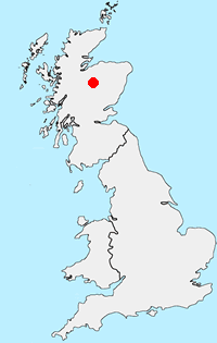
Location Map
Cairngorms Guide
Walking in the Cairngorms National Park, which was formed in 2003 to protect the unique aspects of the area, offers some of the great walks of Scotland. It is the UK's largest national park with a large mountain range at its heart with diverse communities around it. The habitat offers a secure haven for many of Britain's rarest bird, animal and plant species. Forests include remnants of the original Caledonian pine forest which contrast with large areas of heather moorland to foster ecological diversity. Of particular interest to hill walkers is that four of Scotland's five highest peaks can be found in this National Park where the arctic wilderness is the largest example of arctic mountain landscape in the British Isles.
Cairngorms Walking Guide
Other walks in Britain - For a list of all the areas where walks are available go to the Main Walk Index.
Walk grading - Learn how each walk is assessed and select a walk to suit your ability and experience by going to Walk Grading Details.
Messaging & Social Media
Message Walking Britain and follow the latest news.

Mountain Weather
Stay safe on the mountains with detailed weather forecasts - for iOS devices or for Android devices.