Somerset WalksWalking Routes & Hiking Trails
Find Somerset walks from the list below which features the best walking routes in the area. Most are circular walks and are listed from the shortest and easiest to the longest more challenging routes.
The Somerset walks listed below range from easy circular walks to longer and more demanding routes. All walks are free to download and print and all longer routes have GPS files. The walks include the countryside and coast of the County. Walks in the popular Mendip Hills, Quantock Hills and Exmoor National Park are also included. Some walks feature attractive villages, historic houses and churches and areas where you can observe birds and wildlife.
| Walk | Description | Grade | Miles |
|---|---|---|---|
| 2201 | Historic Wells Circular | easy | 1.50 |
| 1212★ | Glastonbury Tor | easy | 2.50 |
| 1750★ | Dunkery Beacon (short ascent) | easy/mod | 2.50 |
| 1924★ | Lydeard Hill to Wills Neck | easy | 2.60 |
| 2184★ | Ebbor Gorge from Wookey Hole | easy/mod | 3.00 |
| 1891★ | Solsbury Hill from Northend | easy | 3.00 |
| 2426★ | Wraxall circular from Tyntesfield | easy | 3.20 |
| 3675★ | Bedlam and Great Elm from Mells | easy/mod | 4.70 |
| 2211★ | Minehead to Dunster | easy | 5.00 |
| 1925★ | Plainfield to Wills Neck | easy | 5.00 |
| 3570★ | River Tone from Stoke St Gregory | easy | 5.20 |
| 3725★☩ | Selworthy Beacon from Selworthy | easy/mod | 5.50 |
| 2087★ | The Cam Brook Valley from Southstoke | easy | 5.50 |
| 3332★ | Cameley & Hinton Blewett from Litton | easy | 5.60 |
| 2097★ | Blagdon Lake | easy/mod | 5.70 |
| 1822★ | Hodder's Combe, Bicknoller Post & Higher Hare Knap | easy/mod | 5.75 |
| 2387★ | Pinkery Pond Circular | easy/mod | 5.80 |
| 2451★ | Withypool & Barle Valley from Landacre Bridge | easy/mod | 6.00 |
| 1662★ | Wavering Down & Crook Peak from Winscombe | easy/mod | 6.00 |
| 1222★ | Winsford Hill & the Allotment from Winsford | moderate | 6.00 |
| 3412★ | Dowsborough Fort from Holford | easy/mod | 6.00 |
| 2172★ | Ebbor Gorge & Priddy from Wookey Hole | easy/mod | 6.30 |
| 3386★ | Barle Valley & Cow Castle from Simonsbath | easy/mod | 6.40 |
| 3454★ | Corton Denham and Cadbury Castle | easy/mod | 6.70 |
| 1978★ | Blackdown Hills & Castle Neroche from Staple Fitzpaine | easy/mod | 6.80 |
| 2940★ | Beacon Hill & Bicknoller Post from Kilve Beach | easy/mod | 7.00 |
| 3666★ | West Mendip Way & Old Ditch from Rodney Stoke | moderate | 7.00 |
| 1973★ | River Parrett from Pawlett | easy/mod | 7.10 |
| 3211 | Crowcombe & Wills Neck | moderate | 7.30 |
| 1696★ | Weacombe Combe, Bicknoller Post, Kilve & Longstone Hill | easy/mod | 7.50 |
| 1860★ | The River Barle and Withypool from Tarr Steps | easy/mod | 7.50 |
| 2103★ | Shepton Mallet and the Fosse Way | easy/mod | 7.50 |
| 3399★ | Ham Woods, Croscombe & Knowle Hill from Shepton Mallet | easy/mod | 7.50 |
| 3499★ | West Compton & North Wootton from Pilton | easy/mod | 7.50 |
| 1220★ | Dunkery Beacon from Wheddon Cross | moderate | 8.00 |
| 1669★ | Anstey Gate & Hawkridge from Tarr Steps | moderate | 8.20 |
| 1856★ | Lilstock & East Quantox Head | easy/mod | 8.40 |
| 1221★ | Selworthy Beacon & North Hill from Bossington | moderate | 8.50 |
| 2804★ | Bath to Keynsham over Kelston Round Hill | easy/mod | 9.00 |
| 2330★ | Quantock Hills from Dead Woman's Ditch | moderate | 9.20 |
| 1275★ | Wells, North Wootton & Worminster | moderate | 9.50 |
| 3304★ | Pennard Hill from Pylle | moderate | 10.00 |
| 1567★ | Keynsham to Bath on the south side of the Avon | easy/mod | 11.10 |
| 1346★ | Priddy, Ebbor Gorge & Wookey Hole from Wells | moderate | 13.50 |
Walks that start in adjacent counties / areas.
Walks that start in adjacent counties or areas but cross the boundary and include sections of the route within Somerset.
| Walk | Description | Starts In |
|---|---|---|
| 1263★ | The Doone Valley | Devon |
★ GPS file ☩ Route profile
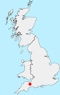
Location Map
Somerset Guide
Somerset is a rural county in south-west England. The high land of the Blackdown Hills, Mendip Hills, Quantock Hills and Exmoor National Park, contrast with the wide expanses of flat wetland including the Somerset Levels. Adding interest to the landscape are the extensive network of caves and the Cheddar Gorge. Exmoor National Park crosses the border into neighbouring Devon and provides excellent walking. The highest point in Somerset is Dunkery Beacon on Exmoor, with an altitude of 519 metres (1,703 feet). The coast also offers great walking especially the section of South West Coast Path west of Minehead.
Other walks in Britain - For a list of all the areas where walks are available go to the Main Walk Index.
Walk grading - Learn how each walk is assessed and select a walk to suit your ability and experience by going to Walk Grading Details.
Messaging & Social Media
Message Walking Britain and follow the latest news.

Mountain Weather
Stay safe on the mountains with detailed weather forecasts - for iOS devices or for Android devices.