South Pennines WalksWalking Routes & Hiking Trails
Find South Pennines walks from the list below which features the best walking routes in the area. Most are circular walks and are listed from the shortest and easiest to the longest more challenging routes.
Listed below are the best places to walk in the South Pennines. The hikes range from easy low-level walks to harder routes across the wild moors. The walks cover all the major valleys and areas of high moorland from the Brontë moors in the north to Bleaklow in the south. The Pennine Way crosses this area and walks including sections of this long distance footpath area also listed. All walks are free to download and print and all routes have GPX files.
| Walk | Description | Grade | Miles |
|---|---|---|---|
| 1243★ | Haworth Moor and Bronte Bridge from Oxenhope | easy | 3.50 |
| 2196★ | Clowbridge Reservoir & Singing Ringing Tree | easy/mod | 4.00 |
| 2183★ | Irwell Sculpture Trail from Bacup | easy | 4.50 |
| 3159★ | March Haigh Reservoir & Eastergate Bridge from Marsden | easy/mod | 5.00 |
| 1793★ | Lothersdale from Cowling | easy/mod | 6.00 |
| 3719★ | Ramsden Wood & Hades Hill from Walsden | easy/mod | 6.10 |
| 2098★ | Marsden Moor from Marsden | easy/mod | 6.40 |
| 1411★ | Walsden & Warland Reservoir | easy/mod | 6.50 |
| 2634★ | Broadstone Hill & the Cotton Famine Road | moderate | 7.00 |
| 1336★ | Sowerby Bridge and Norland Moor | easy/mod | 7.00 |
| 1458★ | The Rossendale Way from Greave | easy/mod | 7.00 |
| 2121★ | Crimsworth Dean, Lumb Bridge & Hardcastle Crags | moderate | 7.50 |
| 1849★ | Blackstone Edge and the Pennine Way without a car | moderate | 8.00 |
| 1307★ | Circuit of Ovenden Moor from Oxenhope | moderate | 8.00 |
| 1135★ | Top Withins and the Bronte Bridge from Haworth | moderate | 8.00 |
| 2553★ | Greenfield Reservoir & Raven Stones from Dovestone | moderate | 8.00 |
| 2946★ | Buckstones and Linsgreave Head from Marsden | moderate | 8.75 |
| 1900★ | Standedge Trail from Marsden | moderate | 9.00 |
| 3015★ | Stoodley Pike & Withens Clough Reservoir from Lobb Mill | moderate | 9.00 |
| 1829★ | Holme & Marsden Clough from Ramsden Reservoir | moderate | 9.00 |
| 3380★ | Blackstone Edge from Hollingworth Lake | moderate | 9.00 |
| 2630★ | Upper Holme Valley & Ramsden Clough | moderate | 9.00 |
| 2661★ | Keighley Moor Reservoir & Hitching Stone from Cowling | moderate | 9.50 |
| 2561★ | Digley & Ramsden Reservoirs from Wessenden Head | moderate | 9.50 |
| 2518★ | Black Hill & Four Reservoirs from near Wessenden Head | moderate | 10.00 |
| 1291★ | Stoodley Pike from Hebden Bridge | moderate | 11.00 |
| 2644★ | Marsden and the Standedge Trail | moderate | 11.00 |
| 2705★ | Oxenhope to Hebden Bridge without a car | moderate | 11.00 |
| 2260★ | White Hill from Hollingworth Lake | moderate | 11.20 |
| 2606★ | Hoof Stones Height, Noah Dale and Colden Water | moderate | 11.50 |
| 2926★ | Cupwith & Shooter's Nab from Marsden | moderate | 13.00 |
| 2613★ | Boundary Walk from Marsden | moderate | 13.00 |
| 2600★ | Chew Reservoir & the Pennine Way | mod/hard | 14.00 |
| 2359★ | Cuckoo Walk & Bacon Butties from Marsden | hard | 19.50 |
| 1697★ | Marsden to Edale challenge | very hard | 22.00 |
★ GPS file ☩ Route profile
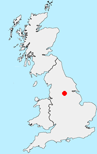
Location Map
South Pennines Guide
The South Pennines stretch from the northern boundary of the Peak District to the southern boundary of the Yorkshire Dales. Consisting of high rolling moorland, intersected by deep valleys, there is nowhere in this region that exceeds 2000 feet. The moors and valleys are where the old rivals, Lancashire and Yorkshire meet and where too the rival industries of cotton and wool.
South-Pennines Walking Guide
Other walks in Britain - For a list of all the areas where walks are available go to the Main Walk Index.
Walk grading - Learn how each walk is assessed and select a walk to suit your ability and experience by going to Walk Grading Details.
Messaging & Social Media
Message Walking Britain and follow the latest news.

Mountain Weather
Stay safe on the mountains with detailed weather forecasts - for iOS devices or for Android devices.