Staffordshire WalksWalking Routes & Hiking Trails
Find Staffordshire walks from the list below which features the best walking routes in the area. Most of routes are circular walks although there are a few linear hikes. The walks are listed from the shortest and easiest to the longest more challenging routes. The walks are divided into sub areas so you can find specific walks.
The Staffordshire walks listed below cater for walkers of all abilities from easy low-level routes to harder routes involving more ascent. All walks are free to download and print and all routes have GPS files. The county has much to offer walkers from the Peak District National Park in the north, to Cannock Chase AONB and Kinver Edge further south. In between these well known areas pleasant walking can be enjoyed throughout most of the county.
White Peak - Manifold Valley & Dovedale Walks
Peak District National Park
Walking highlights - Dramatic Dovedale and its sister dales are typical of the White Peak with limestone outcrops a character of the landscape. The Manifold Valley, lying to the west of Dovedale, also has much to offer walkers including Thor's Cave perched high on the valley side. Between the Dove and Manifold valleys lies high ground, including Ecton Hill and the villages of Alstonefield and Wetton which provide a good base for Peak District walks in this area.
Where to stay - Hartington, Alstonefield, Wetton, Grindon and Ashbourne are all convenient for this area.
| Walk | Description | Grade | Miles |
|---|---|---|---|
| 3131★ | Thorpe Cloud and the Dove Valley | easy | 1.60 |
| 2681★ | Wetton & Manifold Valley from Wetton | easy/mod | 3.60 |
| 2259★ | Ilam | easy | 4.50 |
| 1475★ | Bunster Hill and Dovedale from Ilam | easy/mod | 4.50 |
| 2252★ | Manifold Valley and Ecton Hill | easy/mod | 6.30 |
| 1181★ | Wetton Hill & the Manifold Valley | easy/mod | 6.50 |
| 2455★ | Lum Edge & Revidge Moor | easy/mod | 6.50 |
| 1709★ | Milldale and Wolfscote Dale | easy/mod | 6.50 |
| 2537★ | Ecton Hill & Wetton from Wetton Mill | moderate | 7.00 |
| 3527★ | Dovedale and Manifold Valley from Ilam | moderate | 7.50 |
| 1257★ | Wolfscote Dale | easy/mod | 7.50 |
| 1653★ | The Manifold Valley from Wetton | easy/mod | 7.80 |
| 2263★ | Grindon & the Manifold Way from Waterhouses | moderate | 8.00 |
| 3455★ | Manifold Valley & Dovedale om Ilam | moderate | 9.50 |
| 3597★ | Manifold Valley, Thor's Cave, Ecton & Wetton Hills from Alstonefield | moderate | 10.00 |
| 3601★ | Dove & Manifold Valleys | moderate | 10.00 |
White Peak - Upper Dove Valley & Chrome Hill Walks
Peak District National Park
Walking highlights - Chrome Hill and Parkhouse Hill (the Dragon's Back) are the main attractions in this area. As you head up towards the source of the River Dove the scenery gets wilder and more dramatic.
Where to stay - Hartington and Longnor are convenient for this area.
| Walk | Description | Grade | Miles |
|---|---|---|---|
| 1185★ | Chrome Hill (Dragon's Back) from Hollinsclough | easy/mod | 4.50 |
| 3445★ | The Dragon's Back (Chrome Hill) from Hollinsclough | moderate | 4.50 |
| 1862★ | Earl Sterndale and High Wheeldon from Longnor | easy/mod | 6.00 |
| 2837★ | Parkhouse & Chrome Hills from Longnor | easy/mod | 6.70 |
| 2531★ | Upper Dove Valley | moderate | 7.50 |
| 2545★ | High Edge & Chrome Hill from Hollinsclough | moderate | 8.50 |
| 2723★ | Pilsbury Castle, Hartington & Sheen from Longnor | easy/mod | 9.60 |
Western Moors - Three Shires Head & the Roaches Walks
Peak District National Park
Walking highlights - The Roaches offer great views with little effort, Three Shires Head where the counties of Staffordshire, Derbyshire and Cheshire meet at a picturesque packhorse bridge and lonely Axe Edge Moor, which is the highest point in Staffordshire.
Where to stay - Leek, Buxton, Gradbach and Danebridge are convenient for this area.
| Walk | Description | Grade | Miles |
|---|---|---|---|
| 1596★ | Lud's Church and Roach End from Gradbach | easy/mod | 4.50 |
| 1707★ | The Roaches short circular | easy/mod | 5.00 |
| 1598★ | Lud's Church, Back Forest & Clough Head | easy/mod | 6.80 |
| 3030★ | Roaches & Lud's Church | easy/mod | 7.00 |
| 3323★ | Gradbach, Three Shires Head & Knotbury | easy/mod | 7.10 |
| 1178★ | Roaches and Lud's Church | moderate | 7.25 |
| 2577★ | Hawk's Nest, Goldstitch Moss & Lud's Church | moderate | 8.00 |
| 3197★ | Flash, Knotbury & Three Shires Head | easy/mod | 8.20 |
| 1288★ | Roaches & Hen Cloud from Tittesworth Reservoir | moderate | 8.50 |
Cannock Chase Walks
Cannock Chase AONB is an area of heathland and forestry plantations lying close to Stafford and Cannock. The parkland of the Shugborough Estate lies close by and adds variety to walking in this area.
| Walk | Description | Grade | Miles |
|---|---|---|---|
| 1753★ | Abraham's Valley & Haywood Warren from Seven Springs | easy | 3.00 |
| 1324★ | Glacial Boulder & Sherbrook | easy | 3.50 |
| 1801★ | Three Memorials of Cannock Chase | easy | 3.50 |
| 1843★ | Haywood Slade & Sherbrook from Seven Springs | easy | 4.00 |
| 1370★ | Sherbrook Valley from Punch Bowl, Milford | easy | 4.00 |
| 1348★ | Sherbrook Valley & Katyn Memorial | easy | 4.00 |
| 1802★ | Shugborough Park from Milford | easy | 4.50 |
| 1413★ | Sherbrook, Stepping Stones & Freda's Memorial | easy | 6.00 |
| 2111★ | Milford, Seven Springs, Little Haywood & Shugborough | easy | 6.00 |
| 2911★ | Seven Springs, Little Haywood, Shugborough & Milford | easy | 6.50 |
| 1189★ | Cannock Chase Circular | easy | 6.50 |
| 2023★ | Cannock Chase War Trail | moderate | 7.50 |
| 1731★ | Highlights of Cannock Chase from Marquis Drive | easy/mod | 10.00 |
South Staffordshire Walks
South Staffordshire is dominated by a sandstone ridge lying to the southwest of Kinver. Kinver Edge as it is known locally provides excellent walking although the proliferation of footpaths can be confusing at times. Close by is Highgate Common which lies in rural countryside north of Kinver.
| Walk | Description | Grade | Miles |
|---|---|---|---|
| 3241★ | Kinver Edge & Holy Austin Rock | easy | 2.60 |
| 2874★ | Enville Estate and the Sheepwalks | easy | 4.00 |
| 2834★ | Kinver Edge circular | easy | 4.20 |
| 3003★ | Kinver Edge & Blakeshall from Holy Austin Rock | easy | 4.25 |
| 2024★ | Kinver Edge, South Staffordshire | easy/mod | 6.00 |
| 1934★ | Highgate Common and Surrounding Country | easy | 6.00 |
Mid Staffordshire Walks
Mid Staffordshire is dominated by relatively flat farmland. The area, centered on the County town of Stafford, provides a number of easy walks some using canal towpaths on the Grand Union Canal and the Staffordshire and Worcestershire Canal.
| Walk | Description | Grade | Miles |
|---|---|---|---|
| 2099★ | Stafford - a town centre stroll | easy | 1.50 |
| 1327★ | The Fauld Crater from Hanbury | easy | 1.70 |
| 2917★ | Downs Banks near Barlaston | easy | 2.50 |
| 1375 | Blithfield Estate Circular | easy | 2.50 |
| 1711★ | Draycott in the Clay circular from Hanbury | easy | 3.00 |
| 2199★ | Brocton & Walton-on-the-Hill Circular | easy | 3.50 |
| 3591★ | Derrington circular from Stafford Castle | easy | 3.60 |
| 1941★ | Outwoods & Beffcote | easy | 4.10 |
| 2842★ | Sandon Park from Salt | easy | 4.60 |
| 1837★ | Norbury Junction Circular | easy | 4.60 |
| 2353★ | Aqualate Mere & Sutton | easy | 5.20 |
| 3405★ | Abbots Bromley Circular | easy | 6.00 |
| 2500★ | Chillington Hall & Shropshire Union Canal from Brewood | easy | 6.00 |
| 1394★ | Bednall & Acton Trussell from near Stafford | easy | 6.50 |
| 3531★ | Cop Mere and the Offleys | easy | 7.00 |
| 2443★ | Tixall from St Thomas Priory near Stafford | easy | 7.00 |
| 2499★ | Aqualate Mere & Forton | easy/mod | 8.00 |
| 2269★ | Norbury Junction, Gnosall & Aqualate Mere | easy/mod | 8.10 |
North Staffordshire Walks
Much of North Staffordshire lies within the boundaries of the Peak District National Park and these walks are listed under a separate sub-heading. Outside the National Park boundaries lie two interesting areas to explore. These are the Churnet Valley, nicknamed Little Swizerland by Victorian tourists, with the Caldon Canal and The Cloud, a prominent hill near Mow Cop offering grand views across the Cheshire Plain and parts of the Peak District National Park.
| Walk | Description | Grade | Miles |
|---|---|---|---|
| 1752★ | Churnet Valley | easy | 2.60 |
| 3562★ | The Weaver Hills from Wootton | easy | 3.20 |
| 1284★ | Churnet Valley - Kingsley to Cheddleton | easy | 5.00 |
| 2310★ | The Cloud from Rushton Spencer (short route) | easy/mod | 5.00 |
| 2519★ | The Cloud from Rushton Spencer | easy/mod | 9.00 |
| 2604★ | Dane Valley & Wincle from Rushton Spencer | moderate | 9.50 |
Walks that start in adjacent counties / areas.
Walks that start in adjacent counties or areas but cross the boundary and include sections of the route within Staffordshire.
| Walk | Description | Starts In |
|---|---|---|
| 1699★ | Mow Cop Circular | Cheshire |
| 1183★ | Shining Tor & Axe Edge Moor | Cheshire |
| 1728★ | Axe Edge Moor & Three Shires Head | Cheshire |
| 2233★ | Flash & Three Shires Head | Cheshire |
| 1652★ | Three Shires Head | Cheshire |
| 1021★ | Milldale & Hall Dale | Derbyshire |
| 2079★ | Beresford & Wolfescote Dales from Hartington | Derbyshire |
| 2301★ | Biggin & Parsley Hay from Hartington | Derbyshire |
| 1195★ | High-level Dovedale | Derbyshire |
| 1042★ | Pilsbury Castle | Derbyshire |
| 2272★ | Flash Circular from Cistern Clough | Derbyshire |
★ GPS file ☩ Route profile
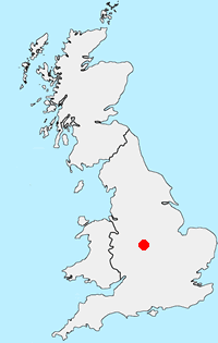
Location Map
Staffordshire Guide
The County of Staffordshire is located within the Midlands. The northern part of the county includes part of the Peak District National Park featuring both Gritstone moorland of the Dark Peak and limestone dales of the White Peak. To the south the heathlands of Cannock Chase form part of a National Landscape (formerly AONB). Elsewhere the county is predominantly rural with pleasant countryside and easy walking.
Other walks in Britain - For a list of all the areas where walks are available go to the Main Walk Index.
Walk grading - Learn how each walk is assessed and select a walk to suit your ability and experience by going to Walk Grading Details.
Messaging & Social Media
Message Walking Britain and follow the latest news.

Mountain Weather
Stay safe on the mountains with detailed weather forecasts - for iOS devices or for Android devices.