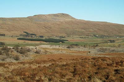
Whernside & Dentdale from Dent
Yorkshire Dales Walk
Nat Park - Yorkshire Dales - Three Peaks Country
County/Area - Cumbria & North Yorkshire
Author - Lou Johnson
Length - 12.0 miles / 19.5 km Ascent - 1975 feet / 598 metres
Time - 8 hours 0 minutes Grade - mod/hard
Maps 

| Ordnance Survey Explorer OL2 | Sheet Map | 1:25k | BUY |
| Anquet OS Explorer OL2 | Digital Map | 1:25k | BUY |
| Ordnance Survey Landranger 98 | Sheet Map | 1:50k | BUY |
| Anquet OS Landranger 98 | Digital Map | 1:50k | BUY |
Walk Route Description
Click image to see photo description.
Dent is well known as being one of the more interesting and picturesque villages in the Yorkshire Dales and provides a great place to start a walk to the highest of Yorkshire's 'Big Three'. Although the village can be busy you soon escape the crowds climbing high onto the valley side during the ascent. The return route is no less scenic with superb views of Dentdale and section of the Dales Way.
The start of this Yorkshire Dales walk is the main car park in the village of Dent (Grid ref. SD 703871). Exit the car park and take the lane opposite heading south. The lane deteriorates and becomes a stony track, climbing quite steeply on the west bank of Flinter Gill. Quickly gaining height you soon have a fine retrospective view over Dent and Dentdale, enough of an excuse for frequent stops to catch your breath. The gradient eases to reach a T-junction (Grid ref. SD 698868) where you turn left.
This walled lane is known as the 'Occupation Road' and contours the northern slops of Great Coum leading you to the top of Deepdale and the road from Dent to Ingleton (Grid ref. SD 723823). This sounds easier than it is as you will have covered around 4 miles in the process and, if its being raining recently, will have dodged a number of puddles and muddy areas. Notwithstanding these annoyances the views to your left will have been superb with Dentdale and Deepdale exhibiting fine scenery.
Reaching the road you should turn right. After about 400 yards take the signed footpath on your left. This climbs the western slopes of Whernside with the path following a wall, which is on your left. The climb is steep and with a cairn coming into view ahead you can be excused for thinking the summit is close. All that can be said about the cairn is the superb view north into Deepdale as you still have nearly 300 feet of ascent until you reach the wall and trig point that marks the summit of Whernside.
The view east is superb - one of the best in the Yorkshire Dales - with Ingleborough and Pen-y-ghent adding to the extensive panorama laid out beneath your feet. The return to Dent starts by following the wall north. Go as far as the first wall junction (Grid ref. SD 740823). Ignore the path descending right towards Ribblehead, instead crossing the wall and following a less well-trodden path north towards Whernside Tarns. Keeping the Tarns on your left and continuing in a northerly direction, descend gently over unpathed moorland to reach a wall corner (Grid ref. SD 745841). With the wall on your left, descend alongside it to reach the Craven Way, which links Ribblehead with Dent. Turn left and continue descending into Dentdale.
The Craven Way continues descending to reach Dyke Hall Lane (Grid ref. SD 724857). Turn right down the lane to a junction by a small chapel. Turn left here and continue along the lane to cross Deepdale Beck. Just after the bridge take the signed footpath on your right (The Dales Way) and follow this across valley pastures and alongside the river to reach Church Bridge on the outskirts of Dent village. Turn left here and follow the road through the village to reach the start.
Other walks nearby
| Walk 2146 | Deepdale Circular (near Dent) | moderate | 7.0 miles |
| Walk 3135 | Dentdale & Bleamoor | moderate | 12.5 miles |
| Walk 1196 | The Calf | mod/hard | 10.5 miles |
| Walk 2438 | Cautley Spout & the Calf from Sedbergh | moderate | 10.0 miles |
| Walk 3008 | Winder & Arant Haw from Sedbergh | moderate | 7.0 miles |
| Walk 1970 | Great Knoutberry Hill & Dent Head | moderate | 9.5 miles |
| Walk 3032 | Gragareth & Great Coum from Yordas Cave | moderate | 9.0 miles |
| Walk 2409 | The Upper Eden valley without a car | moderate | 12.0 miles |
| Walk 3006 | Cautley Spout & The Calf | moderate | 5.5 miles |
| Walk 1393 | Yarlside | moderate | 4.0 miles |
Recommended Books & eBooks
Walking the Lake District Fells - Mardale and the Far East
 Part of the Walking the Lake District Fells series, this guidebook covers a wide range of routes to 36 Lakeland summits that can be climbed from the Ullswater, Haweswater, Troutbeck, Kentmere and Longsleddale valleys, with highlights including High Street, Place Fell and the Kentmere fells. Suggestions for longer ridge routes are also included.
More information
Walking the Lake District Fells - Buttermere
 Part of the Walking the Lake District Fells series, this guidebook covers a wide range of routes to 32 Lakeland summits that can be climbed from the Buttermere, Lorton and Newlands valleys, with highlights including Haystacks, High Stile, Grasmoor and the fells of the Coledale Round. Suggestions for longer ridge routes are also included.
More information
Messaging & Social Media
Message Walking Britain and follow the latest news.

Mountain Weather
Stay safe on the mountains with detailed weather forecasts - for iOS devices or for Android devices.