Faringdon, Radcot and Littleworth
Oxfordshire Walk
County/Area - Oxfordshire
Author - Visit Southern Oxfordshire
Length - 8.0 miles / 13 km Ascent - 250 feet / 76 metres
Time - 4 hours 20 minutes Grade - easy/mod
Maps 

| Ordnance Survey Explorer 170 | Sheet Map | 1:25k | BUY |
| Anquet OS Explorer 170 | Digital Map | 1:25k | BUY |
| Ordnance Survey Landranger 163 | Sheet Map | 1:50k | BUY |
| Anquet OS Landranger 163 | Digital Map | 1:50k | BUY |
| Ordnance Survey Landranger 164 | Sheet Map | 1:50k | BUY |
| Anquet OS Landranger 164 | Digital Map | 1:50k | BUY |
Walk Route Description
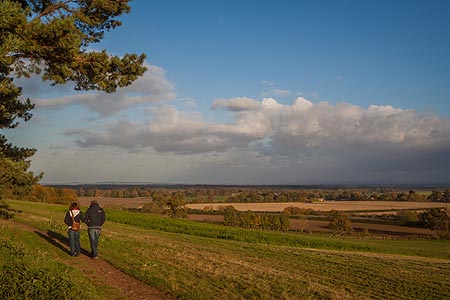
Click image to see photo description.
1 - Start the walk in Faringdon Market Place and head uphill to Church Street, past the churchyard and past the A4095 to Witney. When the metalled road turns 90 degrees right, Carry straight on to a farm track. When it starts to bend, continue straight on to an enclosed footpath (Church Path).
2 -- At the footpath junction, turn left , (Grove Cottage is on the right) then follow field-edge path down hill. Continue walking on a well marked footpath across two large arable fields, first diagonally towards the right of Haremoor Wood, then on to a footbridge and head towards Smokedown Cottages. Near the cottages, join a track which takes you to the Thrupp road (signed Faringdon 2 miles).
3 -- At the Thrupp road (very quiet) turn right and walk along the road to Barley Cottage on the left . Just past the cottage take the footpath signed Radcot 1m.
4 -- Walk along the field edge with the hedge on your left. Continue straight on to the next field over a plank bridge. Continue along the left field edge and over another wooden bridge over a stream. Continue along left field edge, over a stile. From here you can see Cradle Bridge and the Thames. Continue to Cradle Bridge. To visit The Swan Public House, cross Cradle Bridge (a wooden structure), continue to the road and turn right over the bridge. The Swan provides food and drink , a garden to sit in and bicycles to hire if you want to explore the area further!
5 -- If you choose not to visit The Swan, don't cross the bridge but take the path immediately right, and follow the river on your left until Radcot Lock is reached. Beyond the lock take a wide, metalled track to Old Man's Bridge.
6 -- Take the sign right, (marked Littleworth 2 miles). Continue along field edge and climb gate or fence. Bear left on gravel path to meet the Thrupp Road.
7 -- Follow this straight, quiet road, past Spotted Cow cottages all the way into Littleworth. The road winds past Park Farm on the right. In the village, look for a footpath sign on your left (Church Walk Faringdon 1.5 miles) just outside Hill House.
8 -- Follow this path round to the right, over stile at a footpath sign. At this point you should see Faringdon Folly in the distance. Take the footpath over fields to Haremoor Farm and onto Grove Lodge. Return to Faringdon Market Square via Church path.
Other walks nearby
| Walk 1069 | Badbury Hill, including the Great Barn at Great Coxwell | easy | 6.0 miles |
| Walk 3630 | Longcot & Uffington Circular | easy | 5.2 miles |
| Walk 1062 | Pusey & Buckland circular | easy | 3.5 miles |
| Walk 1554 | Wayland's Smithy & Uffington Castle | easy/mod | 5.5 miles |
| Walk 2915 | Uffington Castle, the White Horse and Wayland's Smithy | easy/mod | 6.5 miles |
| Walk 3116 | Uffington White Horse & Wayland's Smithy | easy | 3.3 miles |
| Walk 2410 | Wayland's Smithy, Ashdown House and Ashbury | easy/mod | 7.5 miles |
| Walk 1419 | The Lambourn Downs from near Astbury | moderate | 14.0 miles |
| Walk 1873 | The Ridgeway from Ardington | easy/mod | 7.0 miles |
| Walk 1439 | Fulbrook & Widford | easy | 6.0 miles |
Recommended Books & eBooks
No suggestions for this area.Messaging & Social Media
Message Walking Britain and follow the latest news.

Mountain Weather
Stay safe on the mountains with detailed weather forecasts - for iOS devices or for Android devices.