Faringdon, Wicklesham, The Folly & Folly Park
Oxfordshire Walk
County/Area - Oxfordshire
Author - Visit Southern Oxfordshire
Length - 4.0 miles / 6.5 km Ascent - 250 feet / 76 metres
Time - 2 hours 20 minutes Grade - easy
Maps 

| Ordnance Survey Explorer 170 | Sheet Map | 1:25k | BUY |
| Anquet OS Explorer 170 | Digital Map | 1:25k | BUY |
| Ordnance Survey Landranger 163 | Sheet Map | 1:50k | BUY |
| Anquet OS Landranger 163 | Digital Map | 1:50k | BUY |
| Ordnance Survey Landranger 164 | Sheet Map | 1:50k | BUY |
| Anquet OS Landranger 164 | Digital Map | 1:50k | BUY |
Walk Route Description
Click image to see photo description.
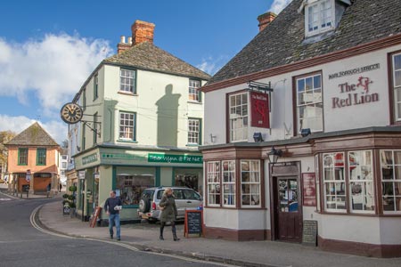
1 - From the Market Place walk along Southampton Street (Bell Hotel on corner), continue over road to cul-de-sac, and along Southampton Street (South). At the end of Southampton Street, continue along the track into the housing estate. Carry straight on along Volunteer Way (passing Brunel House and the Medical Centre on your right) until you reach the A417 (Park Road).
2 - Cross the road, turn left and pass 2 houses (Oriel cottages). Turn right after the cottages (signed) and follow the footpath over a stile and on to the next stile. Cross the A420 with care and at the top of the bank go over a stile, (signed). It may be easier to cross the A420 if you walk up to the roundabout and follow the drive to the quarry, you will soon join the drive to Wicklesham Lodge Farm. Continue straight on down the farm access track to Wicklesham Lodge Farm.
3 - Turn left remaining on the bridleway. Just over a little bridge (once a bridge over Faringdon branch line) bear left diagonally across a field.
4 - Turn left onto a track which exits onto the Stanford Road by the kennels.
5 - Turn left back towards the A420. Cross the road near to the roundabout with care. Turn right through a gate into a field. Follow the field edge path then turn left up hill to the Folly, (where on a clear day you have a magnificent view of a large part of Oxfordshire, and parts of Wiltshire and Gloucestershire). Continue straight on past the tower (on your right) following a metalled path down to Stanford Road.
6 - At the road, turn left to continue your walk through Folly Park or turn right to join London Street and return to the Market Square. To visit the Folly Park turn left and walk up the Stanford Road (dead end) until you reach the entrance to the Nursery View estate on the right. Walk down through the estate until you reach the back entrance to the Folly Park. Walk down through the Park and eventually out onto Park Road.
7 - At Park Road, turn right and after about 200m look out for a footpath on the right near to a zebra crossing, which takes you into Southampton Street. At the end then turn left to return to the Market Square.
Other walks nearby
| Walk 1069 | Badbury Hill, including the Great Barn at Great Coxwell | easy | 6.0 miles |
| Walk 3630 | Longcot & Uffington Circular | easy | 5.2 miles |
| Walk 1062 | Pusey & Buckland circular | easy | 3.5 miles |
| Walk 1554 | Wayland's Smithy & Uffington Castle | easy/mod | 5.5 miles |
| Walk 2915 | Uffington Castle, the White Horse and Wayland's Smithy | easy/mod | 6.5 miles |
| Walk 3116 | Uffington White Horse & Wayland's Smithy | easy | 3.3 miles |
| Walk 2410 | Wayland's Smithy, Ashdown House and Ashbury | easy/mod | 7.5 miles |
| Walk 1419 | The Lambourn Downs from near Astbury | moderate | 14.0 miles |
| Walk 1873 | The Ridgeway from Ardington | easy/mod | 7.0 miles |
| Walk 1439 | Fulbrook & Widford | easy | 6.0 miles |
Recommended Books & eBooks
No suggestions for this area.Messaging & Social Media
Message Walking Britain and follow the latest news.

Mountain Weather
Stay safe on the mountains with detailed weather forecasts - for iOS devices or for Android devices.