Ashness Bridge & Grange Fell from Kettelwell
Lake District Walk
Nat Park - Lake District - Lake District Central Fells
Wainwrights - Grange Fell
County/Area - Cumbria
Author - Lou Johnson
Length - 9.0 miles / 14.6 km Ascent - 1370 feet / 415 metres
Time - 5 hours 50 minutes Grade - moderate
Maps 

| Ordnance Survey Explorer OL4 | Sheet Map | 1:25k | BUY |
| Anquet OS Explorer OL4 | Digital Map | 1:25k | BUY |
| Ordnance Survey Landranger 90 | Sheet Map | 1:50k | BUY |
| Anquet OS Landranger 90 | Digital Map | 1:50k | BUY |
Walk Route Description
Click image to visit gallery of 3 images.
To start this Lake District walk, we parked beside the shore of Derwentwater at the Kettelwell car park (grid ref. NY267195) just off the main road into Borrowdale from Keswick. Heading north along the lake we soon reached the Ashness landing stage. Here you need to cross the main road and take the narrow lane signed Ashness Bridge and Watendlath. You soon gain height and reach the old pack-horse bridge. From here you have a superb panorama over Derwentwater, a foretaste of a similar but improved view further up the lane often referred to as "Surprise View".
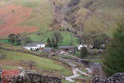
From Ashness Bridge continue to follow the road for a short way. Reaching "Surprise View", you are standing on a precarious ledge on the edge of woodland. With a steep drop at your feet you have a comprehensive panorama over Borrowdale, Derwentwater and Keswick, with Skiddaw providing an excellent backdrop. Keeping to a path running parallel to the lane, follow Watendlath Beck up stream using the footbridge marked on the map to gain the western bank. For nearly two miles you cross meadows and walk beneath crags to the hamlet of Watendlath. This is a lovely spot on the shores of Watendlath tarn.
From Watendlath take the uphill path signed Rosthwaite which follows the northern shore of the Tarn before climbing steadily to Puddingstone Bank. Until now you will have followed a well-trodden route and probably have seen plenty of other walkers. the next section however is quieter and requires some careful navigation. Leaving the main path just before the first wall on the right, make for a ladder stile which you cross. Taking care not to go astray make for the knobbly outcrop of Jopplety How. This is one of many separate little "tops" that make up Grange Fell and it provides an excellent viewpoint.
The next objective is Kings How. This summit is easily seen from Jopplety How but the route between is less straightforward requiring a good sense of direction and a bit of luck. However eventually you will find the stiles and little used paths that eventually reach the summit of King's How. The view from here is superb especially over Derwentwater and far better than anything you have seen so far.
The descent from King's How can be tricky to find (consult relevant Wainwright). On the Borrowdale side there are some might crags and these should be avoided unless suicide is your intention. The main path leaves the fell in an easterly direction before dropping steeply down into Borrowdale. After one false start, we were lucky as someone staggered up from the valley marking our downward route far better than any cairn.
Although steep the descent is not unpleasant as the path has seen extensive work and the deciduous woods have wonderful character. Reaching the main Borrowdale road a short section of road walking leads to the small village of Grange where refreshments are readily available. Take the "back lane" towards Manesty and after about half a mile take the path on the right signed Lodore. This leads across low lying land with raised duck-boards providing a dry route across the wet areas. You are soon back at the main Borrowdale road. Turn left and wherever possible use the signed paths in the woods on the eastern side of the road. All too soon you are back at the Kettlewell car park having completed a walk that includes a taste of many aspects of Lakeland scenery.
Other walks nearby
| Walk 1356 | Walla Crag | easy/mod | 4.5 miles |
| Walk 1268 | Cat Bells & High Spy | moderate | 8.0 miles |
| Walk 2036 | Cat Bells from Gutherscale | easy/mod | 4.0 miles |
| Walk 3525 | Cat Bells (Route 2) | easy/mod | 4.0 miles |
| Walk 3119 | The Newlands Horseshoe - Catbells, Dale Head & Hindscarth | mod/hard | 12.0 miles |
| Walk 2587 | Castlerigg Stone Circle & St John's in the Vale | easy/mod | 8.5 miles |
| Walk 3029 | Derwentwater & Walla Crag | easy/mod | 6.5 miles |
| Walk 3037 | High Seat & Bleaberry Fell from Keswick | moderate | 9.0 miles |
| Walk 2321 | Shores of Derwentwater from Keswick | easy | 3.5 miles |
| Walk 2525 | Standing Crag & Dock Tarn from Watendlath | moderate | 7.0 miles |
Recommended Books & eBooks
Great Mountain Days in the Lake District
 An inspirational guidebook to 50 challenging walks on the high fells of the Lake District. The graded circular routes, between 4 and 14 miles in length, cover classic Lakeland summits like Fairfield, Scafell Pike, Great Gable and Blencathra, to the lesser-known High Spy, King's How and Brund Fell.
More information
Hadrian's Wall Path
 Hadrians Wall Path guidebook to walk the 84 mile National Trail. Described in both directions, the main description is west to east between Bowness-on-Solway and Wallsend, Newcastle, with extensions to Maryport and South Shields. With extensive historical information related to this World Heritage site and separate 1:25,000 OS map booklet included.
More information
Messaging & Social Media
Message Walking Britain and follow the latest news.

Mountain Weather
Stay safe on the mountains with detailed weather forecasts - for iOS devices or for Android devices.