Bradley & Burkham Circular
Hampshire Walk
County/Area - Hampshire
Author - Peter Lane
Length - 5.5 miles / 8.9 km Ascent - 250 feet / 76 metres
Time - 3 hours 0 minutes Grade - easy
Maps 

| Ordnance Survey Explorer 144 | Sheet Map | 1:25k | BUY |
| Anquet OS Explorer 144 | Digital Map | 1:25k | BUY |
| Ordnance Survey Landranger 185 | Sheet Map | 1:50k | BUY |
| Anquet OS Landranger 185 | Digital Map | 1:50k | BUY |
Walk Route Description
Click image to visit gallery of 6 images.
A pleasant North Hampshire walk over rolling hills, ideal for escaping the hurly burly of life in the south east for a few hours! This walk may be very muddy at times, so gaiters and long trousers are recommended in wet conditions.
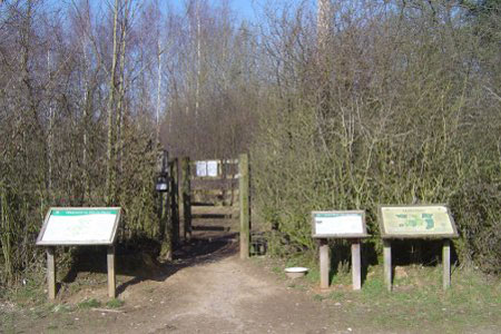
The walk commences at Home Farm Woodland Trust car park tucked away down a narrow country lane, grid reference SU655416. The area is clearly shown as Access Land on the OS Explorer map.
Exit the car park back onto the approaching country lane, turn right and in 100 metres take the enclosed green line on the right heading south west. Follow this track for some 900 metres to a junction of four byways and a fingerpost. Continue heading south west, notionally straight on (don't take the path on the right!) along Rushmoor Lane according to the Explorer map. This continues as a muddy, enclosed green lane for just over 1000 metres, finally reaching a metalled country lane.
At the country lane carry straight on to a junction at the heart of the hamlet of Lower Wield. Turn left and in 200 metres look for an enclosed footpath up a few steps on the right, through a kissing gate. Follow this past the attractive back gardens of the properties in the hamlet (labelled Three Castles Path on Explorer map). The path continues in a north westerly direction, crossing a number of hedges and fences (well waymarked). There are some excellent views over the downs as you leave the properties behind and head for open fields. The path turns slightly left towards Park Copse.
Follow the waymarks into the copse (briefly) and then back out to follow its southern flank. Leaving the copse, continue along the same bearing (296 degrees), following the contour to a hedge where the path turns right without passing through the gap in the hedge. Keep this hedge to your left all the way to the hamlet of Bradley.
Turn left onto the road and walk past the duck pond following the road as it then sweeps left. The onward route is the turning on the right heading for the traditional flint built church. Go through the churchyard and through a gate into the field behind the church. Turn left following the churchyard fence (north east) and on to Upper Farm. The track is quite broad and reaches a line of trees after passing the farm. There is a distinct temptation to follow the track to the left side of the trees, but careful scrutiny of the map confirms that the path stays to the right of the trees. It is important to be to the right of the trees when the path meets up with the trees that come up from the right at SU647423.
The onward route is through a field where the path may well not be invisible on the ground. Take a bearing of 94 degrees or simply head for the far right hand corner of the field. Pass between a field on the right and the gardens of the house on the left through a gate and onwards keeping the fence to the right until reaching the road to the house you've just passed. Pass down this drive until reaching an entrance to the Access Land of Home Farm.
Now you have a choice: attempt to find your way through the Access Land back to the car park (approx bearing of 160 degrees) or, ignoring this, continue to Burkham Lodge along the drive, turn right and return along the country lane.
Other walks nearby
| Walk 2459 | Upper Wield & Godsfield Circular | easy/mod | 6.7 miles |
| Walk 1025 | Farleigh Wallop and Ellisfield | easy/mod | 6.5 miles |
| Walk 3693 | Alton to Farnham using St Swithun's Way | moderate | 12.0 miles |
| Walk 1726 | Weston Corbett from Upton Grey | easy | 5.6 miles |
| Walk 1964 | Abbotstone from Old Alresford | easy | 5.1 miles |
| Walk 1976 | Noar Hill from Selborne | easy/mod | 5.0 miles |
| Walk 3324 | Cheriton Mill & Tichborne from Cheriton | easy | 5.7 miles |
| Walk 2165 | Overton & the Harroway | easy | 4.3 miles |
| Walk 2225 | Around Dogmersfield on the Basingstoke Canal | easy | 5.0 miles |
| Walk 2416 | Around Dogmersfield on the Basingstoke Canal | easy | 3.0 miles |
Recommended Books & eBooks
Walking Hampshire's Test Way
 Guidebook to walking the 71km (44 mile) Test Way in Hampshire from high on the chalk downs of Inkpen Beacon to the Eling Tide Mill near Southampton Water. Following the beautiful, crystal clear River Test, it passes picturesque villages and fascinating historic sites. Also includes 15 day walks to explore this lovely part of pastoral England.
More information
Messaging & Social Media
Message Walking Britain and follow the latest news.

Mountain Weather
Stay safe on the mountains with detailed weather forecasts - for iOS devices or for Android devices.